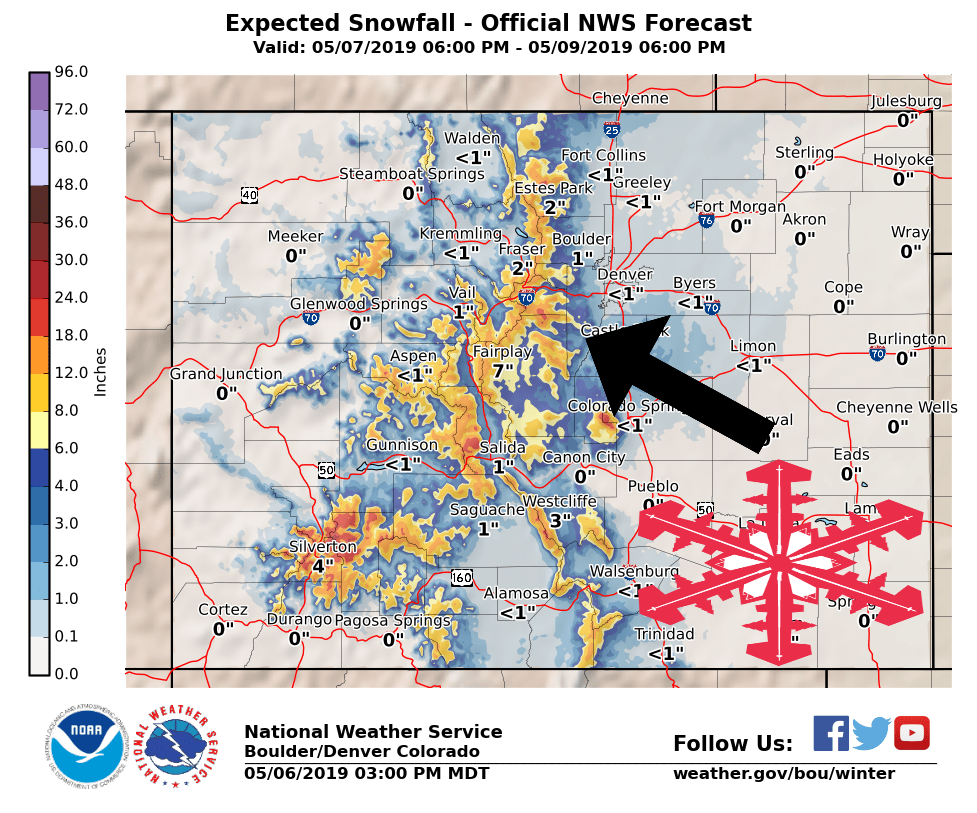
Colorado’s in for another late season snow storm.
Several inches of snow is likely Tuesday night – Thursday.
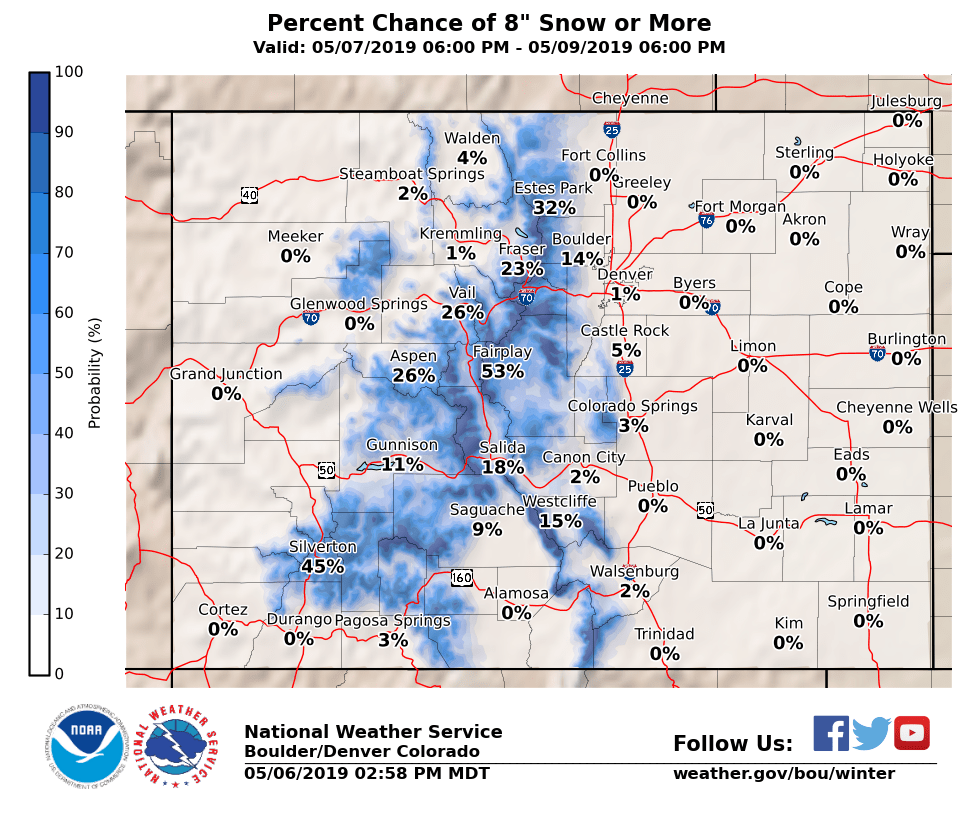
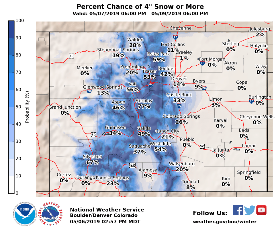
The heaviest accumulations will be in the mountains, but snow is possible all the way down to 5,500ft.
Colorado:
- Several Inches Of Snow Tuesday Night – Thursday
More snow is expected to impact the area through Saturday evening.
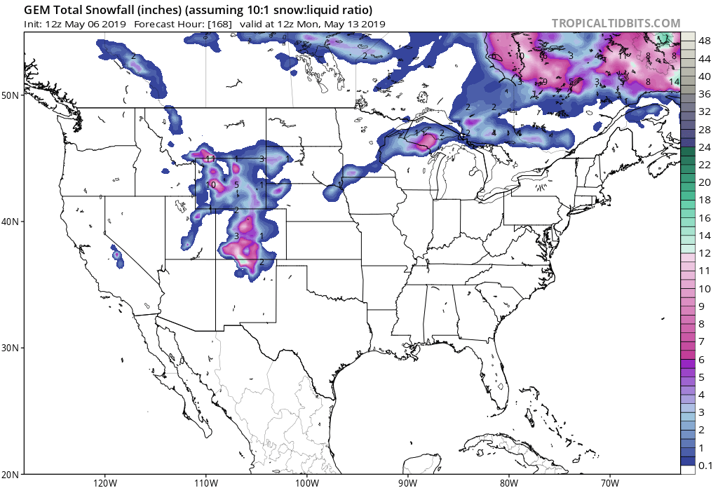
Snow is likely above 9,000ft, but snow levels are expected to drop all the way down to 5,500ft.
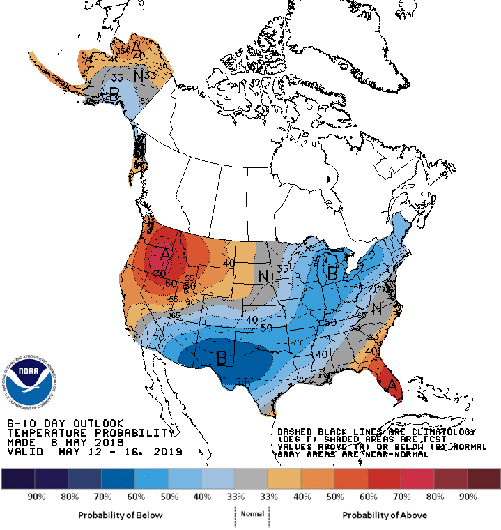
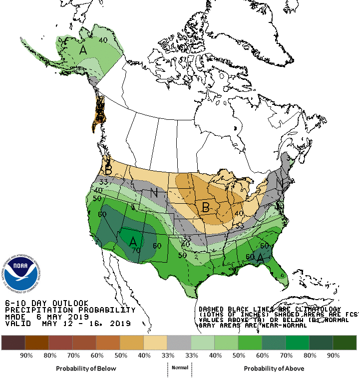
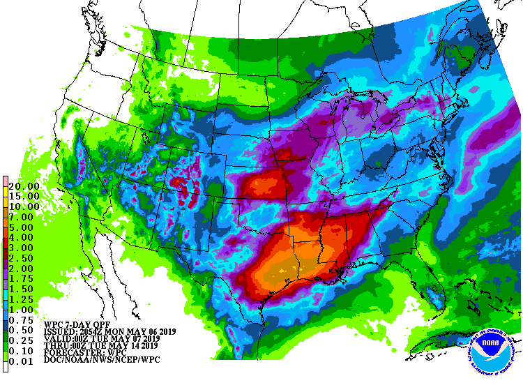
The 6-10 day outlook calls for above average precipitation and below average temperatures in Colorado.
Additional Storm Info:
Colorado: Several Inches Of Snow Tuesday Night – Thursday
* Tuesday night through Saturday will be unsettled with thunderstorms
  possible each afternoon and evening. Some snow is also possible, mostly
  above 9,000 feet.
- NOAA Grand Junction, CO
Hazardous Weather Outlook:
Hazardous Weather Outlook
National Weather Service Grand Junction CO

COZ001>014-017>023-UTZ022>025-027>029-071200-
Lower Yampa River Basin-Central Yampa River Basin-
Roan and Tavaputs Plateaus-Elkhead and Park Mountains-
Upper Yampa River Basin-Grand Valley-Debeque to Silt Corridor-
Central Colorado River Basin-Grand and Battlement Mesas-
Gore and Elk Mountains/Central Mountain Valleys-
Central Gunnison and Uncompahgre River Basin-
West Elk and Sawatch Mountains-Flat Tops-
Upper Gunnison River Valley-Uncompahgre Plateau and Dallas Divide-
Northwest San Juan Mountains-Southwest San Juan Mountains-
Paradox Valley/Lower Dolores River-
Four Corners/Upper Dolores River-Animas River Basin-
San Juan River Basin-Southeast Utah-Eastern Uinta Mountains-
Eastern Uinta Basin-Tavaputs Plateau-Arches/Grand Flat-
La Sal and Abajo Mountains-Canyonlands/Natural Bridges-
532 AM MDT Mon May 6 2019

This hazardous weather outlook is for eastern Utah and western
Colorado.

.DAY ONE...Today and Tonight

Isolated thunderstorms are expected this afternoon, mostly north
of the I-70 corridor. The main concern from any storms will be
gusty outflow winds possibly reaching 40 mph.

.DAYS TWO THROUGH SEVEN...Tuesday through Sunday

A few storms are possible Tuesday up north and along the
Continental Divide. Again, gusty outflow winds will be the biggest
concern.

Tuesday night through Saturday will be unsettled with
thunderstorms possible each afternoon and evening. Some snow is
also possible, mostly above 9,000 feet.