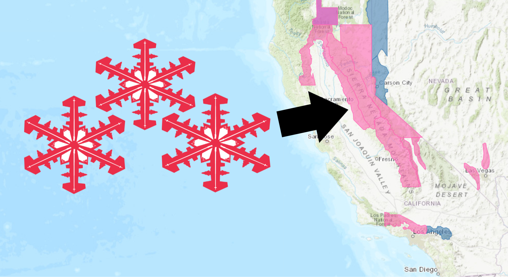
The National Weather Service has issued a Winter Storm Warning for California. It’s in effect from 4:00pm this afternoon – 10:00pm Monday night. High winds and heavy snowfall are forecasted to impact the area throughout that time.
Multiple rounds of heavy snowfall are expected to hit California over the weekend. Blizzard conditions are possible Sunday night into Monday morning.
California:
- 3-6 FEET of Snow Above 7,000ft Friday – Monday
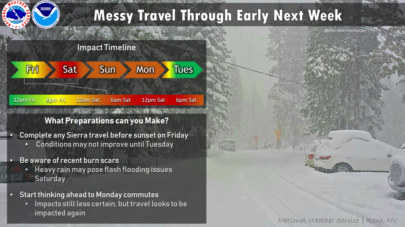
“Two storms are expected to move through the area this weekend, causing messy travel conditions through early next week. The first storm (Friday evening-Saturday) will bring heavy snow to the Sierra and mainly rain to the valleys. There is a possibility this rain could change to snow on Saturday morning, but accumulations are not expected. Rain could be heavy at times, so be aware of possible flooding concerns. A second storm will move through Sunday-Monday evening. This second storm will be colder and there is a higher chance of accumulating valley snow, but it is still too early to pinpoint amounts. That being said, both morning and evening commute problems are possible Monday.
It’s important to note that a definite break in between the two systems in which to head over the passes is not expected. So, complete travel over the Sierra by sunset on Friday or put it off until Tuesday, if you can.”
– NOAA Reno, NV
Snow levels will lower to 3500ft – 4500ft over the weekend, before dropping down to 1000ft – 2000ft on Monday.
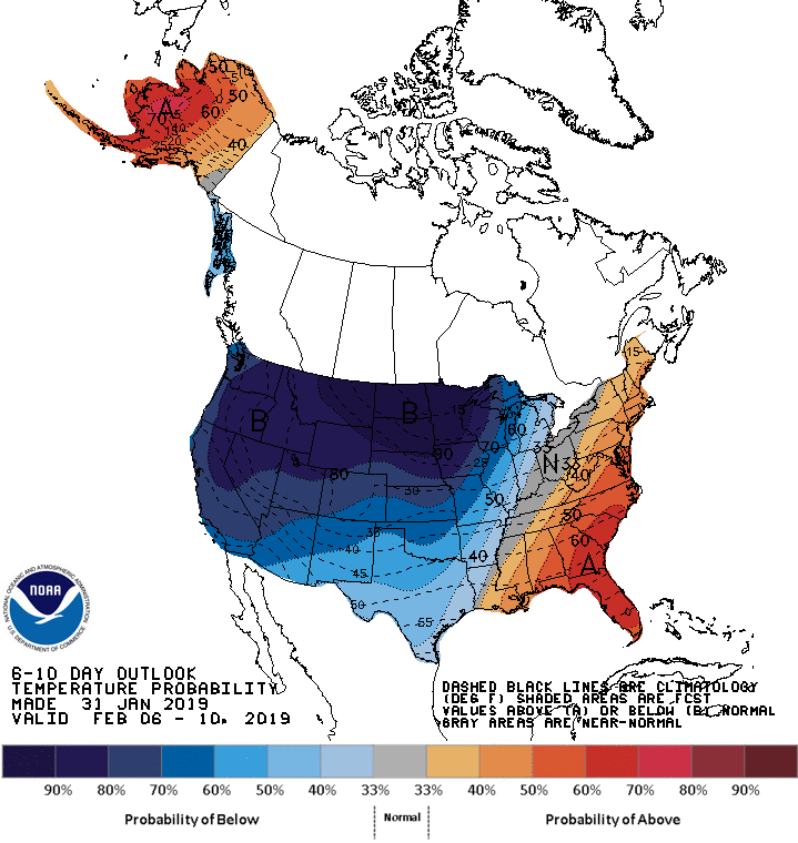
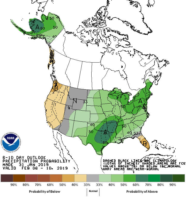
The 6-10 day outlook calls for below average temperatures and below average precipitation in California.
Additional Storm Info:
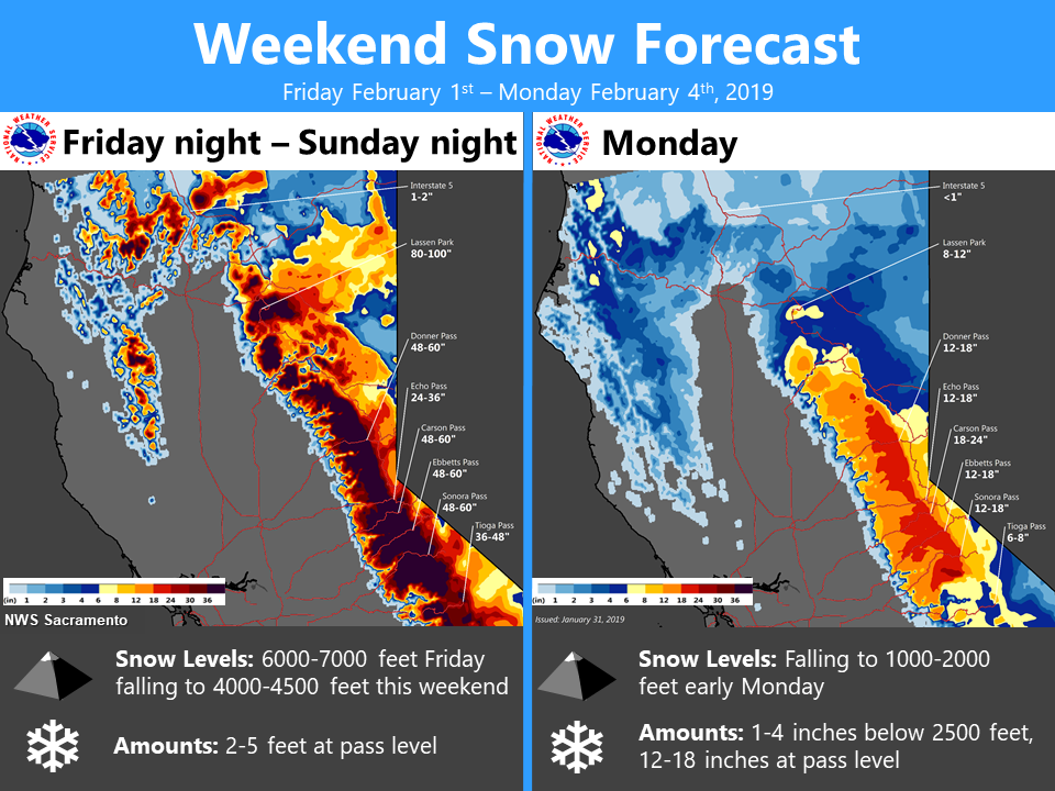
California: 3-6 FEET Of Snow Friday – Monday Above 7,000ft
* Heavy snow and gusty winds expected. Total snow
  accumulations of 2 to 4 feet at lake level, except
  3 to 6 feet above 7000 feet expected.
- NOAA Reno, NV
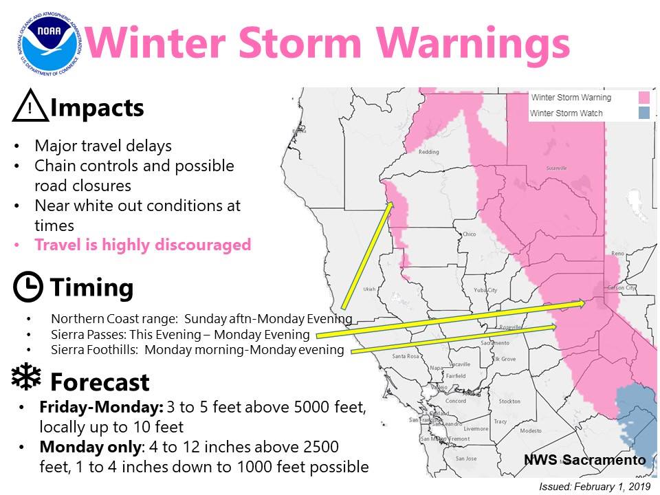
Winter Storm Warning:
URGENT - WINTER WEATHER MESSAGE
National Weather Service Reno NV
328 AM PST Fri Feb 1 2019

Greater Lake Tahoe Area-
Including the cities of South Lake Tahoe, Truckee, Stateline,
and Incline Village

...WINTER STORM WARNING REMAINS IN EFFECT FROM 4 PM THIS
AFTERNOON TO 10 PM PST MONDAY...

* CHANGES...none.

* WHAT...Heavy snow and gusty winds expected. Total snow
  accumulations of 2 to 4 feet at lake level, except 3 to 6 feet
  above 7000 feet expected. Winds gusting as high as 50 mph
  Sunday afternoon into Monday with gusts to 100 mph over
  ridges. A period of blizzard conditions is possible Sunday
  night into Monday.

* WHERE...Greater Lake Tahoe Area.

* WHEN...From 4 PM Friday to 10 PM PST Monday.

* ADDITIONAL DETAILS...Travel could be very difficult to
  impossible. The hazardous conditions will impact commuting and
  ski resort travel. Very strong winds could cause extensive
  tree damage.