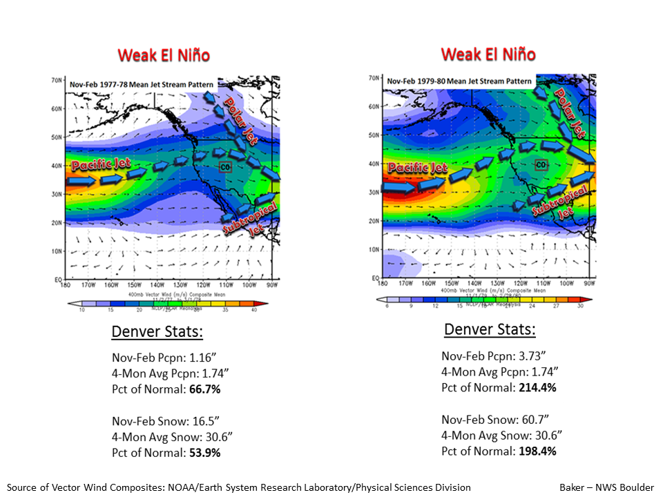
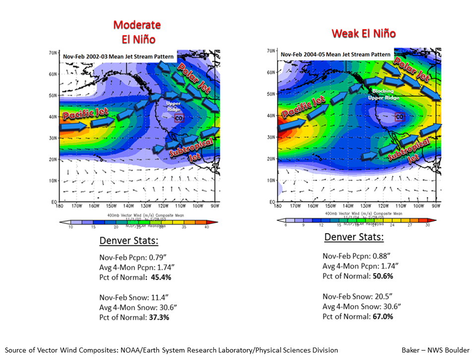
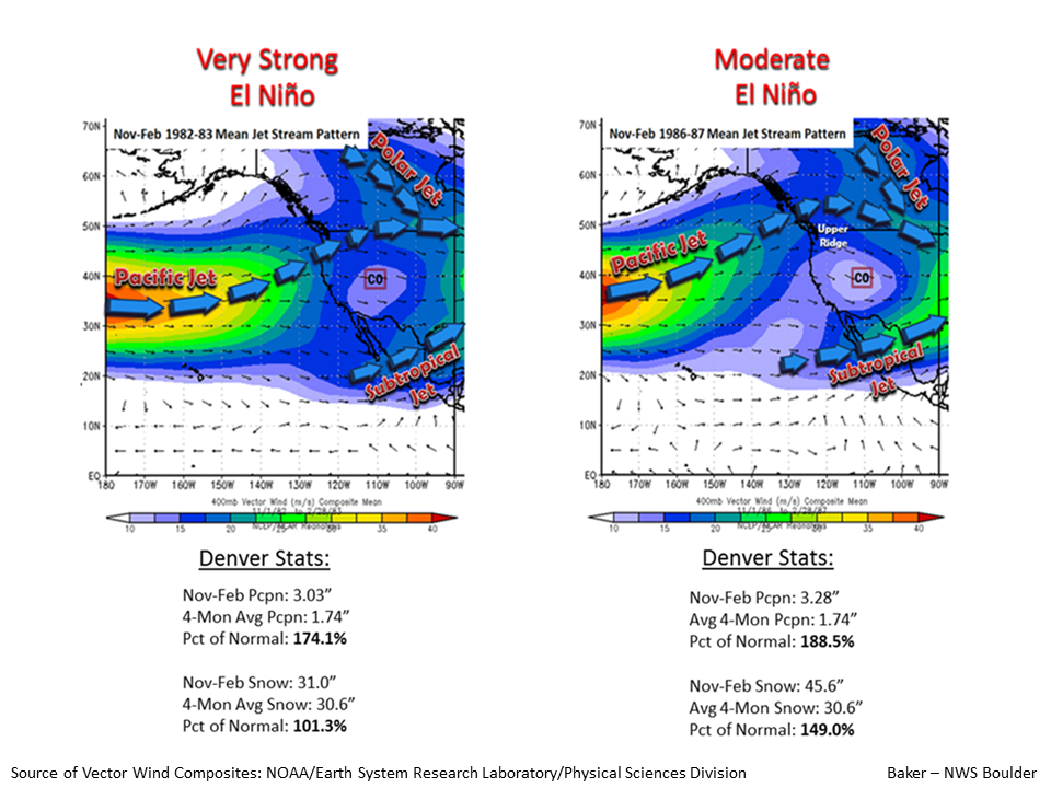
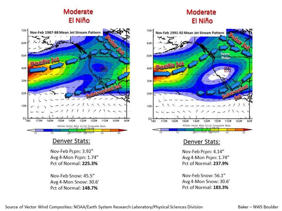
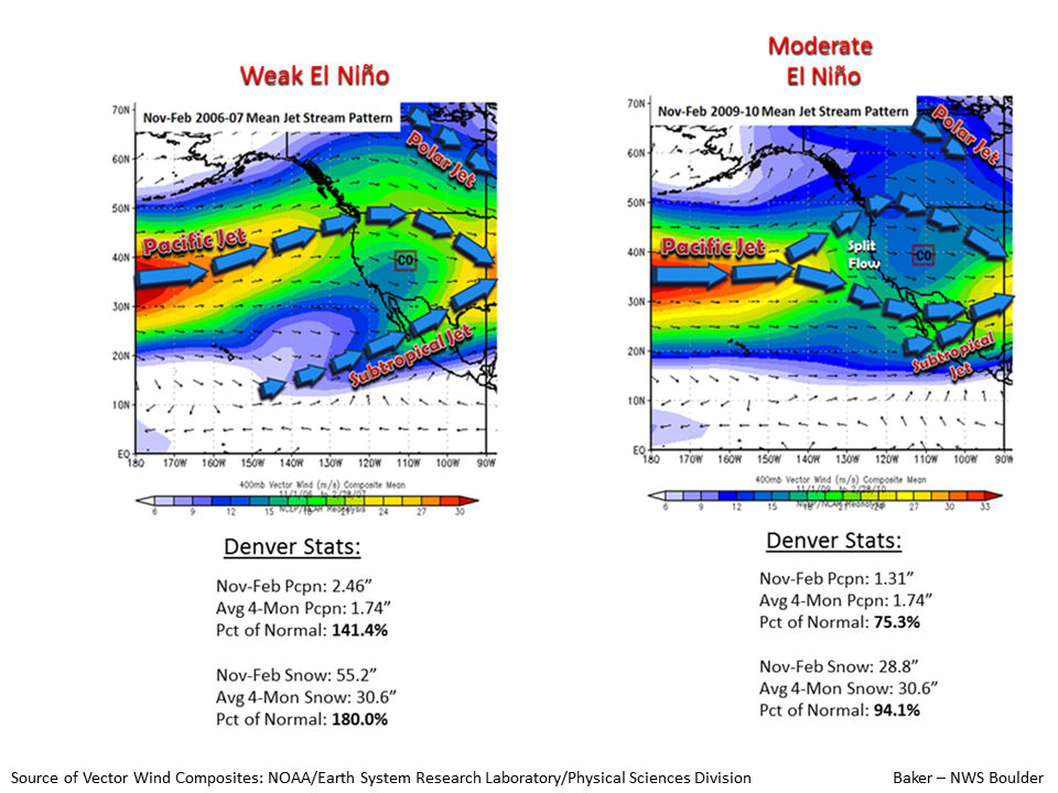
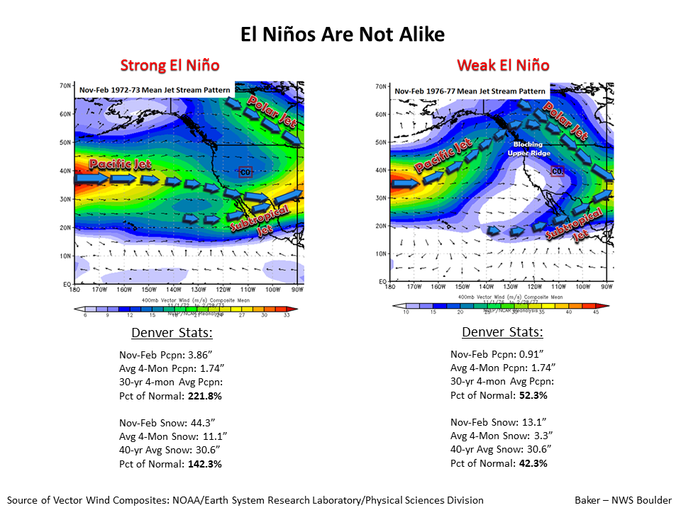
NOAA in Denver, Colorado just released a mountain of information about how this year’s Strong El Nino will effect Colorado including detailed weather maps of every El Nino in Colorado since 1972.
Basically, they’re saying that during El Nino the northern part of the state generally gets below average precipitation and above average temperatures while the southern part of the state gets above average precipitation and below average temperatures.
NOAA:
Strong El Nino conditions continue to strengthen in the eastern Pacific and with these conditions anticipate potentially significant impacts to large scale atmospheric circulation (jet stream) and weather patterns over the eastern Pacific and western North America. The first slide indicates the typical jet stream pattern and weather anomalies during the January-March time period of moderate to strong El Ninos (source – NOAA/CPC). The subsequent slides depict the mean positions of the Pacific, Polar and Subtropical jet streams during the 4-month period of November-February of each of the El Nino events since the 1972-1973 winter season. While it is common for the Pacific jet stream to repeatedly pass over the southern tier of the U.S during winter and early spring of moderate to strong El Ninos, it is nearly as common for this jet stream to undergo large latitudinal shifts in its mean position from one El Nino event to the next, regardless of their magnitude. Lastly, Nov-Feb precipitation and snow totals for Denver,Colorado are provided for each El Nino event since 1972-1973. The purpose of this slide show was to point out the inconsistency in precipitation/snowfall observed along the Colorado Front Range during past El Ninos.
That said, temperature and snowfall across northeast Colorado, including the Denver metro area, are typically above average during El Nino winters. What is not apparent from these slides is the fact that the greater snow accumulation often occurred outside of this 4-month period, notably during late winter and spring at the conclusion of a moderate to strong El Nino. Such was the case during the very strong El Nino of 1997-1998. mrb


