Brought to you by Squaw Valley Alpine Meadows
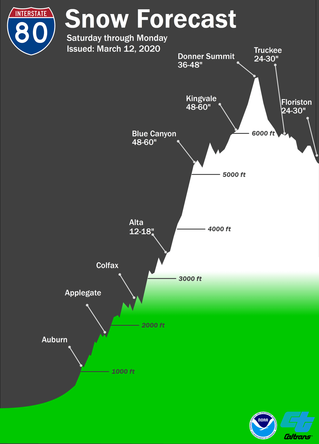
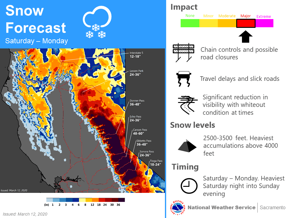
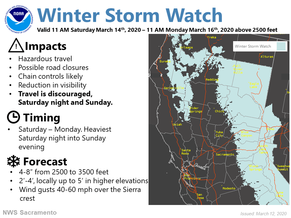
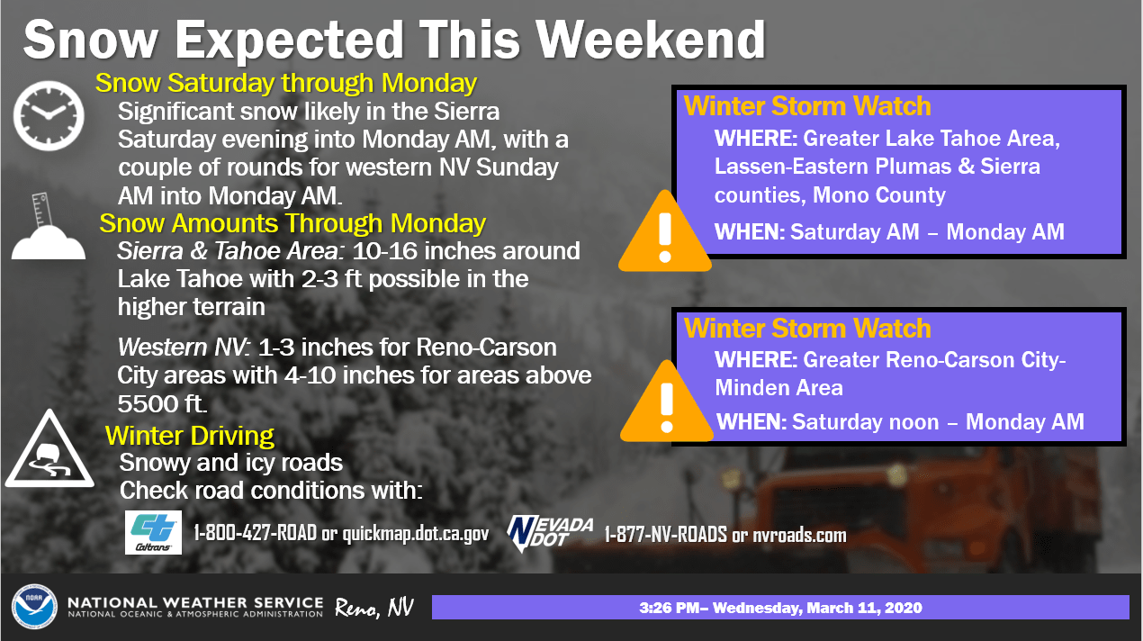
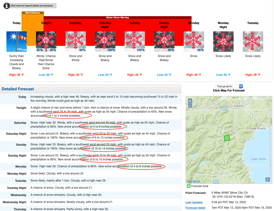
The storm that is about to slam the Tahoe Area of California this weekend, was upgraded to winter storm warning status and the snow totals increased YET AGAIN last night by the NOAA. Most ski resorts should see at least 3-feet of fresh snow, with the hardest hit getting an unbelievable 5-FEET over the duration of the storm. SnowBrains is driving the 12-hours from Jackson Hole to Squaw Valley tomorrow, and we couldn’t be more STOKED. Stay tuned for our reports…
...WINTER STORM WARNING IN EFFECT FROM 11 PM THIS EVENING TO
11 AM PDT MONDAY...

* CHANGES...Upgraded from a Winter Storm Watch.

* WHAT...Heavy snow expected. Total snow accumulations of 12 to 18
  inches, with 2 to 4 feet above 7000 feet. Winds gusting as high as
  50 mph with ridge winds gusting to 100 mph.

* WHERE...Greater Lake Tahoe Area.

* WHEN...From 11 PM this evening to 11 AM PDT Monday.

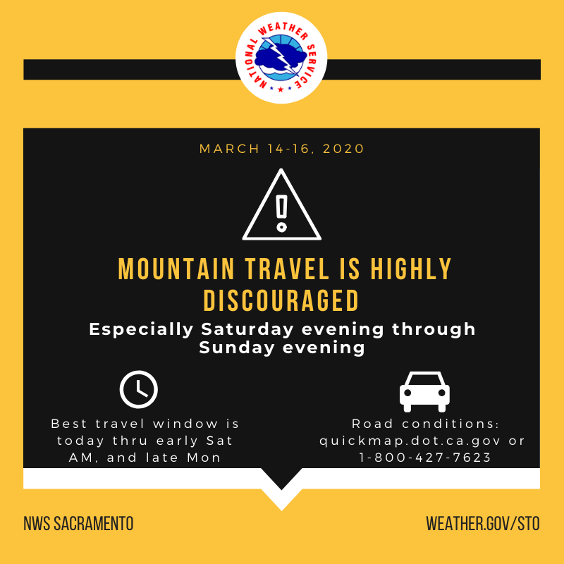
* IMPACTS...Travel could be very difficult to impossible. The
  hazardous conditions could impact the morning commute. Very
  strong winds could cause extensive tree damage.
According to the NOAA’s forecast discussion:
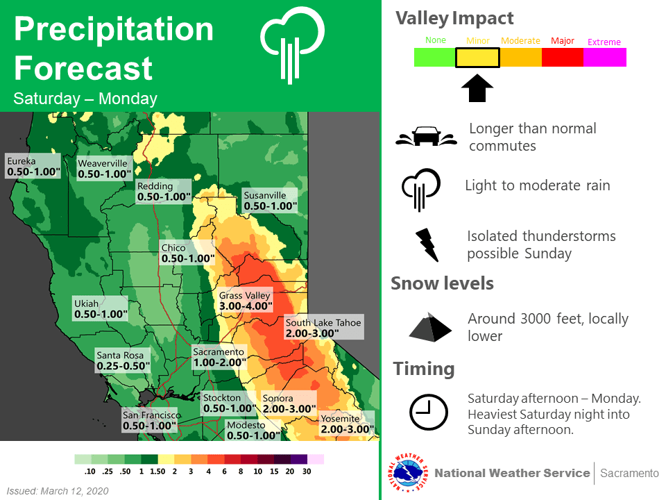
Snow will move into the Sierra tonight becoming heavy and lasting through the weekend. The largest accumulations over the weekend are expected in the central Sierra with 2-4 feet along the crest and 12-18 inches around the Lake Tahoe basin. The low progresses slowly down the coast so Mono County may only see about 1 foot in the higher elevations through the weekend. Travel over the Sierra could be challenging or impossible at times this weekend due to heavy snow and low visibility.
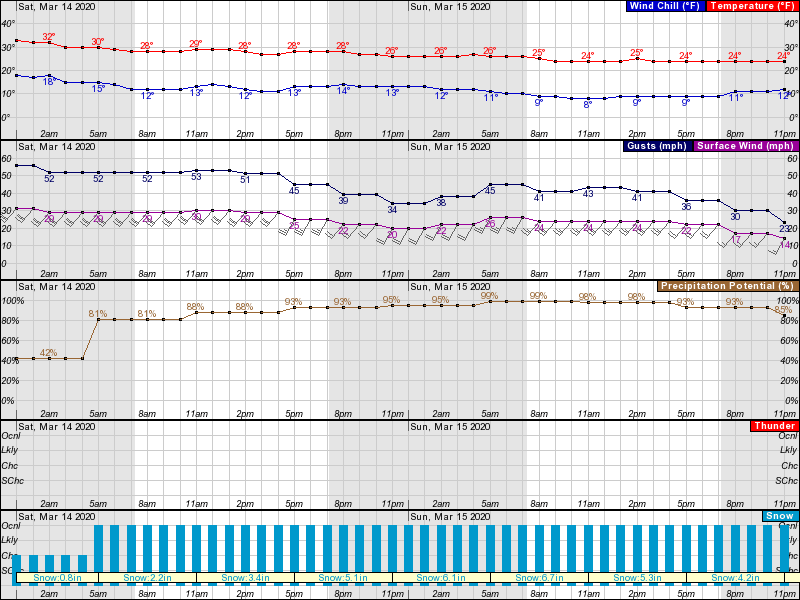
Snow will begin first thing Saturday and continue right through the weekend. Light snow showers early Saturday will gradually increase in intensity and heavy snow will dump most of the weekend. Gusting winds will exceed 70 mph Saturday and 40 mph Sunday. Temperatures will drop, with highs in the 20s at higher elevations.
Expect most areas to see over a foot on the slopes on Sunday morning with another couple of feet falling through the day. Squaw Valley Alpine Meadows should see 48-54″, Sierra-at-Tahoe 32-38″, Northstar 32-38″, Sugar Bowl 44-49″, and Kirkwood 54-60″.
The Sierra Avalanche Center has also issued an avalanche watch warning. Please monitor their site for more details, and be careful out there.
The Sierra Avalanche Center in Truckee has issued a BACKCOUNTRY
AVALANCHE WATCH for the following areas:

Greater Lake Tahoe

* TIMING...In effect from 7 AM PDT Saturday to 7 AM PDT Monday.

* AFFECTED AREA...Central Sierra Nevada mountains between Yuba
  Pass (Hwy 49) on the north and Ebbetts Pass (Hwy 4) on the
  south, including the greater Lake Tahoe area.

* AVALANCHE DANGER...Periods of HIGH avalanche danger may occur
  from Saturday morning through Monday morning.

* REASON/IMPACTS...Forecast heavy snow and high wind may result in
  widespread avalanche activity in the mountains.

* PRECAUTIONARY / PREPAREDNESS ACTIONS...Very dangerous avalanche
  conditions may occur. Travel in avalanche terrain is not
  recommended during HIGH avalanche danger. Large destructive
  avalanches could occur.

Consult https://www.sierraavalanchecenter.org/ or
www.avalanche.org for more detailed information.
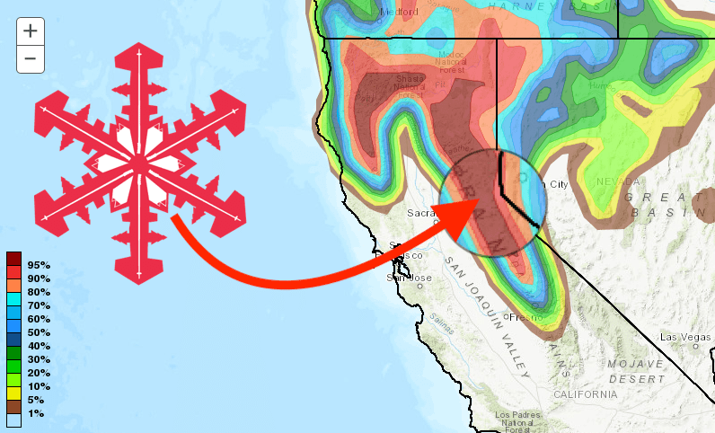
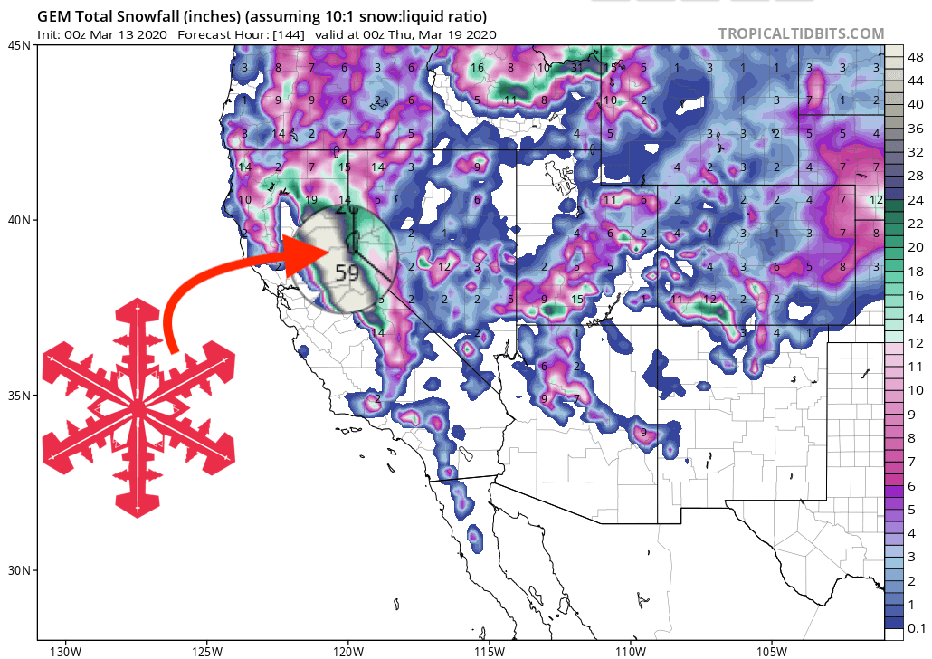
GEM Snowfall Totals Forecast:
Other Info:
