Winter Storm Warning for Utah
11pm Sunday – 3am Monday
URGENT - WINTER WEATHER MESSAGE
National Weather Service Salt Lake City UT
218 PM MST Sat Nov 18 2023
Including the cities of Alta and Brighton
218 PM MST Sat Nov 18 2023

...WINTER STORM WARNING IN EFFECT FROM 11 PM THIS EVENING TO 3 AM
MST MONDAY...

* WHAT...Heavy snow expected. Total snow accumulations 8 to 16
  inches, locally up to 22 inches in the upper Cottonwoods.

* WHERE...Wasatch Mountains South of I-80.

* WHEN...From 11 PM this evening to 3 AM MST Monday.

* IMPACTS...Winter driving conditions can be expected on all
  mountain routes including the Cottonwood Canyons. Traction
  restrictions are possible. Travel may become difficult on
  untreated, seasonal roads.
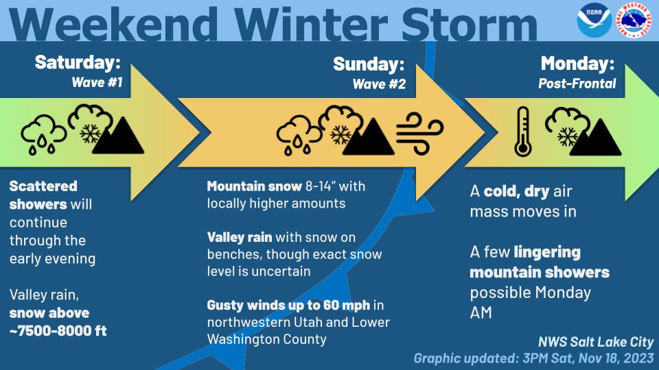
11/18 AFTERNOON FORECAST UPDATE:
by NOAA, Salt Lake City, UT office
As you can see from the showers around, the weekend’s winter storm is already making its presence known. Showers with this first wave will continue into the early evening before a lull. More widespread and impactful precipitation will begin early Sunday with the 2nd wave.
We’ve issued a Winter Storm Warning for Sunday, with 8-14″ forecast for most mountains with locally higher amounts up to 20″ for the Upper Cottonwoods and Tushar Mountains. This will bring significant travel difficulties, particularly for seasonal routes still open.
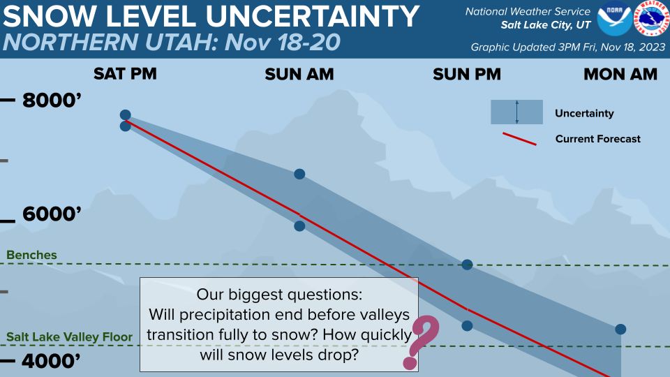
Will Northern Utah valleys get snow? That’s still uncertain. Our current forecast shows snow levels getting as low as about 4,700′, to the benches. However, the lowest snow levels in our guidance range from 4,500′ to 5,500′, which would make a big difference in impacts. The uncertainty in valley impacts is twofold: first, as shown in the previous graphic, there is larger than usual spread as to how cold the air over the area will end up being, impacting how low snow levels go. However, uncertainty also exists as to when valley precip will end. In the guidance, this ranges from early Sunday evening to late in the evening/early Monday morning. If the precip lasts longer, valleys have a greater chance of seeing snow. Something to keep in mind.
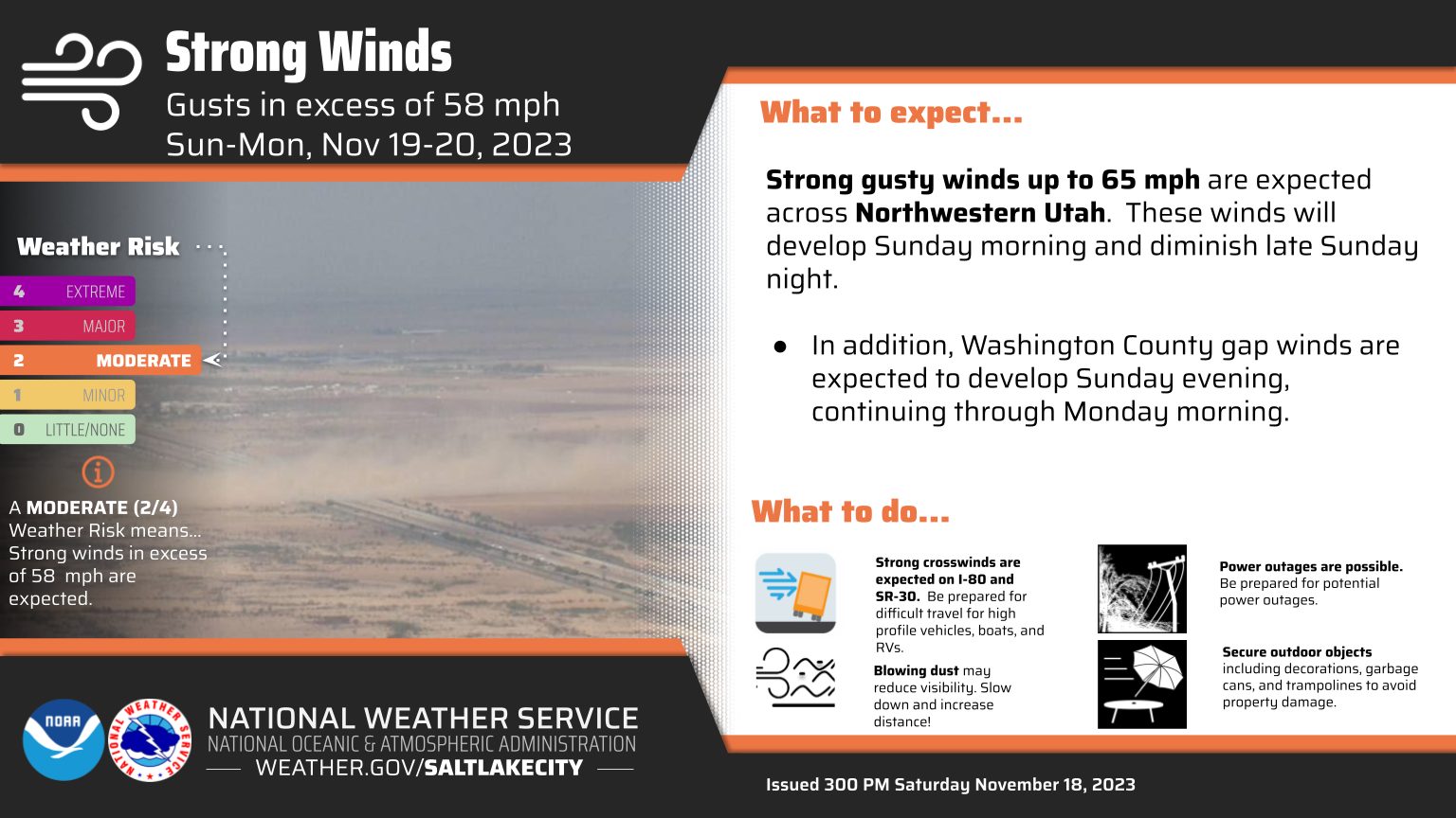
Finally, the arrival of the system will bring strong gusty winds to 65 mph for Northwest Utah, bringing additional travel difficulties. Winds will be strongest along the SR-30 corridor as well as on I-80 from Wendover to Grassy Mountain.