The National Weather Service has issued a Winter Storm Warning for Wyoming. It’s in effect until 5:00pm on Wednesday.
High winds and heavy snowfall are forecasted to impact the area throughout that time.
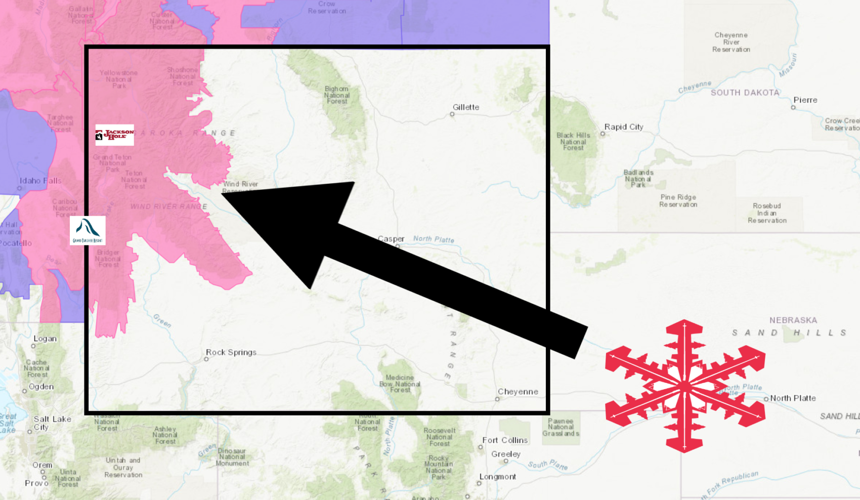
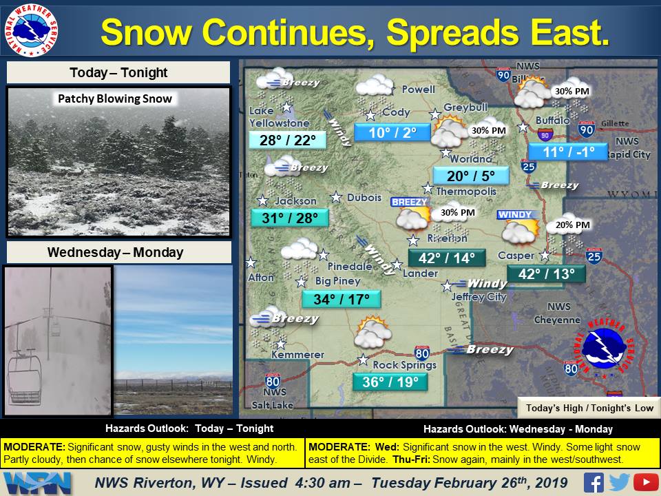
Wyoming:
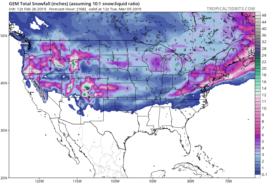
- 13-25″ of Snow Today – Wednesday
“Winter systems will continue to impact western / northern Wyoming through Wednesday. Significant additional snow expected in the west, with light snow spreading to central areas tonight. Windy conditions and blowing snow will create hazardous travel conditions.”
– NOAA Riverton, WY
Grand Targhee Resort, WY has already received 18″ of snow in the past 48 hours.
Jackson Hole Mountain Resort, WY has already received 40″ of snow in the past 48 hours.
Snow is expected to spread east as the storm progresses today.
The 6-10 day outlook calls for below average temperatures and above average precipitation in Wyoming.
Additional Storm Info:
Wyoming: 13-25″ of Snow Today – Wednesday
* Heavy snow. Over 3 feet of snow has fallen across portions
  of the Teton Range from this ongoing snow event so far.
  Additional snow accumulations of 13 to 25 inches. Winds
  gusting as high as 55 mph.
- NOAA Riverton, WY
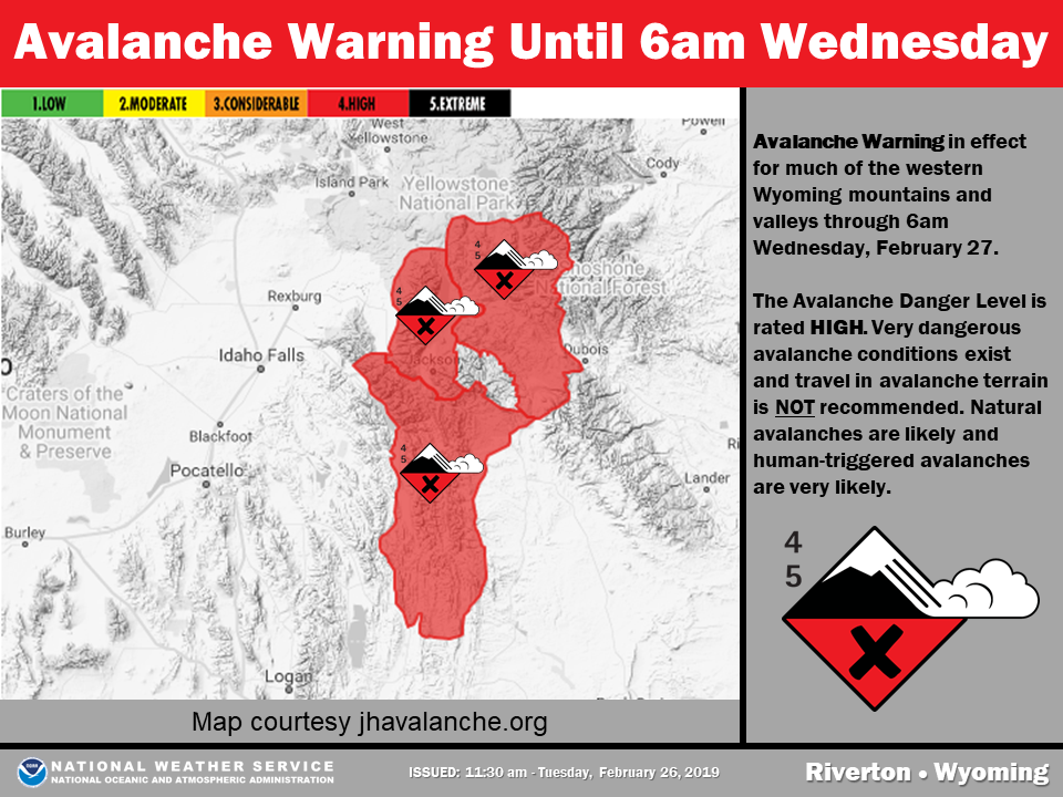
Winter Storm Warning:
URGENT - WINTER WEATHER MESSAGE
National Weather Service Riverton WY
239 AM MST Tue Feb 26 2019

...A Series of Winter Storms will impact western Wyoming through
Wednesday...

.Significant snow will continue across much of Western Wyoming
through at least through the day Wednesday. Also, significant
blowing and drifting of snow will occur in the mountains. Severely
reduced visibilities at times in snow and, or blowing snow.

Teton and Gros Ventre Mountains-

...WINTER STORM WARNING NOW IN EFFECT UNTIL 5 PM MST WEDNESDAY...

* WHAT...Heavy snow. Over 3 feet of snow has fallen across
  portions of the Teton Range from this ongoing snow event so far.
  Additional snow accumulations of 13 to 25 inches. Winds gusting
  as high as 55 mph.

* WHERE...Teton and Gros Ventre Mountains.

* WHEN...Until 5 PM MST Wednesday. The heaviest snowfall will
  occur this morning and will pick up again in intensity by
  Wednesday afternoon.

* ADDITIONAL DETAILS...Travel could be very difficult to
  impossible. Patchy blowing snow could significantly reduce
  visibility. The hazardous conditions could impact the morning
  or evening commute. Gusty winds could bring down tree branches.