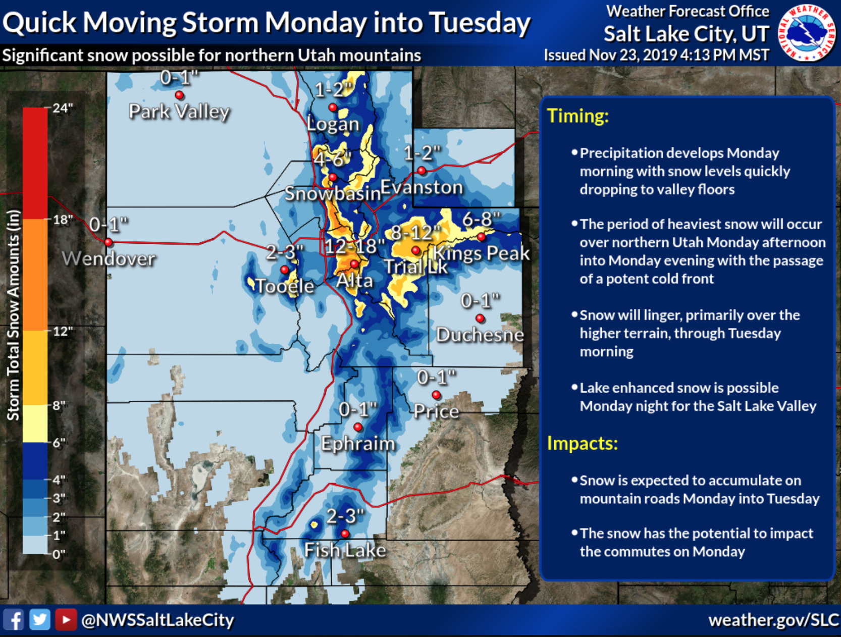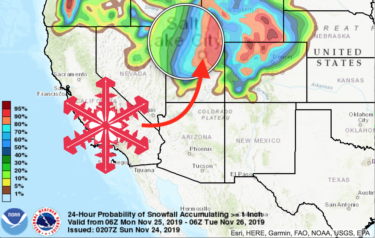
The NOAA has issued a winter storm watch for Salt Lake City, Utah. The Wasatch Mountains could see up to 18″ of fresh snow. Lake enhanced snow is possible Monday night for the Salt Lake Valley.
* WHAT...Heavy snow possible. Total snow accumulations of 6 to 18 inches,
locally higher totals possible in the Cottonwoods.

* WHERE...The Wasatch Mountains.

* WHEN...From late Sunday night through
 Tuesday afternoon.

* IMPACTS...Travel could be very difficult, beginning with the Monday morning
 commute.
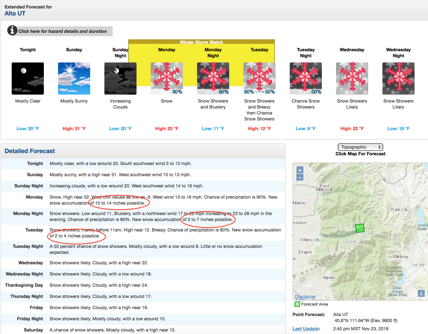
The storm is coming right on time for the start of the 2019-2020 ski season in Utah. Many ski resorts in the Wasatch will open on Friday, November 29 including Alta Ski Area, Snowbird, and Solitude Mountain Resort. Big and Little Cottonwood canyons may see up to 2 feet of snowfall this week. It looks like solid start to winter in Utah!
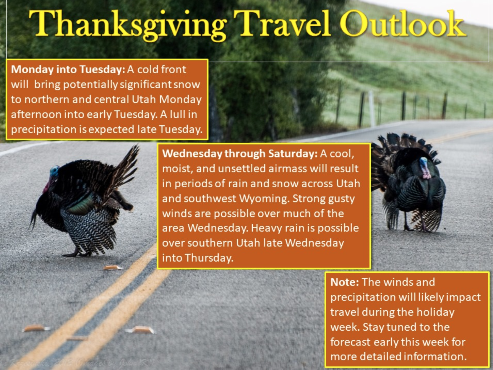
A large and slow moving storm system will then impact the region from Wednesday
into next weekend, potentially bringing travel impacts through the entirety of
the busy Thanksgiving travel period. - NOAA 11/23/19
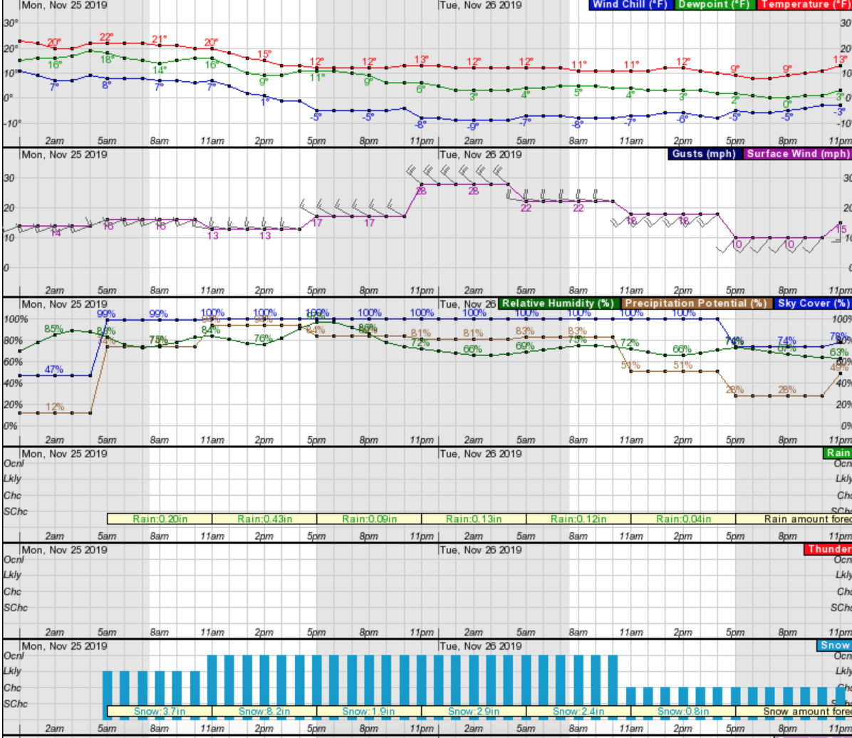
Snow should start late Sunday evening, becoming heaviest Monday afternoon, and continue through the middle of the week into the weekend. Temperatures are expected to drop Sunday night, with a low of 8ºF on Tuesday evening at Alta Ski Area.
All 15 ski areas in the Wasatch Mountains will get snow. Alta, Snowbird, Solitude, and Brighton could each see around 18″ or more each, and Park City and Deer Valley 12″.
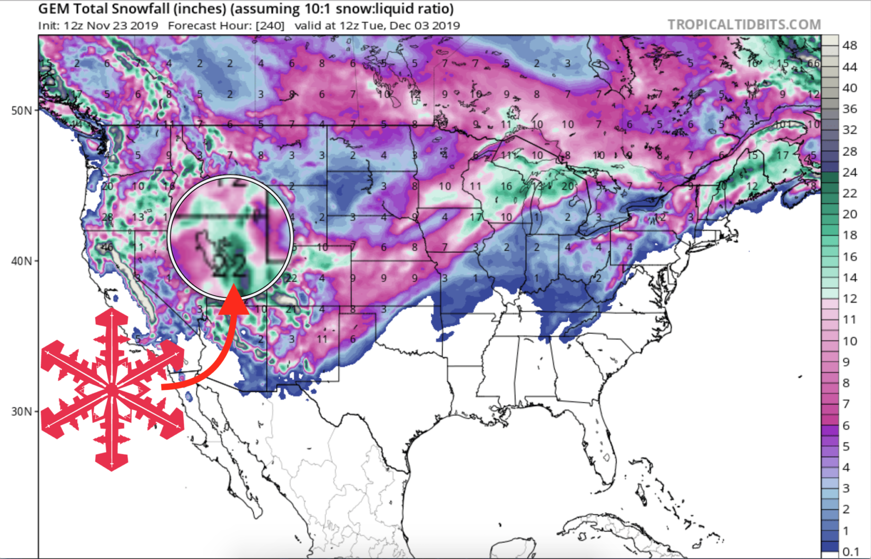
GEM Snowfall Totals Forecast Model:
Other Info:
