The National Weather Service has issued a Winter Weather Advisory for Grand Targhee Resort, WY.
It’s in effect until 6:00am Wednesday morning.
Snow is expected to impact the area throughout that time.
Wyoming:
- 5-10+” of Snow Today – Wednesday Morning
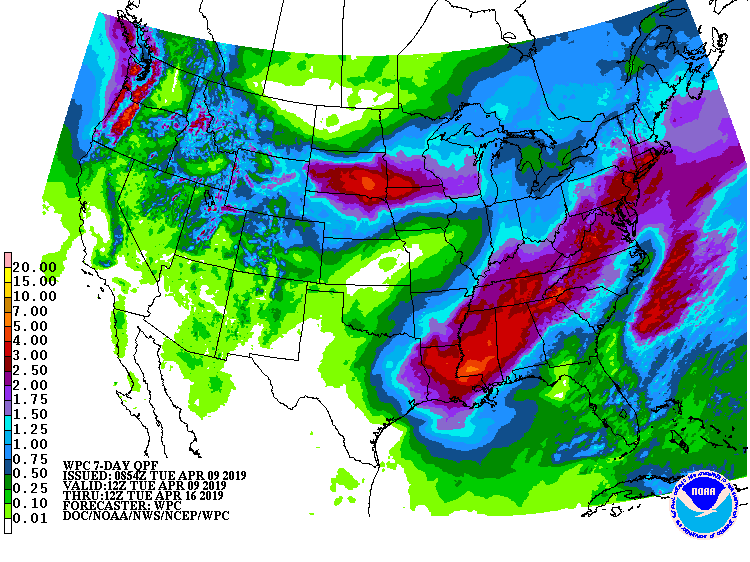
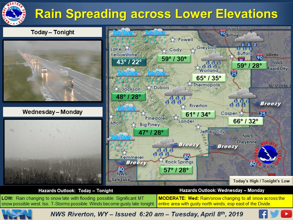
“The spring storm system is bringing rain and snow to parts of the region this morning. Rain will spread southward through the day and slowly change over to snow in the lower elevations tonight, with the passage of a cold front. Winter Weather Advisories and Flood Watches are in effect in the west. Central areas will see increased snow Wednesday and Winter Storm Watches are in effect.”
– NOAA Riverton, WY
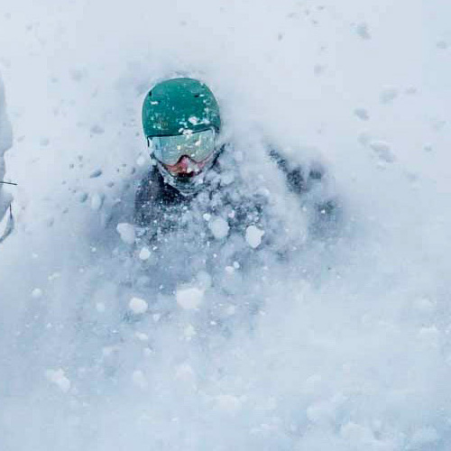
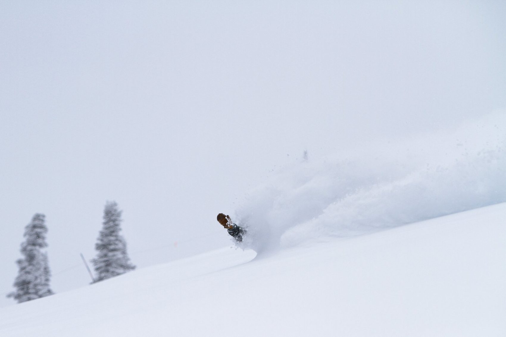
Grand Targhee Resort is sitting pretty with 457″ of snow this season, so this storm should make for some fun mid-week conditions.
Snow levels are expected to drop well below 6,000ft tonight.
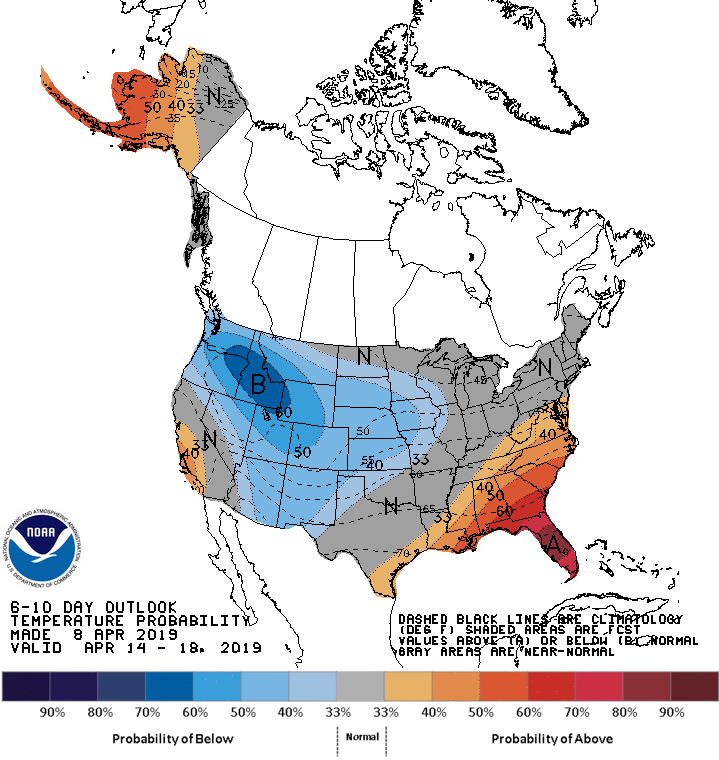
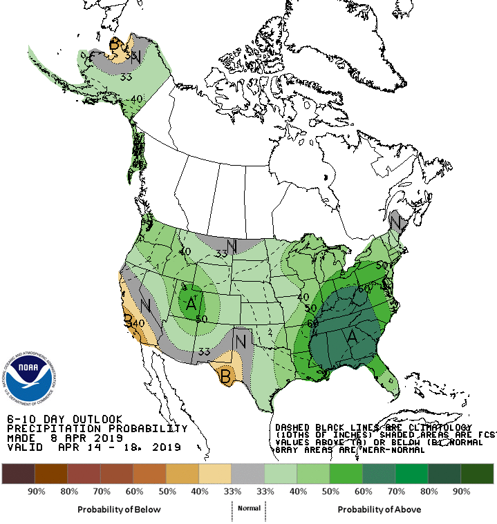
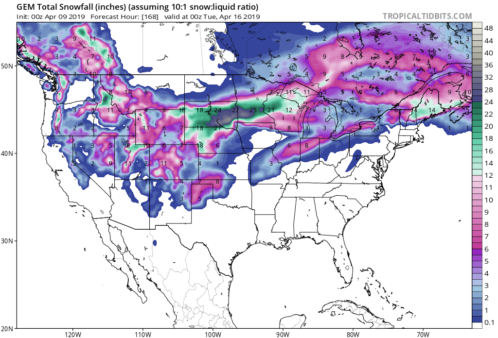
The 6-10 day outlook calls for above average precipitation and below average temperatures in Wyoming.
Additional Storm Info:
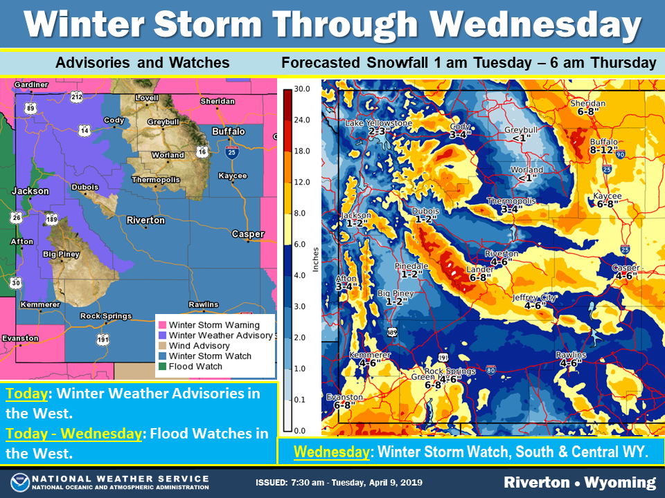
Wyoming: 5-10+” of Snow Today – Wednesday Morning
* Snow expected. Total snow accumulations of 5 to 10 inches
  expected, with locally higher amounts up to 15 inches.
- NOAA Riverton, WY
Winter Weather Advisory:
URGENT - WINTER WEATHER MESSAGE
National Weather Service Riverton WY
146 AM MDT Tue Apr 9 2019

...Winter Storm Will Impact the Area Tonight through Wednesday
Evening...

.A strong spring storm will impact the area today through
Wednesday night with significant snow and rain. The main impacts
tonight through this evening will primarily impact areas west of
the Divide with valley rain and mountain snow. Significant
mountain snow is expected over western mountains along with the
potential for some flooding in the western valleys as rain falls
on ongoing snowmelt. Areas east of the Continental Divide will see
precipitaion increase rapidly later tonight. This system will
initially bring rain to the the lower elevations east of the
Divide with snow levels lowering to the basin floors around
sunrise Wednesday. Moderate to heavy snow and strong north wind
will likely impact parts of northern, central and southern Wyoming
Wednesday. The snow is expected to gradually end from north to
south Wednesday night.

Teton and Gros Ventre Mountains-

...WINTER WEATHER ADVISORY REMAINS IN EFFECT UNTIL 6 AM MDT
WEDNESDAY...

* WHAT...Snow expected. Total snow accumulations of 5 to 10
  inches expected, with locally higher amounts up to 15 inches.

* WHERE...Teton and Gros Ventre Mountains.

* WHEN...Until 6 AM MDT Wednesday.

* ADDITIONAL DETAILS...Travel could be difficult over Togwotee
  Pass at times. Teton Pass should be mainly wet through this
  afternoon, but could become slick and hazardous by around sunset
  this evening.