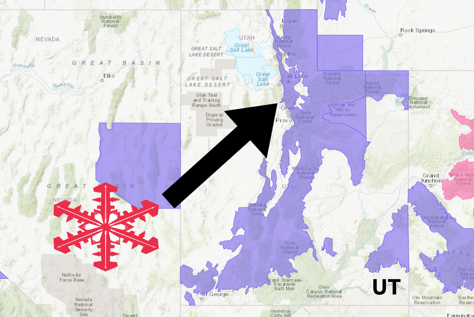
The National Weather Service has issued a Winter Weather Advisory for Utah. It’s in effect until 10:00am Thursday morning.
Heavy snowfall is forecasted to impact the area throughout that time.
More heavy snowfall is headed to the area on Friday.
“A warm and quite moist storm system will impact much of Utah through early Thursday. Significant amounts of valley rain and mountain snow are expected with this storm.”
– NOAA Salt Lake City, UT
If you haven’t already, get your hands on an Ikon Pass, so you don’t miss out on any of these POW days in Utah next season.
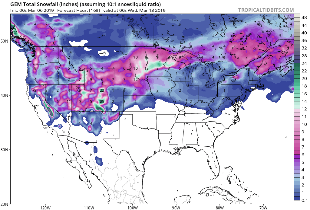
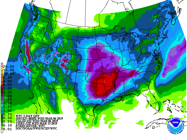
Snow levels are expected to hover around 7,000ft today, before reaching 5,000ft on Thursday.
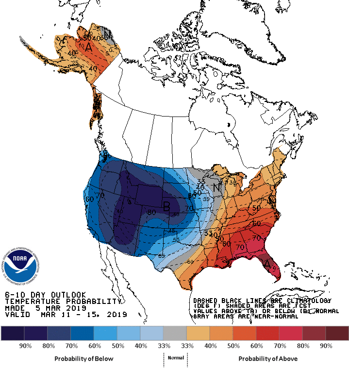
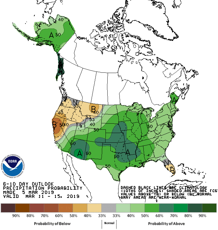
The 6-10 day outlook calls for above average precipitation and below average temperatures in Utah.
Additional Storm Info:
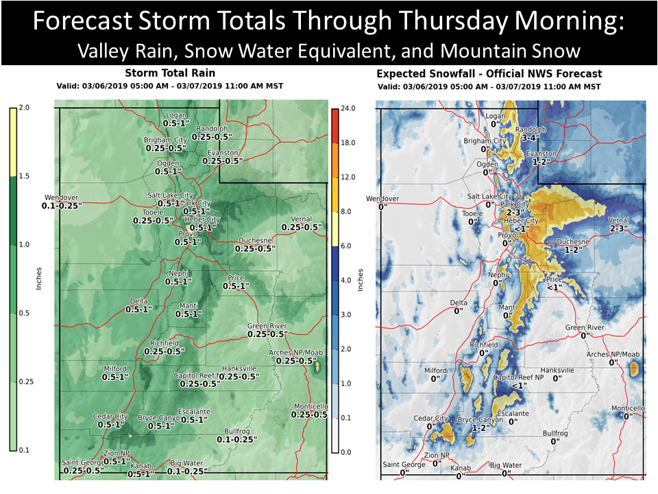
Utah: 6-18+” of Snow Today – Thursday Morning
* Snow expected. Total snow accumulations of 6 to 18 inches expected
  by midday Thursday, mainly above eight thousand feet. Southwest
  slopes may locally see in excess of 2 feet of snow.
- NOAA Salt Lake City, UT
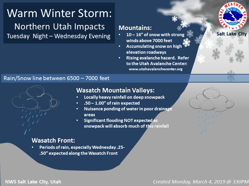
Winter Weather Advisory:
URGENT - WINTER WEATHER MESSAGE
National Weather Service Salt Lake City UT
830 AM MST Wed Mar 6 2019

Wasatch Mountains I-80 North-Wasatch Mountains South of I-80-
Western Uinta Mountains-Wasatch Plateau/Book Cliffs-
Central Mountains-Southern Mountains-
Including the cities of Woodruff, Randolph, Alta, Brighton,
Mirror Lake Highway, Scofield, Cove Fort, Koosharem, Fish Lake,
Loa, Panguitch, and Bryce Canyon

...WINTER WEATHER ADVISORY REMAINS IN EFFECT UNTIL 10 AM MST
THURSDAY...

* WHAT...Snow expected. Total snow accumulations of 6 to 18 inches
  expected by midday Thursday, mainly above eight thousand feet.
  Southwest slopes may locally see in excess of 2 feet of snow.
  Mid elevation winds gusting as high as 50 mph, especially south
  of I-70.

* WHERE...The mountains of Utah.

* WHEN...Until 10 AM MST Thursday.

* ADDITIONAL DETAILS...Winter driving conditions are expected,
  especially above eight thousand feet, though at times as low as
  seven thousand feet. Gusty winds may cause blowing and drifting
  snow, locally reducing visibilities to near zero. The heavy snow
  and winds may down large tree branches.
