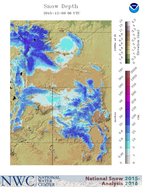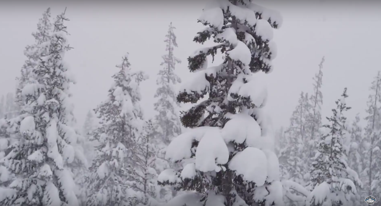
Snow is in the forecast every day this week for the Teton mountains of Wyoming. A “potent system” is forecast to hit the Tetons on Monday.
NOAA has issued a Winter Weather Advisory for the Tetons of Wyoming that is in effect from 2pm today until midnight tonight. 4-8″ o f snow is forecast between 2pm and midnight.
* MAIN IMPACT...4 TO 8 INCHES WITH LOCALLY HIGHER AMOUNTS.
- NOAA Riverton, WY today
***
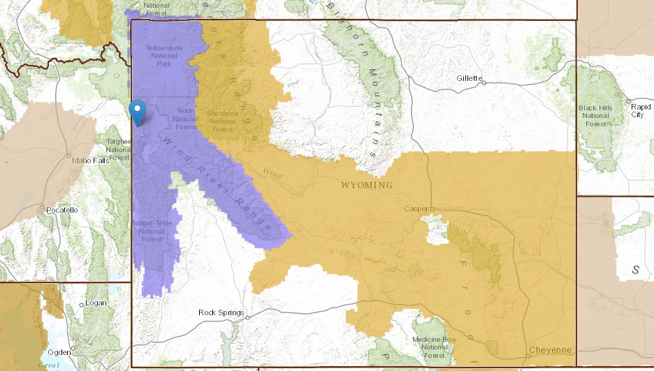
NOAA is calling for 9-17″ of snow at Grand Targhee ski resort between now and Thursday night:
***
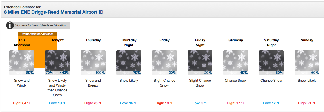
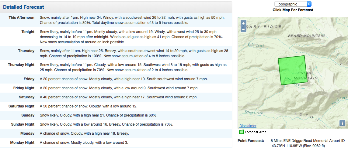
The biggest storm on the horizon is forecast to hit the Tetons on Monday.
SIGNIFICANT SNOWFALL AND STRONG TO POSSIBLY HIGH WIND COULD OCCUR
WITH THIS POTENT SYSTEM EARLY NEXT WEEK. MUCH OF THE PRECIPITATION
IS EXPECTED TO BE SNOWFALL. - NOAA Riverton, WY today
WINTER WEATHER ADVISORY for WYOMING:
URGENT - WINTER WEATHER MESSAGE
NATIONAL WEATHER SERVICE RIVERTON WY
214 AM MST WED DEC 9 2015

...SNOW EXPECTED FOR THE NORTHWESTERN MOUNTAINS...

.A COLD FRONT WILL APPROACH WESTERN WYOMING THIS AFTERNOON AND
EVENING AND BRING PERIODS OF SNOW...MODERATE TO HEAVY AT TIMES. IN
ADDITION...STRONG WEST TO SOUTHWEST WINDS WILL BRING BLOWING SNOW
AND REDUCED VISIBILITIES.

YELLOWSTONE NATIONAL PARK-TETON AND GROS VENTRE MOUNTAINS-
INCLUDING THE CITIES OF...LAKE...MAMMOTH...OLD FAITHFUL

...WINTER WEATHER ADVISORY IN EFFECT FROM 2 PM THIS AFTERNOON TO
MIDNIGHT MST TONIGHT...

THE NATIONAL WEATHER SERVICE IN RIVERTON HAS ISSUED A WINTER
WEATHER ADVISORY FOR SNOW AND BLOWING SNOW...WHICH IS IN EFFECT
FROM 2 PM THIS AFTERNOON TO MIDNIGHT MST TONIGHT.

* TIMING...SNOW WILL BEGIN THIS AFTERNOON CONTINUE INTO THE
  EVENING BEFORE ENDING AFTER MIDNIGHT. THE HEAVIEST SNOW IS
  EXPECTED LATE THIS AFTERNOON AND EARLY THIS EVENING.

* MAIN IMPACT...4 TO 8 INCHES WITH LOCALLY HIGHER AMOUNTS.

* WIND AND VISIBILITY...SOUTHWEST BECOMING WEST 15 TO 30 MPH WITH
  GUSTS TO 40 TO 50 MPH. VISIBILITY WILL BE REDUCED TO UNDER ONE-
  HALF MILE AT TIMES IN SNOW AND BLOWING SNOW.

* OTHER IMPACTS...HEAVY SNOW...DRIFTING AND BLOWING SNOW WILL
  IMPACT TRAVEL OVER MOUNTAIN PASSES...ESPECIALLY OVER TETON
  PASS.