Forecast By SnowBrains Meteorologist – Eric McNamee
9:30 AM MST, Nov. 19, 2020
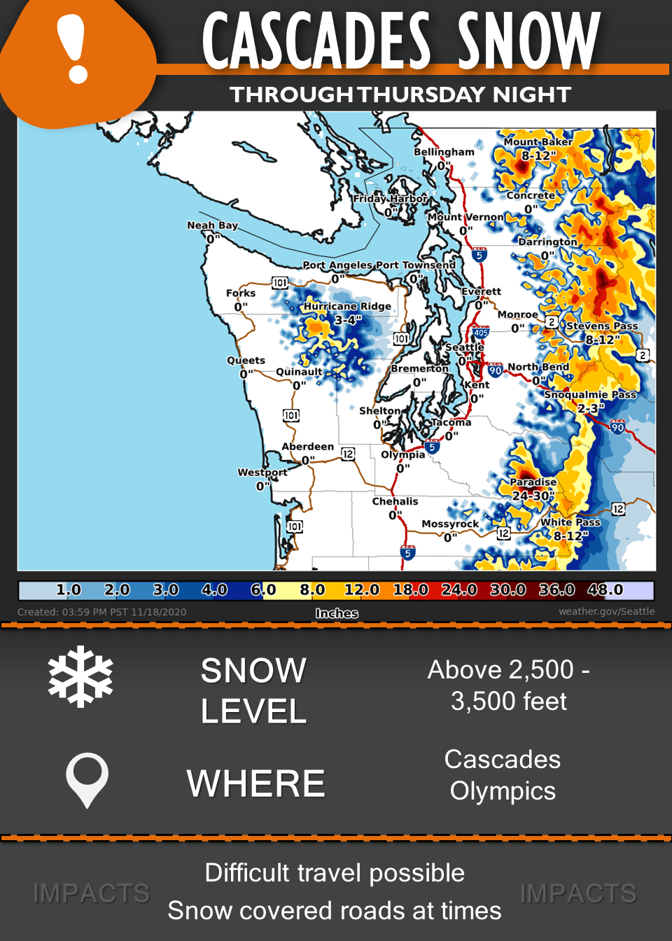
Forecast Summary:
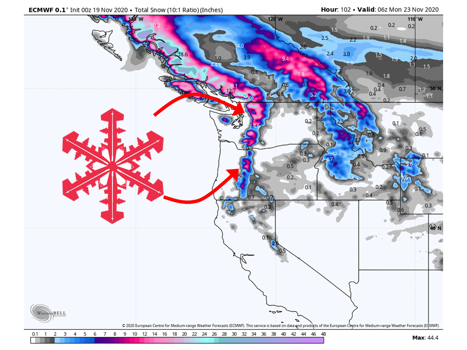
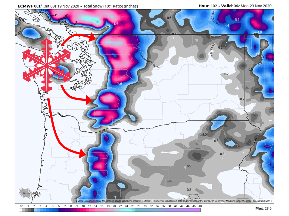
An unsettled weather pattern will bring 1-2 Feet of snow through the weekend.
Resorts likely to get the most snow are Mount Baker, Crystal Mountain, and Stevens Pass.
Active weather looks to continue as a progressive pattern will persist into next week.
Short-Term Forecast:
Thursday-Sunday:
1-2 Feet of snow is expected to fall in the Cascades through the weekend as unsettled weather continues.
A series of weak disturbances will move through the region, allowing for snowfall through the weekend.
This will come in waves so snowfall will not be continuous, but will be heavy at times.
Cold temperatures aloft within these shortwave impulses will
contribute to the development of some lightning flashes and
convective activity through the early evening hours. Per the SPC
HREF analysis, most instability parameters appear to peak in the
early afternoon, lasting through early evening today. Breaks in
shower activity are needed in order to increase surface based
instability for moderate gains in CAPE. Additionally, 0-1km Storm
Relative Helicity is at its maximum within the same time frame. A
GFS model sounding for Puget Sound generally matches with this
analysis. The potential for brief heavy rain and small hail is
there for any cells that develop.

Precipitation on Friday will likely be more scattered in nature,
with the wettest period confined to the morning hours. Snow levels
will drop below 4000 feet Friday morning, therefore the passes
could pick up a couple more inches. If travel plans involve the
Cascade passes, be prepared for winter driving conditions. A
drying trend establishes itself over the area as a shortwave ridge
takes over for Saturday and much of Sunday morning.

-NWS Seattle 11/19/2020
Long-Term Forecast:
Monday-Wednesday:
More robust systems look to move into the Pacific Northwest next week.
At this time, exact snowfall amounts are not certain but additional feet of snow is likely.
Extended Forecast:
Wednesday and Beyond:
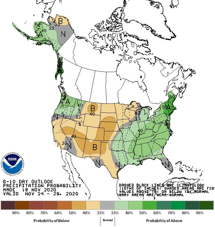
Global models and ensemble indicate active weather is likely in the extended period.
This will likely bring above-average precipitation and relatively average temperatures.