Forecast By SnowBrains Meteorologist – Eric McNamee
11:20 AM MST, 2/17/2021
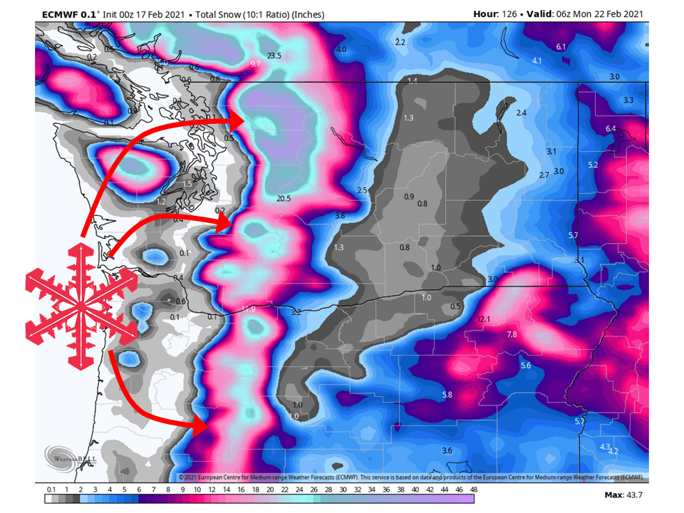
Forecast Summary:
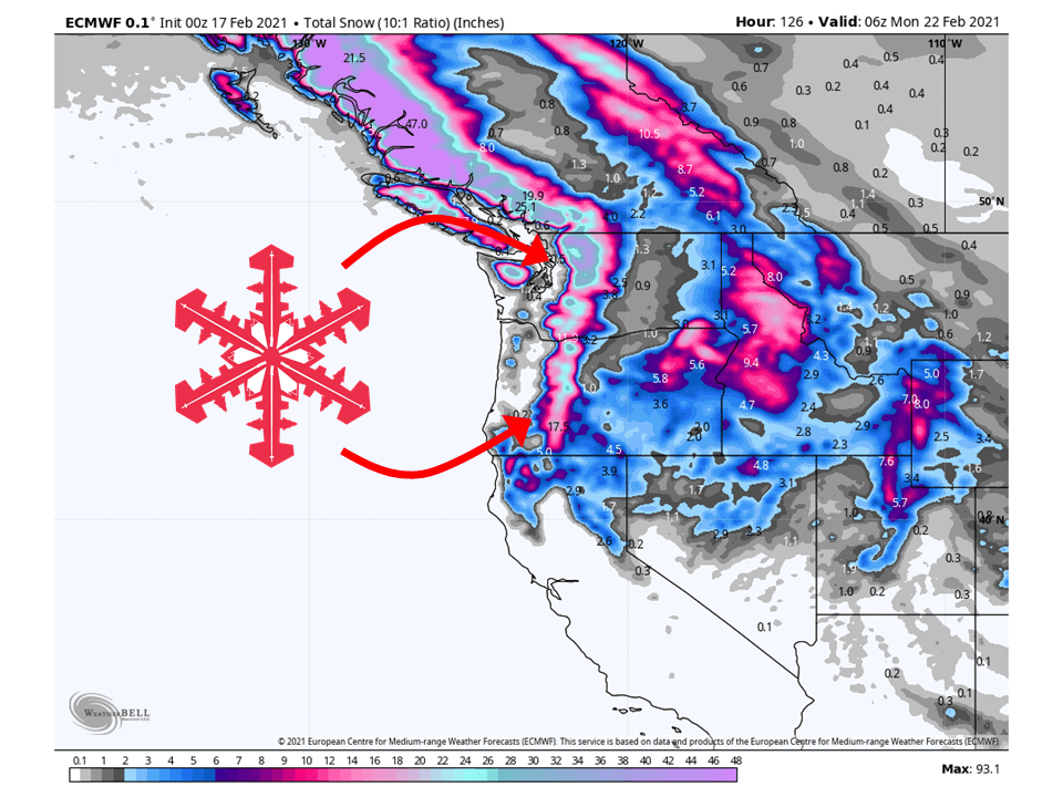
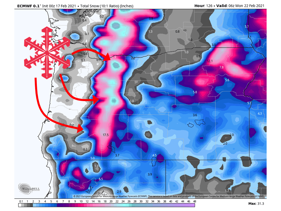
A couple of shortwave troughs will make their way through the Pacific Northwest by Sunday, bringing 1-3 FEET of snow along the Cascades.
The shortwave trough currently in place will bring some light amount to the region.
The first of the two shortwaves will move into the PNW tomorrow, bringing 6-14″ of snow through Friday.
The second shortwave trough will move into the region Saturday night, bringing an additional 8-18″ of snow.
Resorts that look to see the most snow are Mt. Bachelor, Hoodoo Ski Area, Crystal Mountain, Alpental, and Mt Baker.
Short-Term Forecast:
Wednesday-Friday:
The first of two shortwave troughs will move through the region tomorrow, bringing 6-14″ of snow to the Cascades, with the highest amounts in Washington.
Snow from this shortwave trough will last through Friday as moisture streams in from the Pacific.
Snow levels look to be at roughly 3000 feet on the western slope of the Cascades, with snow levels around 4500′ on the east slope.
This has prompted the National Weather Service to issue Winter Weather Advisories for the southern portion of the Cascades.
Long-Term Forecast:
Saturday-Tuesday:
The second shortwave will move in from the Pacific Saturday, bringing 6-18″ of snow along the Cascades, with the highest amounts again in Washington.
At the moment, snow levels are uncertain due to disagreement on the track of this shortwave trough.
Snow showers look to continue into Monday, with more snow possible Tuesday.
Extended Forecast:
Tuesday and Beyond:
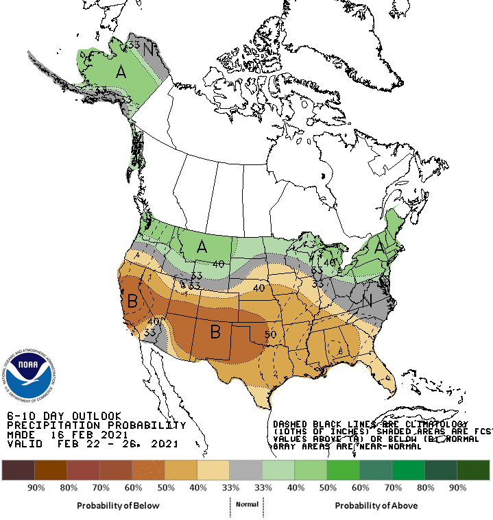
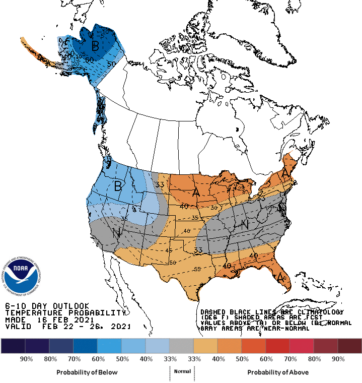
Global ensembles indicate above-average precipitation and below-average temperatures across the Pacific Northwest in the extended.
Oregon:
The first of two shortwave troughs will move through the region tomorrow, bringing 6-12″ of snow to the Oregon Cascades.
The second will move through this weekend and early next week, bringing an additional 6-18″ of snow.
Resorts that look to see the most snow are Mt. Bachelor, Timberline, and Hoodoo Ski Area.
Washington:
The first of two shortwave troughs will move through the region tomorrow, bringing 6-12″ of snow to the Washington Cascades.
The second will move through this weekend and early next week, bringing an additional 6-18″ of snow, with possibly higher amounts.
Resorts that look to see the most snow are Crystal Mountain, Alpental, Stevens Pass, The Summit at Snoqualmie, and Mt Baker.
USA:
Global ensembles indicate above-average precipitation and below-average temperatures across the Pacific Northwest in the extended.