Forecast By SnowBrains Chief Meteorologist – Eric McNamee
9:50 AM MST, 2/19/2023
Forecast Summary:
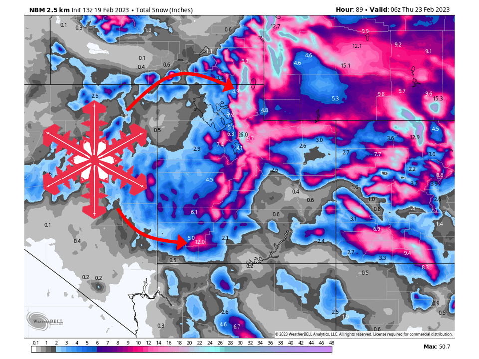
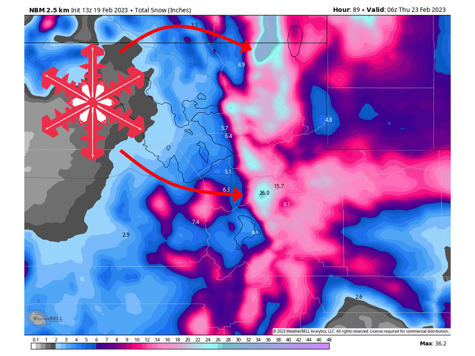
A trough will move through Utah Monday night through Wednesday and bring 1-4 FEET of snow to most mountain locations.
Snow will develop Monday over far northern Utah as moisture is transported into the region ahead of the trough.
The cold front associated trough will push into the northern and central parts of the state on Tuesday evening and Tuesday night.
This cold front will slowly move and transport an abundance of moisture into the state through Wednesday.
Conditions will dry out Wednesday night before more snow moves in Thursday with another system.
Resorts that will see the most snow are:
- Alta
- Snowbird
- Brighton
- Solitude
- Deer Valley
- Park City
- Canyons
- Snowbasin
- Powder Mountain
- Beaver Mountain
- Eagle Point
- Brian Head
Short-Term Forecast:
Monday-Wednesday:
A trough will start to push into Utah Monday night and bring 1-4 FEET of snow to most mountain locations by Wednesday. Snow will start Monday over far northern Utah as moisture is transported into the region ahead of the trough. By Tuesday afternoon and evening, the cold front associated with the trough will push into the northern part of the state. Along this front, a pronounced band of precipitation will present with heavy snowfall rates. The cold front will then stall over the central part of Utah and slowly push to the south/east. Snow will continue behind the front as moist, unstable northwest flow interacts with the terrain. This will continue through Wednesday evening before decreasing and drying out late Wednesday night. The highest totals will be focused on northern Utah, with the Bear River Range likely seeing the most.
Long-Term Forecast:
Thursday-Sunday:
Snow moves back into the state as a system over the California coast draws moisture. This snow will be lighter than the Tuesday/Wednesday system but will be widely scattered. Currently, the highest totals will be focused on southern Utah, with Brian Head benefitting the most, along with Eagle Point. Snow will taper off Friday night, with dry weather expected through the weekend.
Extended Forecast:
Sunday and Beyond:
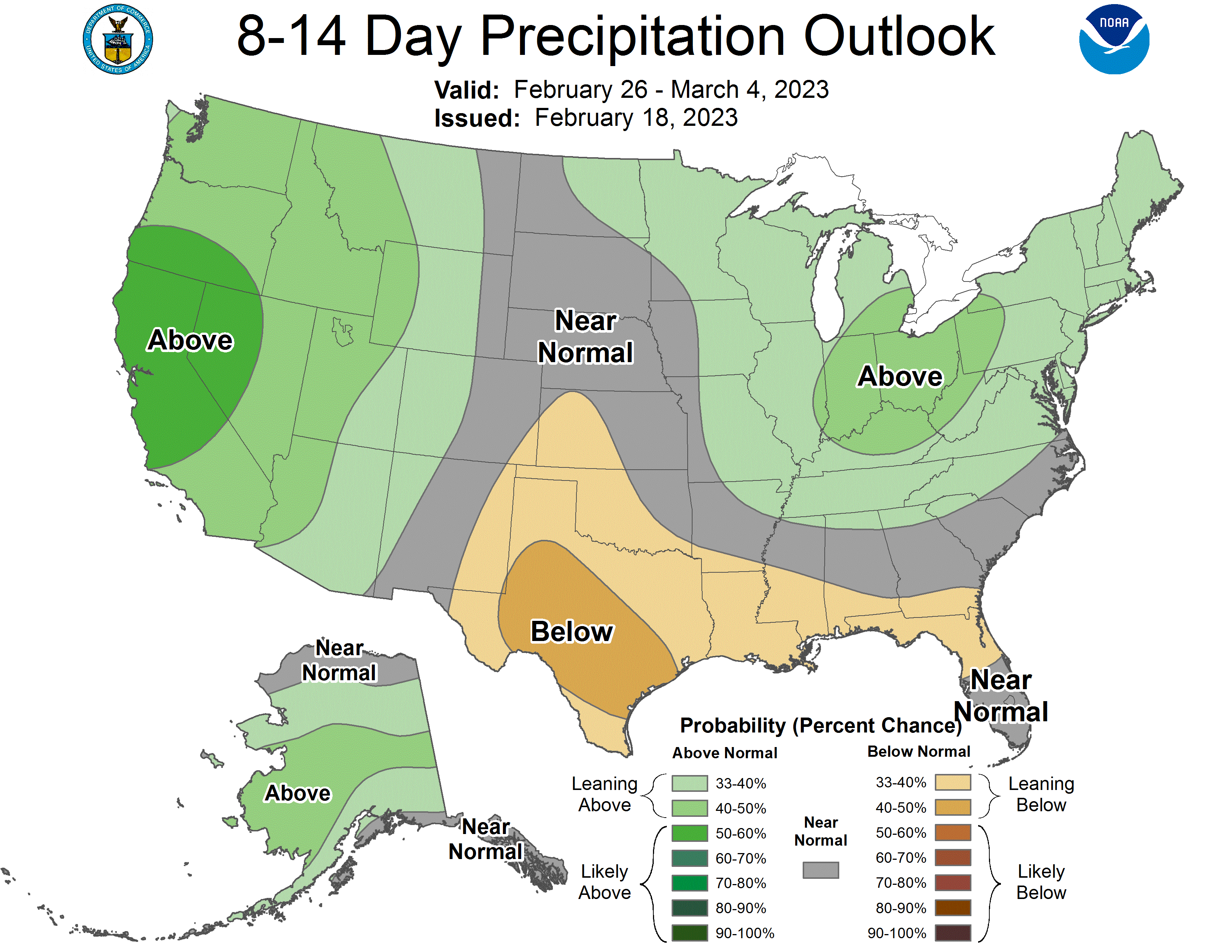
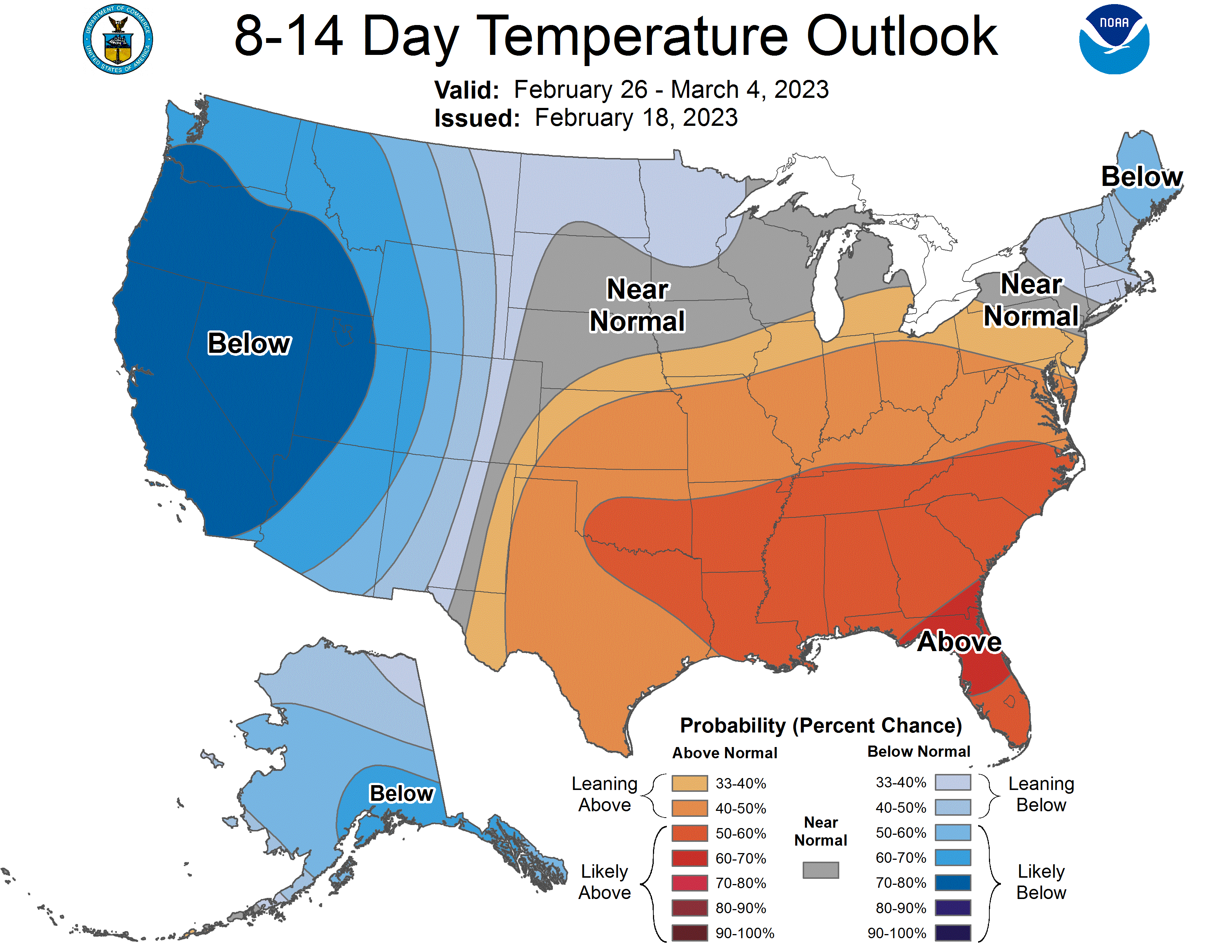
Global ensembles indicate above-average precipitation and below-average temperature across Utah through the extended period.
2 thoughts on “SnowBrains Forecast: 1-4 Feet of Snow Across Utah’s Mountains Through Wednesday With More in the Week”