Forecast By SnowBrains Meteorologist – Eric McNamee
5:20 PM MST 2/2/2022
Forecast Summary:
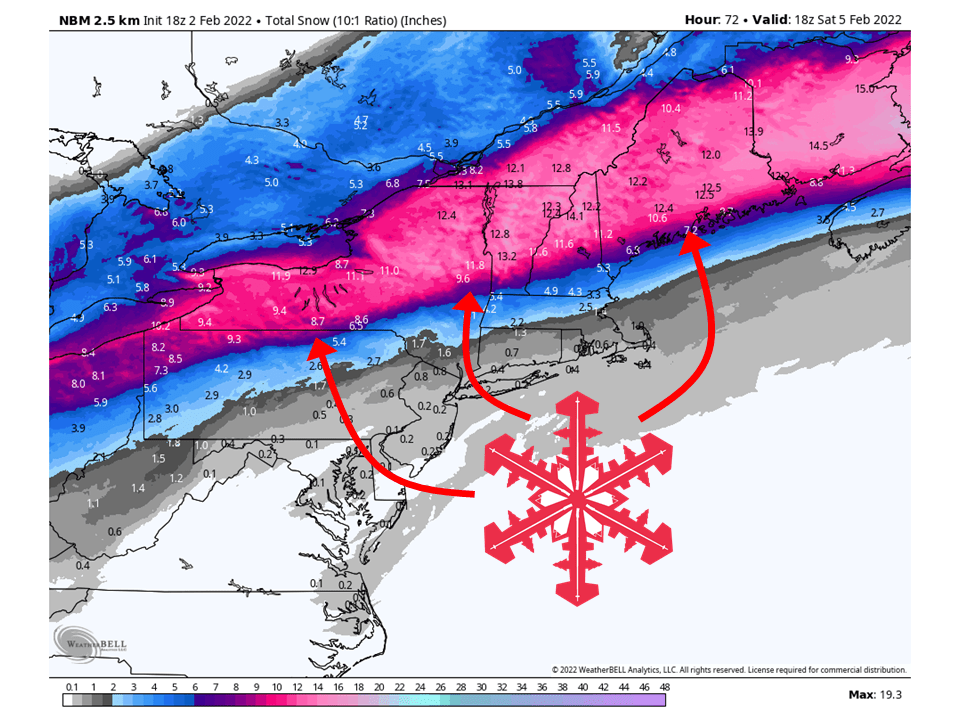
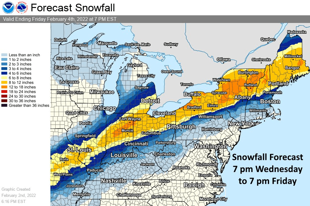
A system will cross through the eastern US to end the work week and bring 10-20″ of snow to ski resorts in the Northeast.
Snow will get started Wednesday night/Thursday morning and fill in from west to east.
Snow will continue through Friday before tapering off Friday night.
Resorts likely to get the most snow are Killington, Hunter, Okemo, Jay Peak, Mad River Glen, Loon, Whiteface, Stratton, and Sunday River.
Short-Term Forecast:
Wednesday-Friday:
A system will cross the eastern US and bring 10-20″ of snow to ski resorts in the Northeast through Friday.
This system does not look overly strong but will eject large amounts of moisture into the region.
This combined with cold air over the interior Northeast will result in high snowfall totals.
Some locations may begin as rain but snow gets started Wednesday night/Thursday morning and fills in from west to east through the day Thursday.
Snow will continue, heavy at times, before tapering off late in the day Friday and into Friday night.
This has led to widespread Winter Storm Warnings and Winter Storm Watches across the Northeast.

Long-Term Forecast:
Saturday-Tuesday:
Conditions generally clear out heading into the weekend with some isolated snow showers possible.
These showers won’t result in any additional accumulations.
The next chance for accumulating snow comes early next week as a system moves through the region.
Snowfall totals are not known at this time.
Extended Forecast:
Tuesday and Beyond:
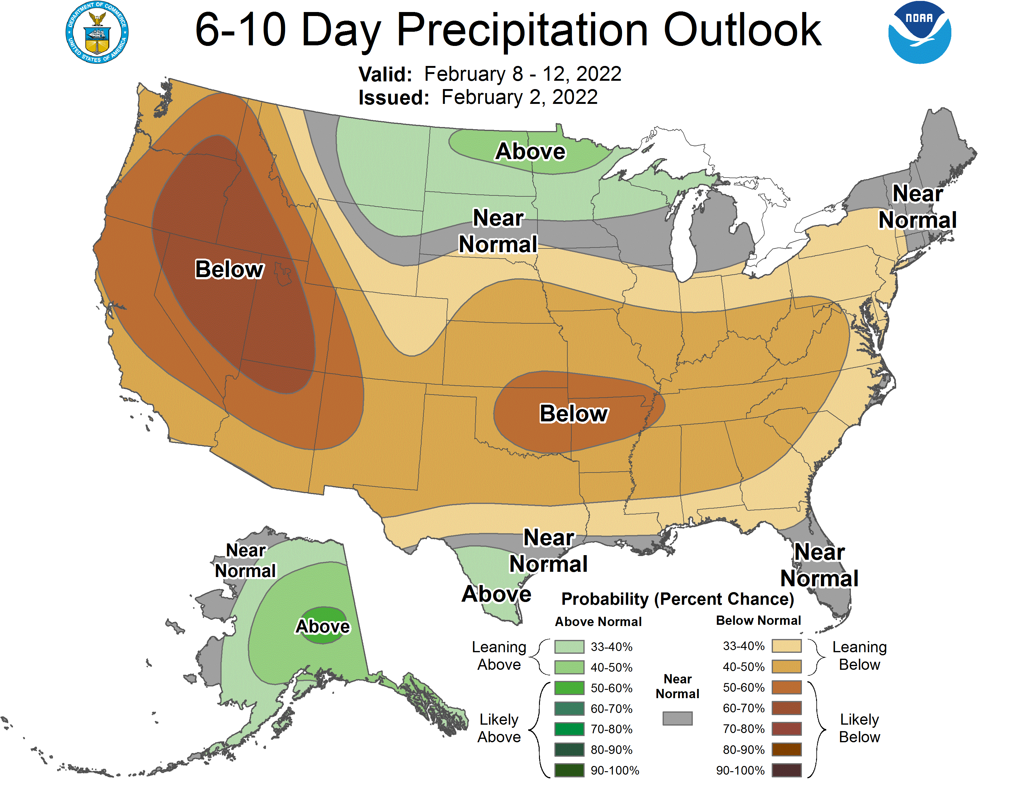
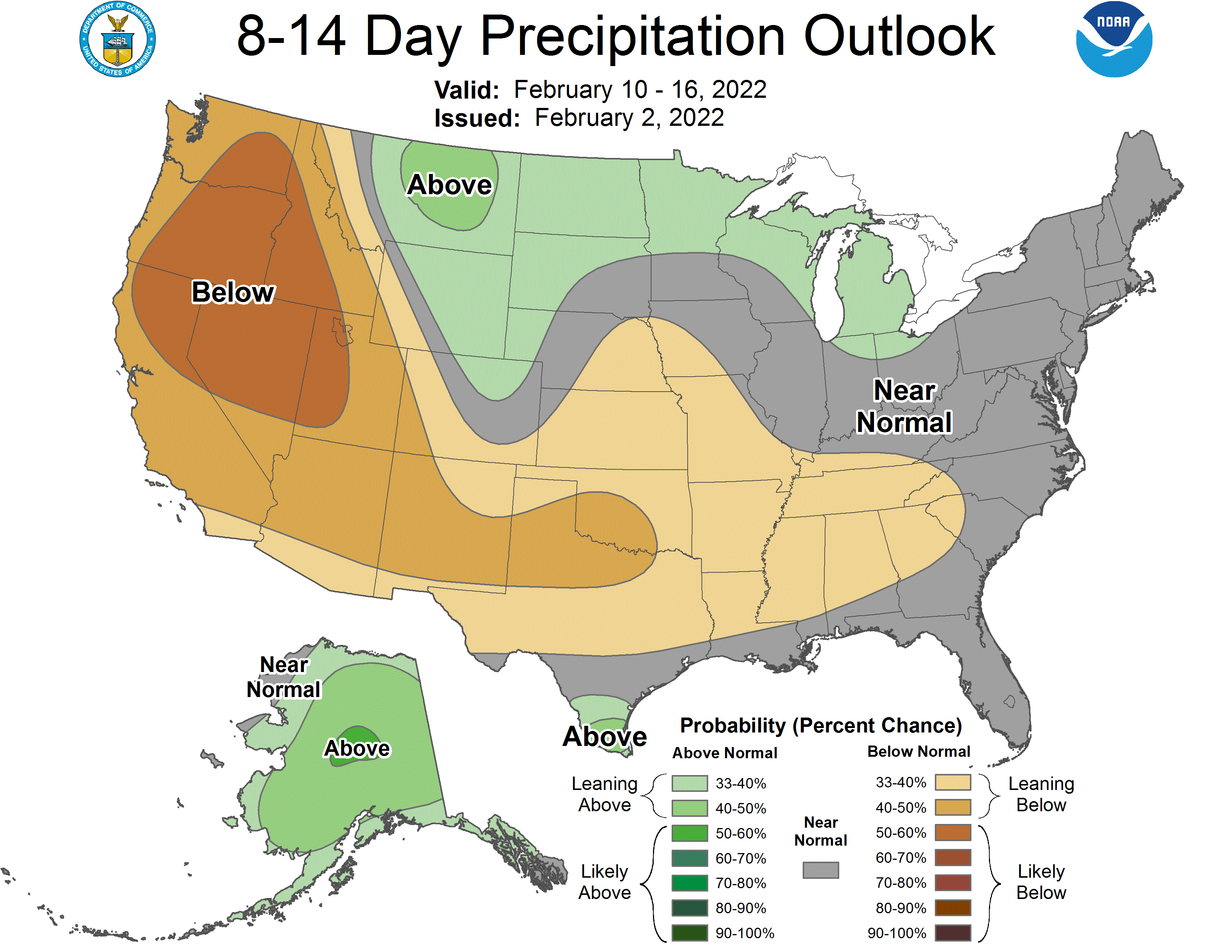
Global ensembles indicate precipitation being right around average heading into the extended.
