Forecast by SnowBrains forecaster Clay Malott at 1pm MT, 10/9/23.
A solid winter storm will dig through the Western US, bringing major accumulations to the Pacific Northwest, Idaho, Montana, Utah, Wyoming, and Colorado.
Snowfall will trickle into the high peaks of Colorado on Wednesday morning. By the end of the day, many mountains in the central and northern mountains above 10,000 feet will have picked up 1-3″.
Snow levels on Wednesday night and Thursday morning will dive below 8,000 feet, so most ski resort base areas will likely wake up with a dusting to a few inches of snow.
A strong secondary push of moisture will arrive in northern Colorado on Thursday morning, lasting through the day. These showers are unlikely to make it much further south than I-70.
The precipitation will be wrapped up by the end of the day on Thursday.
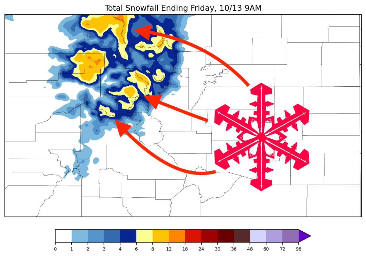
Take a look at the map below depicting total storm snowfall by Friday morning. Note the highest snowfall totals in the Park Range (Steamboat), Flat Tops, and Gore Range. Widespread 4-6+ inch totals with local maxima exceeding a foot:
In terms of resort totals, let’s take a look at projected totals at several major resorts:
- Steamboat: 6-10″
- Vail: 5-8″
- Arapahoe Basin: 2-5″
- Snowmass: 4-7″
- Telluride: 0-1″