Forecast by SnowBrains forecaster Clay Malott
Sunday, November 27th, 11pm PST
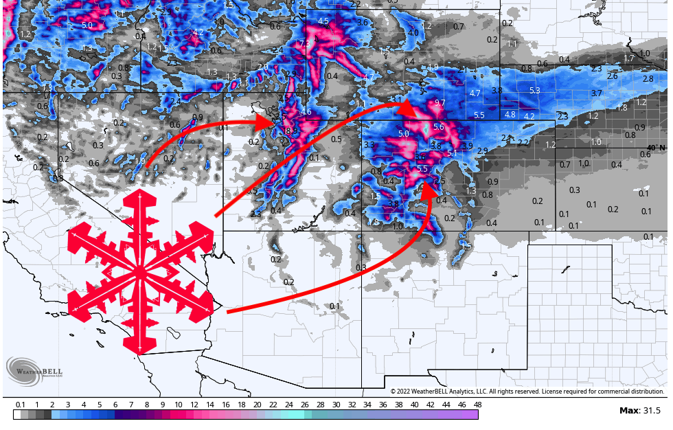
A strong trough will dig through the Western US early this week, bringing significant snow to Utah and Colorado. Totals will range from 6 to 18 inches at ski areas in the region, bringing good ski conditions for Tuesday and Wednesday.
Precipitation will move into Utah’s Wasatch mountains on Monday morning. Precipitation rates will steadily increase throughout the day and peak in the afternoon. By the time lifts stop spinning on Monday, Cottonwood resorts will have picked up 5-8″, so ski conditions will be pretty good throughout the day on Monday. By Tuesday morning, most Cottonwood resorts will have picked up 12-15″. This will freshen up the snow and make ski conditions excellent all week.
Very light showers will begin in the northern mountains in Colorado on Monday morning, although the main surge of precip doesn’t arrive until the afternoon. The moisture will move in from the northwest, starting in the north and gradually moving south. Throughout the ski day on Monday, resorts will only pick up a dusting. By Tuesday morning, I’m looking for 8-12″ in the northern mountains, 6-11″ at Summit County resorts, 8-12″ in the central mountains (Aspen & Crested Butte), and 3-6″ in the southern mountains.
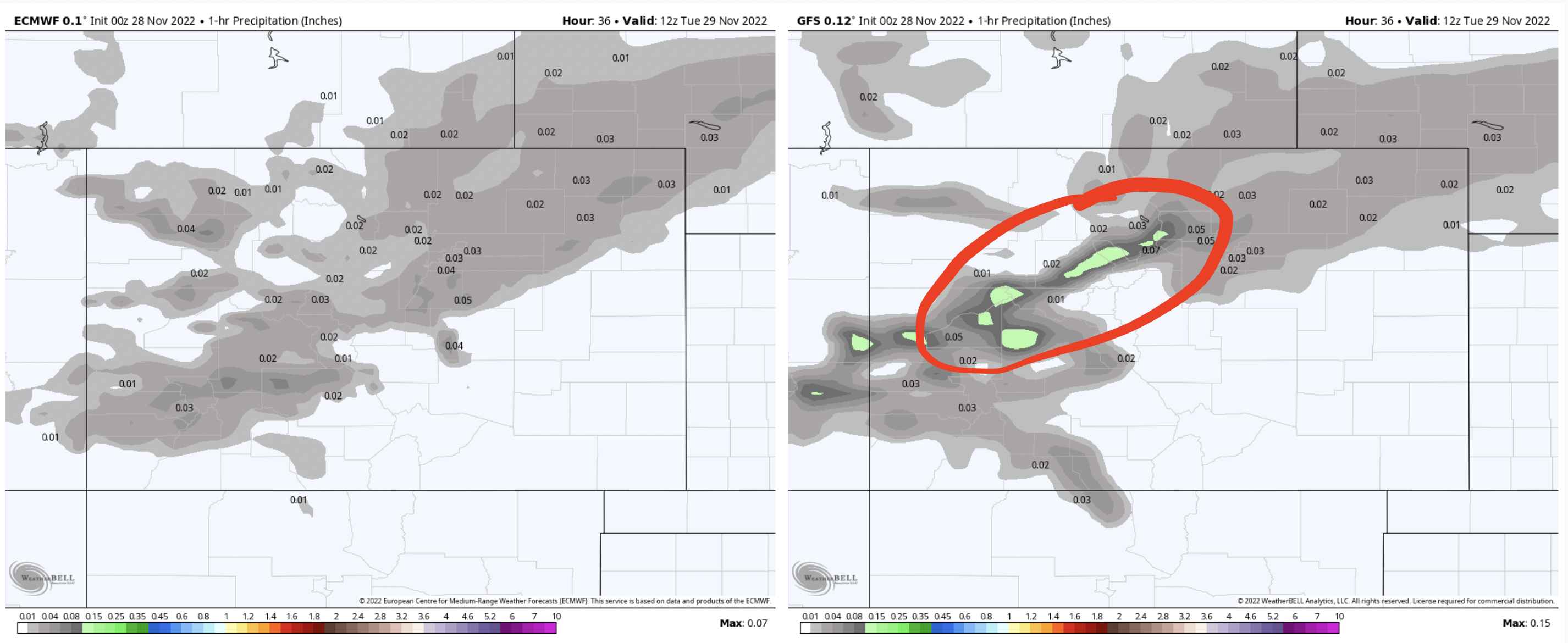
All the models have an embedded band of strong precipitation overnight between Monday and Tuesday that could make a big difference in totals. The Euro has this band dissipating before reaching Summit County and the central mountains while the GFS keeps it intact. If this band materializes and lingers over a location, it could dump some extra snow on resorts in the central mountains, but don’t count on it!
More snow returns to Utah and Colorado on Friday morning. Stay tuned for a forecast as the event gets closer!
