Forecast By SnowBrains Meteorologist – Eric McNamee
7:40 PM MST 3/11/2022
Forecast Summary:
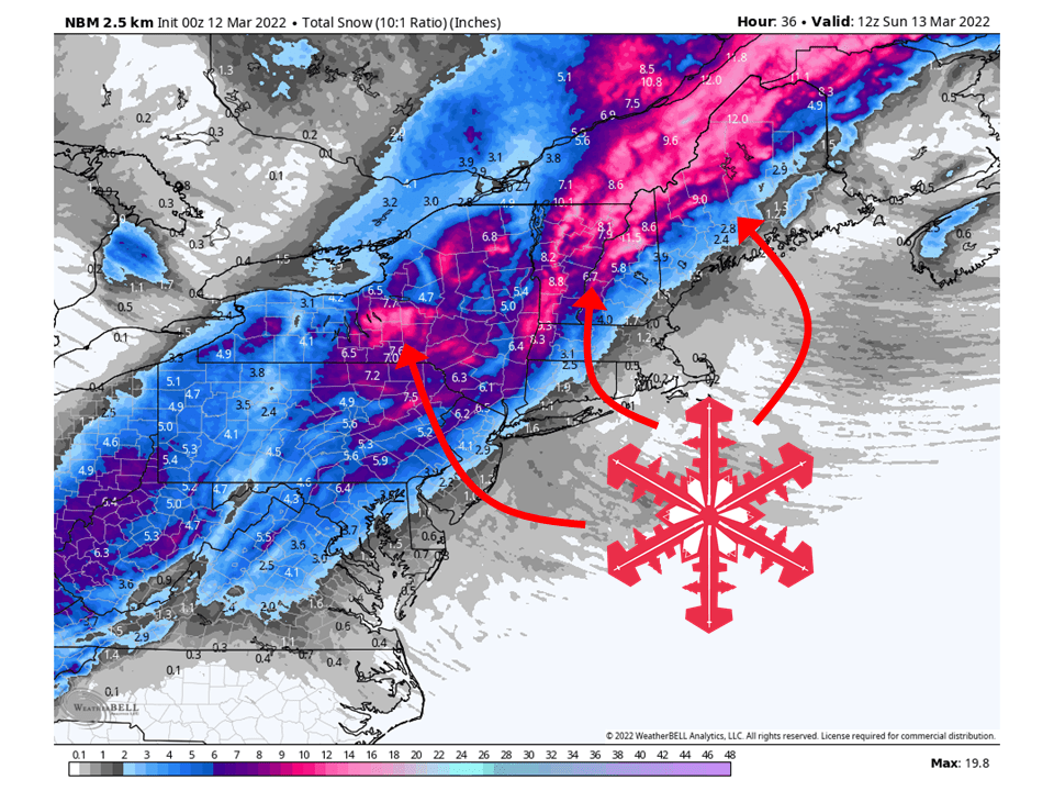
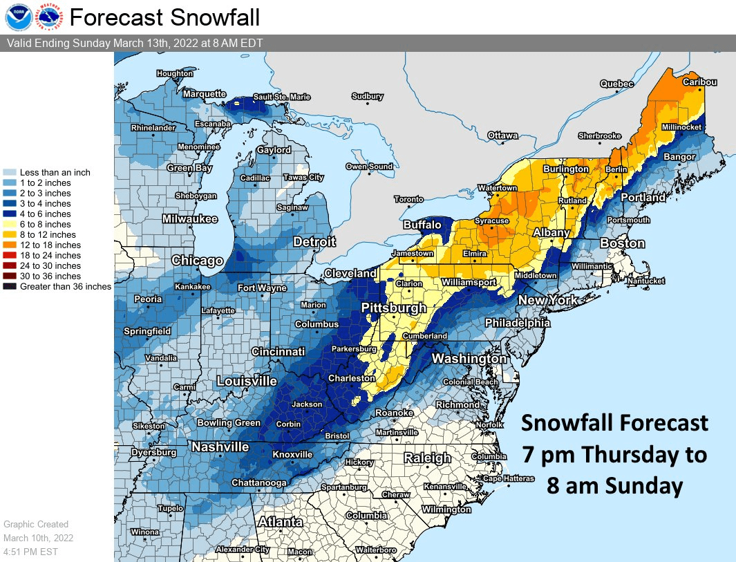
This weekend, a system will cross through the Northeastern US and bring 6-18″ of snow to ski resorts in the Northeast.
Snow will start Friday night/Thursday morning and fill in from west to east.
Snow will continue into Sunday before tapering off Sunday afternoon.
Resorts likely to get the most snow are Killington, Hunter, Okemo, Jay Peak, Mad River Glen, Loon, Whiteface, Stratton, and Sunday River.
Short-Term Forecast:
Friday Night-Sunday:
This weekend, a system will cross through the Northeastern US and bring 6-18″ of snow to ski resorts in the Northeast.
This system will be decently cold and eject large amounts of moisture into the region.
Snow will get started near the Great Lakes Friday night and spread to the east through the day Saturday.
Some locations may begin as rain Saturday morning but turn to snow Saturday afternoon as the system moves west to east.
Snow will continue Saturday night into Sunday morning before tapering off Sunday afternoon.
This has led to widespread Winter Storm Warnings, and Winter Storm Watches across the Northeast.
Long-Term Forecast:
Monday-Thursday:
A weak system is possible Monday/Tuesday next, which could bring additional snowfall to the region.
Snowfall totals are not known at this time.
Extended Forecast:
Thursday and Beyond:
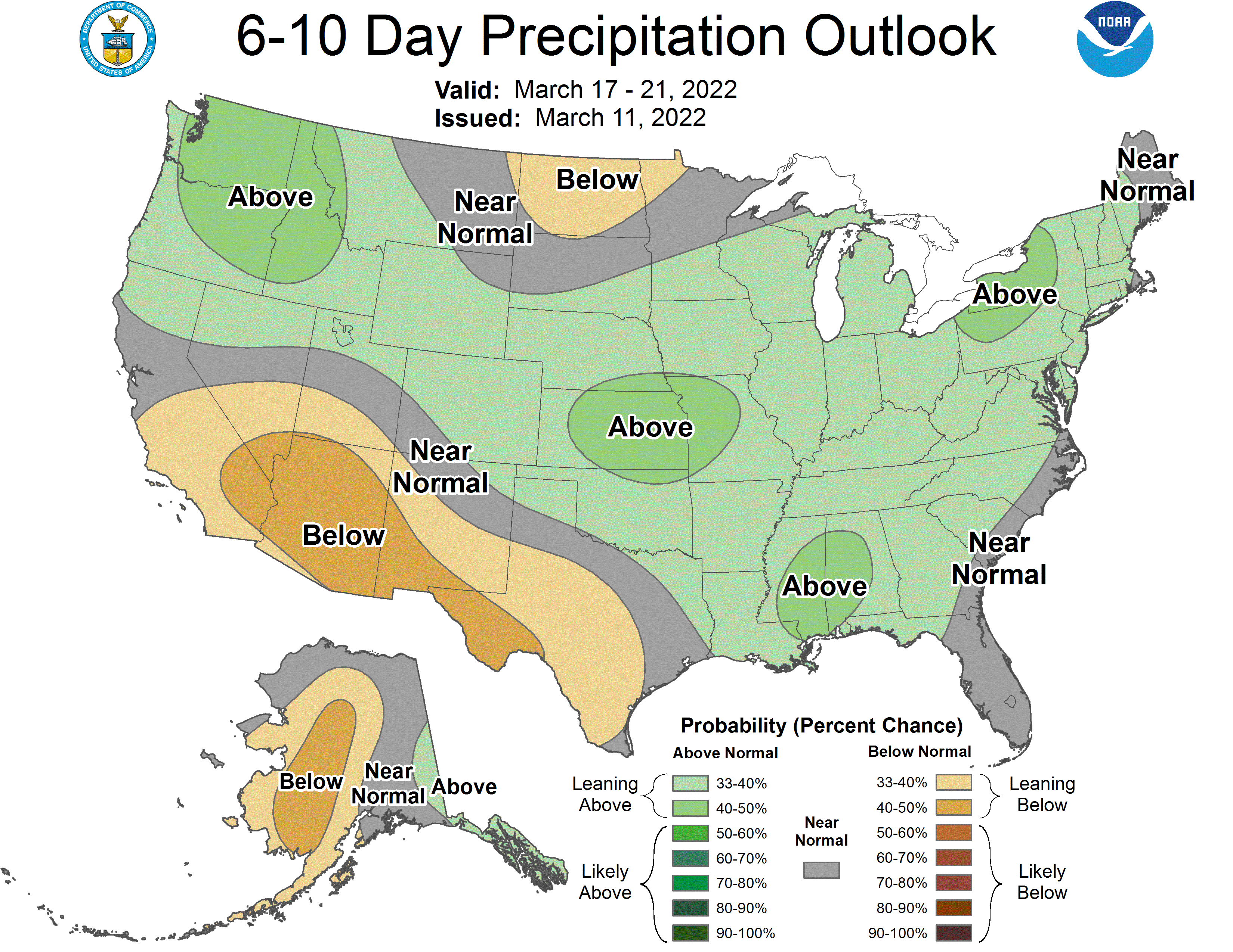
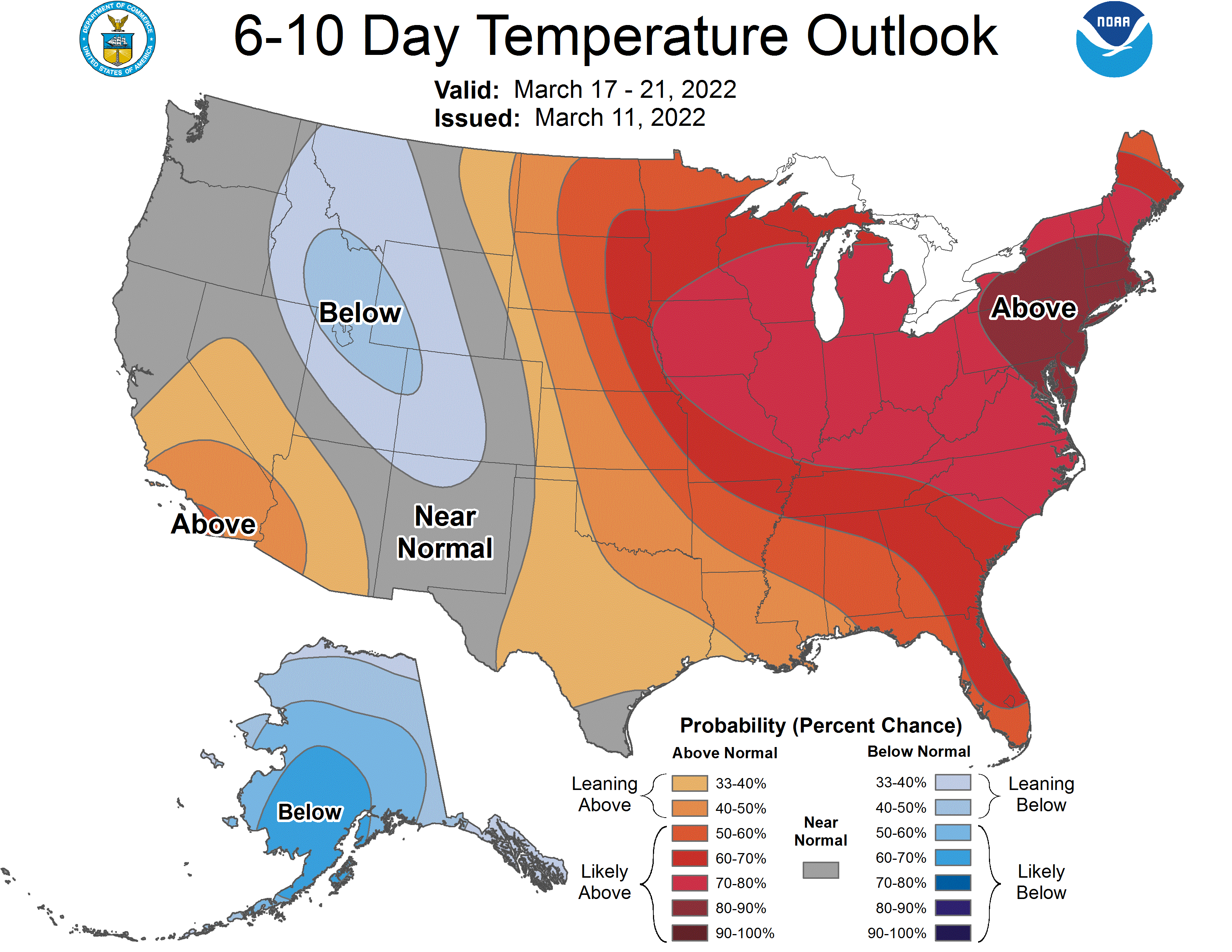
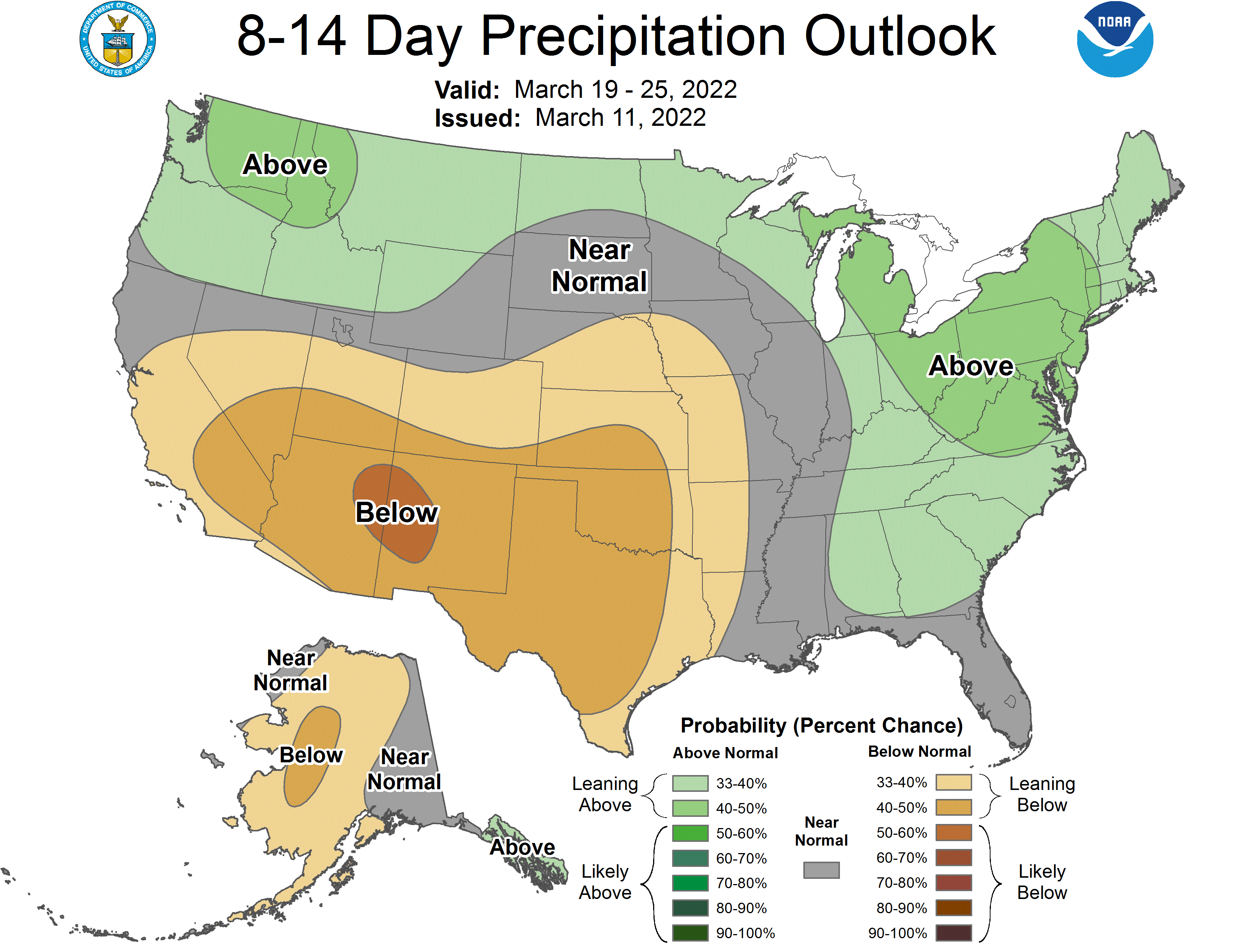
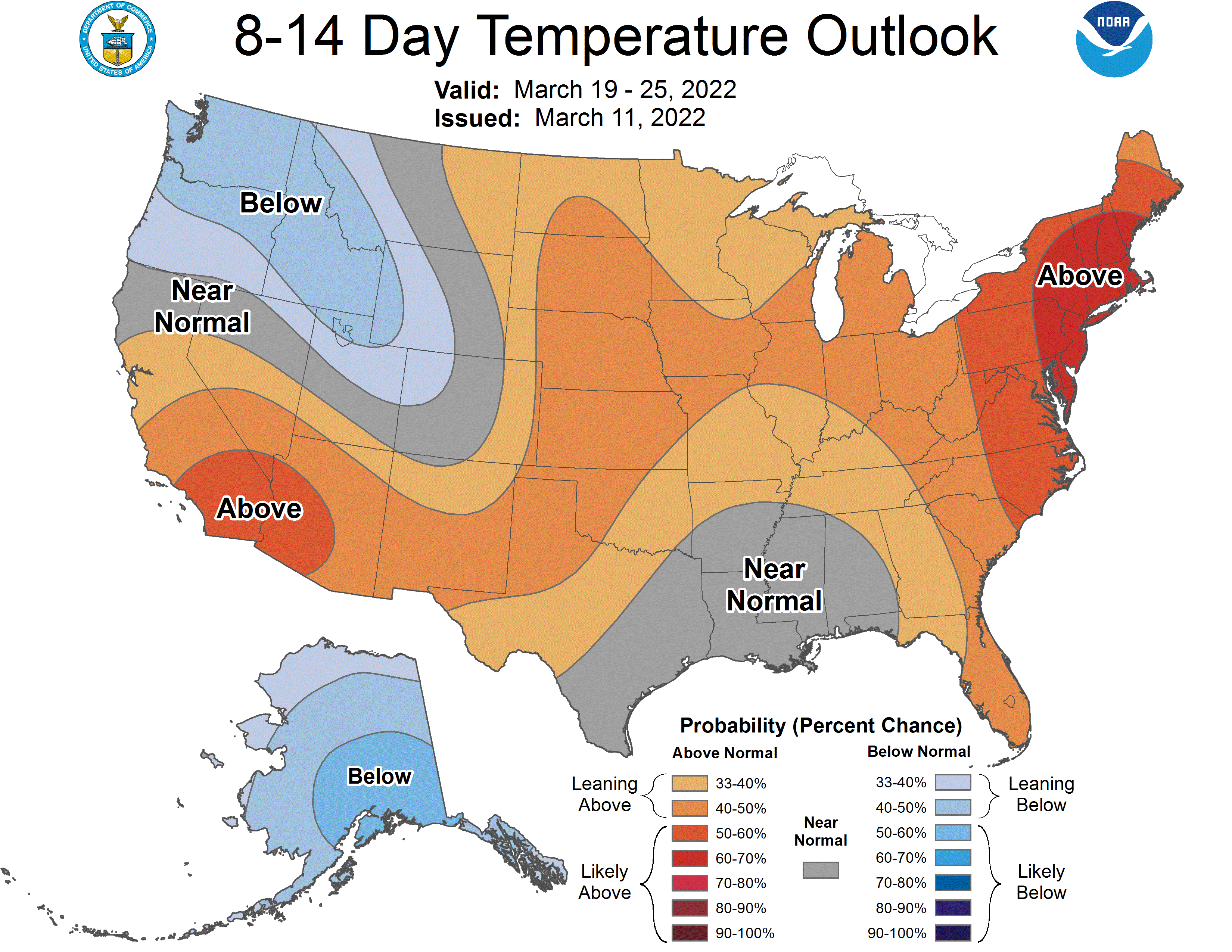
Global ensembles indicate above-average precipitation and above-average temperatures heading into the extended.
