Forecast Published 9:45 PM MDT 10/28/2024
Forecast Summary
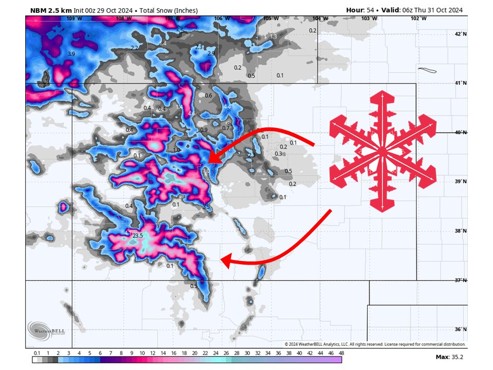
A trough currently digging into the western U.S. will bring snow to the mountains of Colorado through Wednesday. Precipitation is already beginning to move into western portions of Colorado in the form of rain and snow but will increasingly turn into snow across mountain locations as colder air filters in on Tuesday. Snow will continue into Wednesday before tapering off overnight, giving way to dry conditions heading into the weekend.
Short Term
(Now through Wednesday)
As mentioned above, a trough digging into the western U.S. bring the chance of snow to the mountains of Colorado. Precipitation has already begun to move into the area, falling as snow at higher altitudes. The snow line will lower through Monday night and into the day on Tuesday as more moisture and colder air moves in. Snow will continue into Wednesday but wil be much more showery and eventually taper off overnight. Heaviest accumulations will generally be above 9,000 feet where 6-12 inches of snow will be possible, with 1-2 feet for some peaks of western Colorado.
Notable Resort Storm Totals:
- Silverton: 10-18 inches
- Telluride: 8-14 inches
- Wolf Creek: 8-12 inches
- Purgatory: 8-14 inches
- Snowmass: 8-14 inches
- Aspen: 6-12 inches
Long-Term
(Thursday and Beyond)
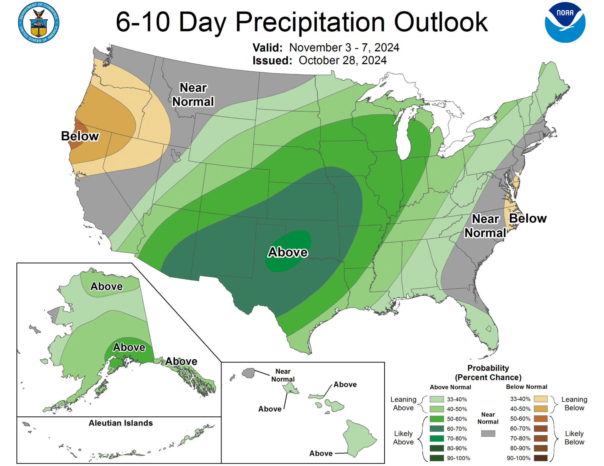
Conditions will dry out heading into Thursday and stay dry through at least Saturday. By Sunday, another trough will dig into the western U.S. However, most of the moisture with this trough will stay to the west of the region with just some showers possible early into next week. A better chance for snow may come in the middle of next week but is too far out to know for sure yet.
