Forecast By SnowBrains Meteorologist – Eric McNamee
11:00 AM MST, 3/24/2021
Forecast Summary:
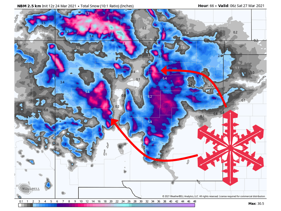
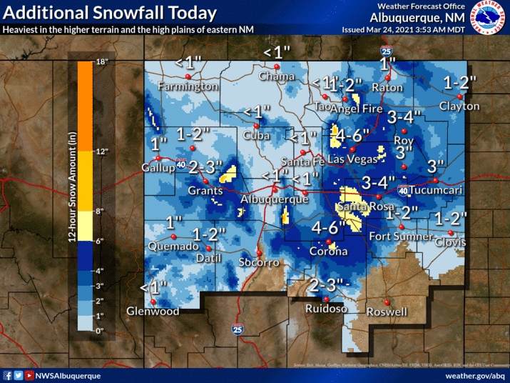
Two troughs will make their way through the state today and Thursday/Friday, bringing an additional 6-12″ of snow.
The trough that is over the state will bring the bulk of that snowfall, with less coming Thursday/Friday.
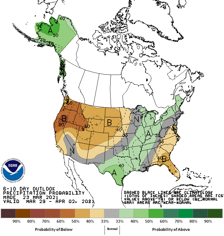
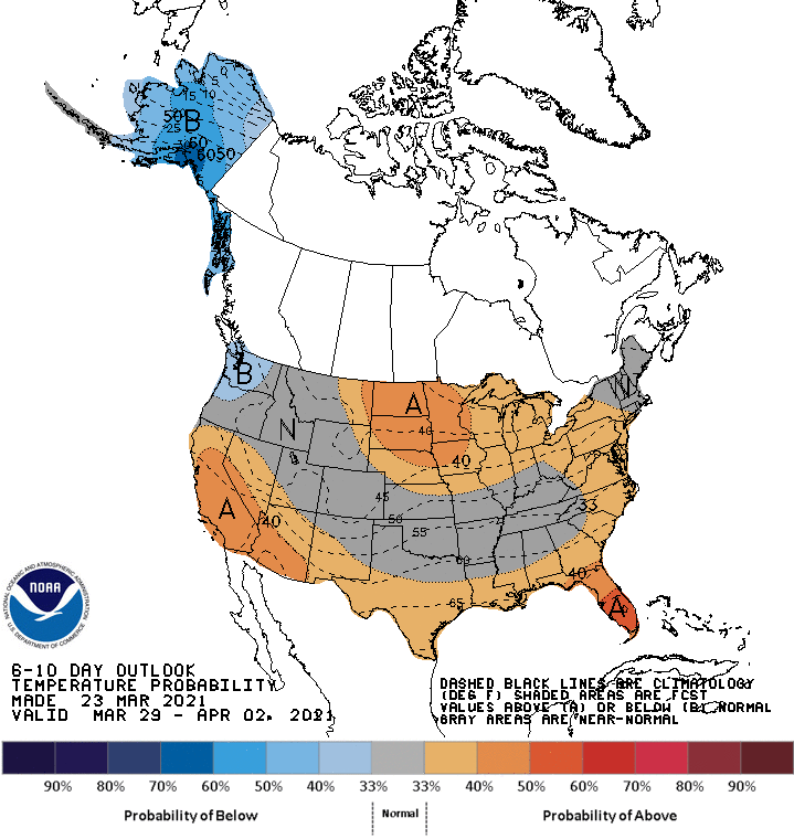
Conditions look to dry out in the long-term and extended.
Resorts that look to see the most snow are Parajito Mountain, Ski Santa Fe, Sipapu, and Taos.
Short-Term Forecast:
Wednesday-Friday:
An additional 6-12″ of snow is expected across the mountains of New Mexico through Friday from two troughs.
The trough over the state today will bring 4-6 more inches of snow through the remainder of the day.
Conditions will temporarily clear out tomorrow morning before another trough moves through tomorrow night.
Another 3-6″ is expected out of that trough, with the highest amounts in the southern San Juans.
By Friday night, most snow will taper off.
Long-Term Forecast:
Saturday-Tuesday:
Getting into the weekend and early next week, conditions look to dry out for the most part as a ridge of high pressure builds over the western US.
Some showers may be possible Sunday, but not much in the way of snow.
Extended Forecast:
Tuesday and Beyond:
Global ensembles are indicating below-average precipitation and above-average temperatures across the region.