Forecast prepared 07:00 MT on November 25, 2024
Summary
Sunday’s storm was lighter than expected, bringing 3-8″ of new snow to the Northern Utah ski areas. Ski conditions are good, but coverage remains thin, and sharks lurk.
The biggest storm of our season will begin Monday night and end Wednesday. Southern and Central Utah will take the brunt of this one, but double-digit snow totals are expected for all of Utah’s ski areas. Tuesday and Wednesday will have good conditions, but Wednesday’s snow will be slightly colder and fluffier.
The extended forecast is pretty disheartening, so get your fix while it’s here.
Short Term Forecast

A landfalling atmospheric river will pump copious moisture into the Great Basin over the next couple of days:
This will fuel waves of rain and snow beginning Monday night. As is typical in this type of storm, it’ll be on the warmer side. Rain is expected below approximately 6,500 feet for much of the event. The snow that falls at resorts will be on the heavier side, ideal for covering up those rocks and bushes. Tuesday will feature some nice soft turns, with snow falling for most of the day.
Cooler air begins to work its way into Utah on Tuesday evening, and the snow level will crash to about 5,000 feet overnight. The colder temperatures will allow for fluffier snow-to-liquid ratios and especially nice turns on Wednesday morning.
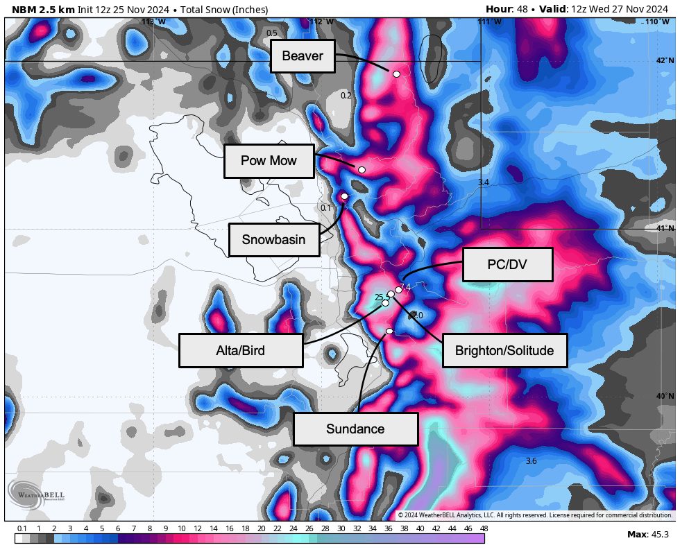
Snow will trend more showery by Wednesday morning, ending by around midday. Storm total snowfall should be pretty healthy. Especially impressive snowfall is expected in the Tushar Range, home to Eagle Point Ski Area. Here’s what I think we’ll see by midday Wednesday:
- Eagle Point: 18-28″
- Alta, Snowbird: 9-16″
- Brighton, Solitude: 9-15″
- Park City & Deer Valley: 8-14″
- Brian Head: 8-14″
- Snowbasin, Powder Mountain: 8-14″
- Beaver Mountain: 6-12″
Long-Range Prospects (Or lack thereof)
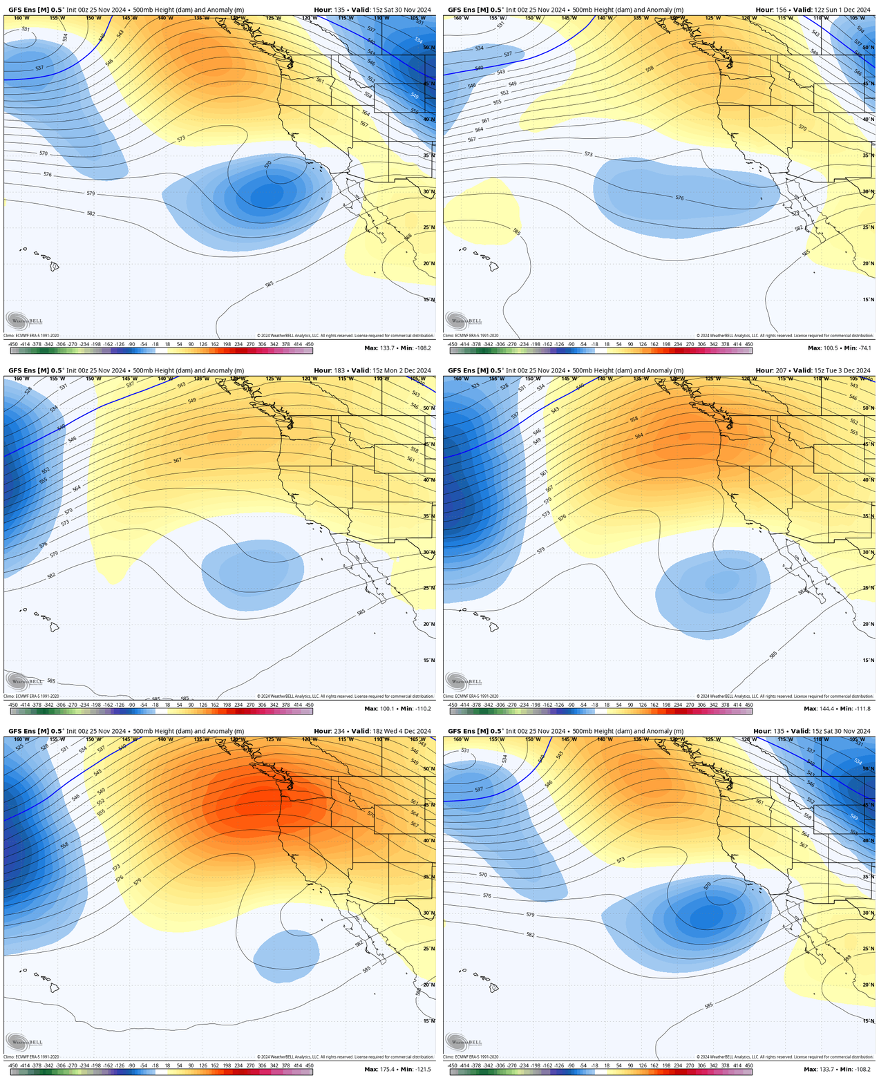
In the wake of our midweek storm, we will transition toward a super dry pattern. Forecast models are in fairly strong agreement that a ridge will build over the Northwest while a cutoff low stalls somewhere off the Southern California Coast:

Not only is this a very dry pattern for Utah, but it’s also an attempt at what meteorologists call a rex block. Blocking patterns impede the usual west-to-east progress of storms and can lead to prolonged dry spells. I’m concerned that’s what will happen to us.
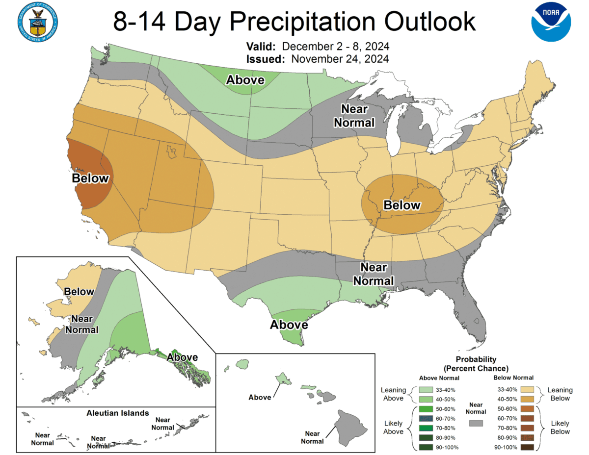
The CPC’s long-range outlooks are pretty dry for Utah in response to this evolution.
