Forecast By SnowBrains Chief Meteorologist – Eric McNamee
9:35 pm MST, 2/12/2023
Forecast Summary:
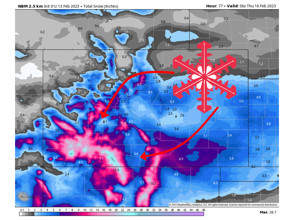
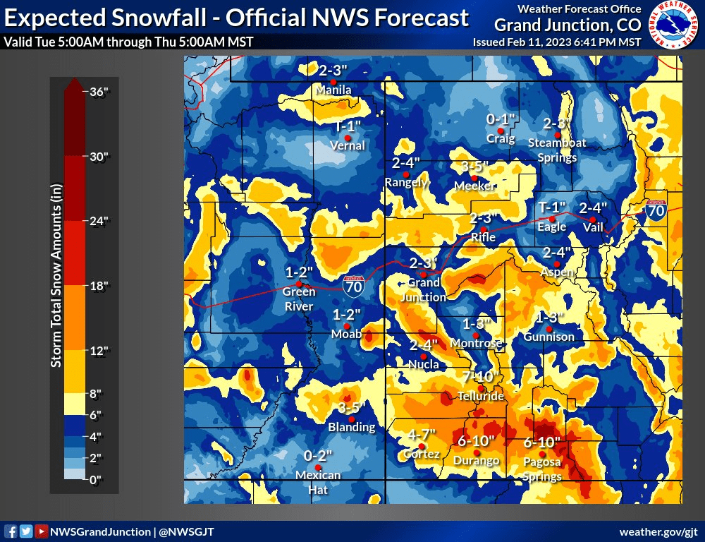
A series of systems will bring multiple FEET of snow to the mountains of Colorado tonight through Wednesday, with the San Juans seeing the most.
A weak system will brush the southern part of Colorado on Monday and bring snow to the area.
A second, more robust trough closes off and will bring more widespread heavy snow to the state Tuesday through Wednesday.
Resorts that will see the most snowfall are Telluride, Purgatory, Monarch, Wolf Creek, Aspen, Snowmass, Vail, and Breckenridge.
Short-Term Forecast:
Monday-Wednesday:
A couple of systems will bring multiple FEET of snow to the mountains of Colorado tonight through Wednesday, with the San Juans seeing the most.
A weak system will bring snow to southwest Colorado Monday morning into Monday afternoon.
The second and more robust trough will dig into the intermountain west Monday night and bring snow/snow showers to most of Colorado.
The heaviest snow will target the San Juans as moisture drawn into the region slams into the mountain range.
Tuesday night into Wednesday, the low will move a bit further east and bring upslope snow to the Front Range,
Snow tapers off Wednesday night as the low moves off to the east.

Long-Term Forecast:
Thursday-Sunday:
The last scattered snow showers will taper off early Thursday as high pressure builds over the region.
Dry weather is expected through the weekend.
Extended Forecast:
Sunday and Beyond:
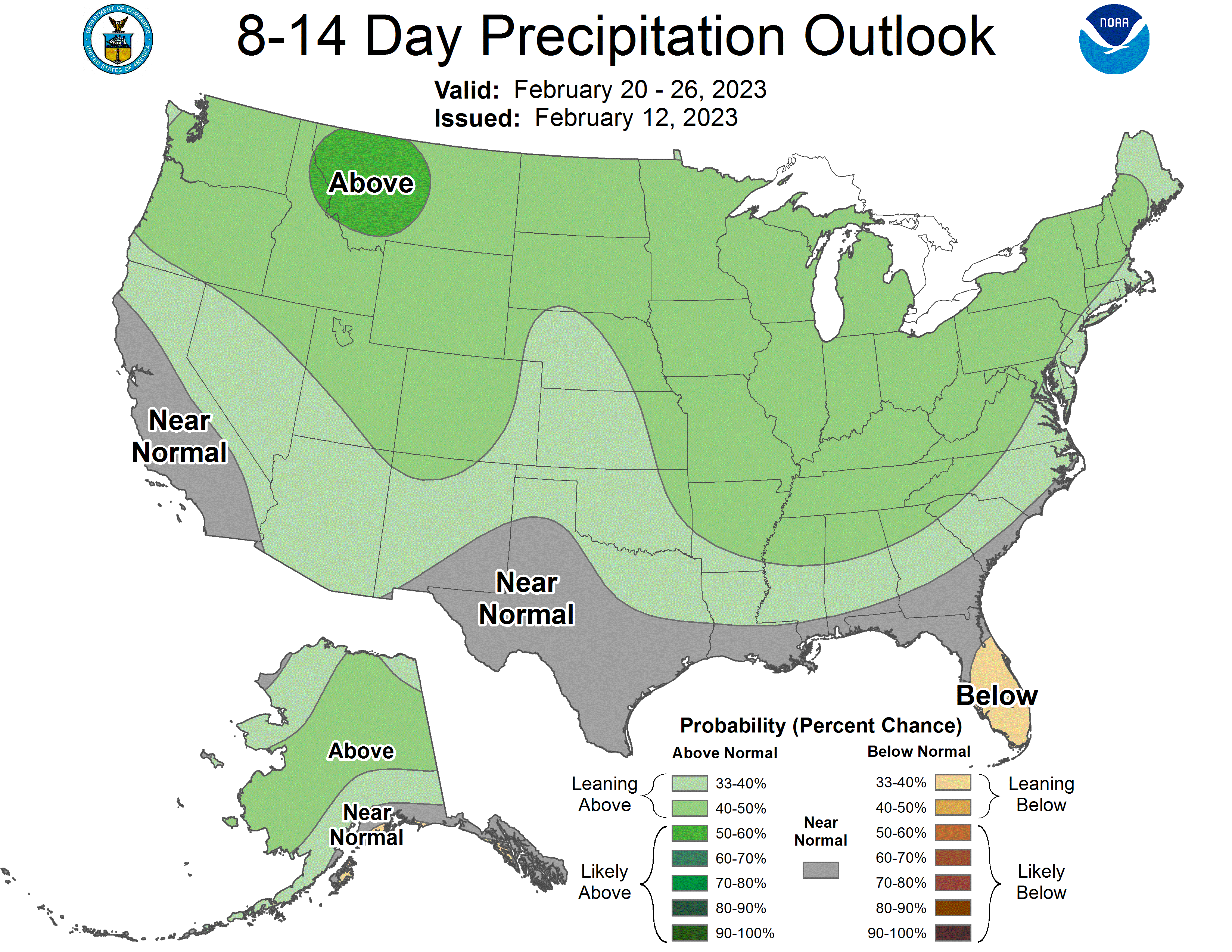
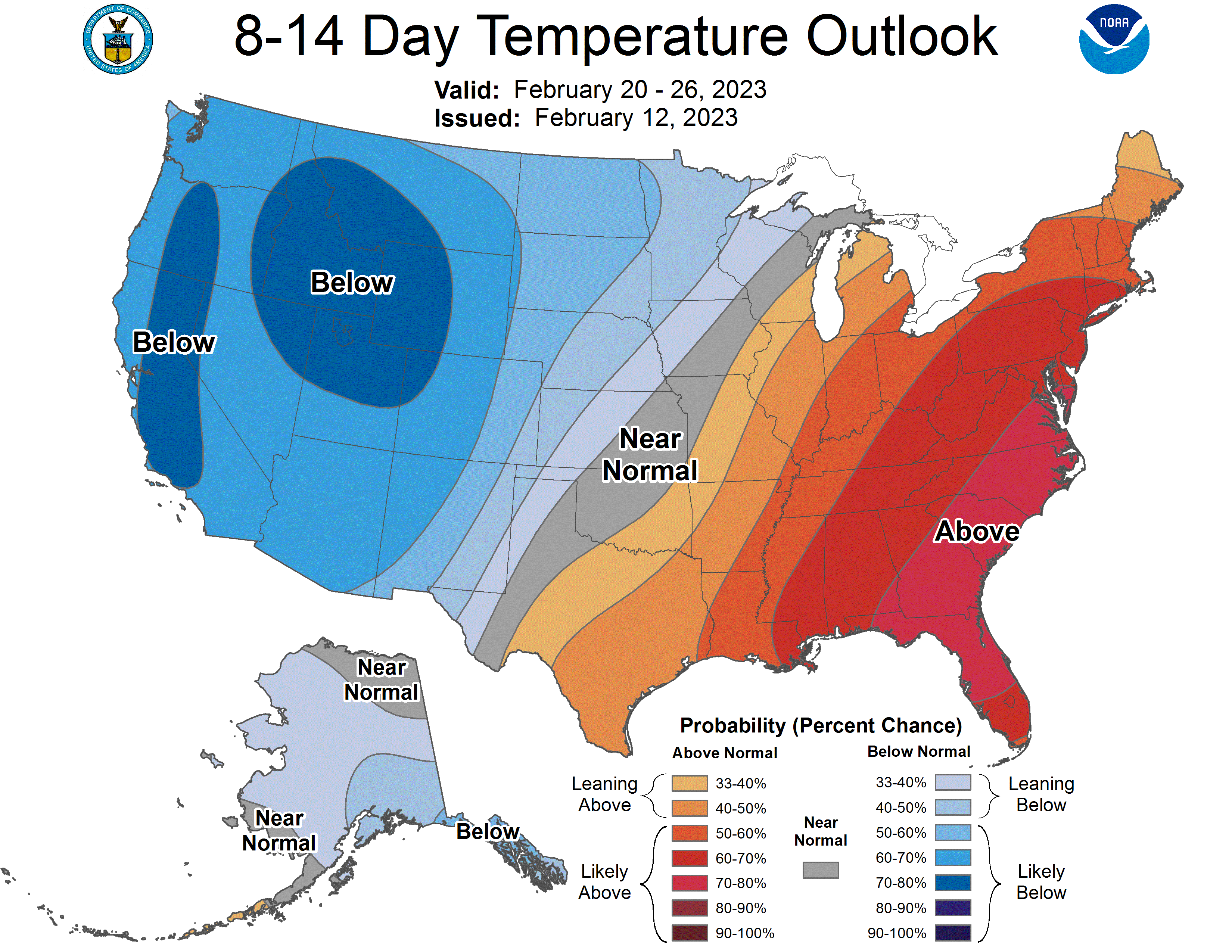
Global ensembles indicate slightly above-average precipitation and below-average temperature across Colorado through the extended.

