Forecast by SnowBrains forecaster Clay Malott
Friday, December 2nd, 2pm PST
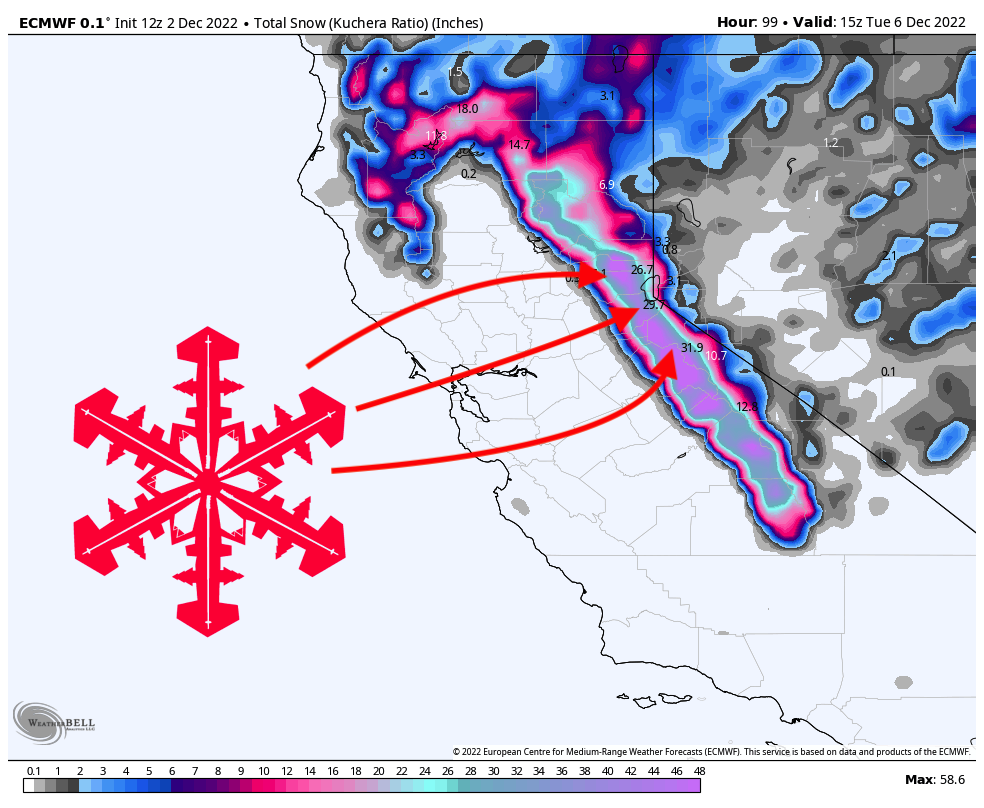
A second major storm will impact California this weekend, dumping 20-30+ inches on local resorts. The best targets for powder-chasing will be found in Mammoth, Kirkwood, Palisades Tahoe, and Sugar Bowl.
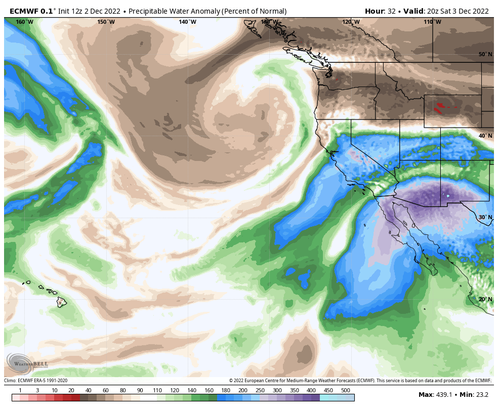
This storm is associated with a deep low-pressure system that is pulling lots of tropical Pacific moisture toward the coast. You can see this displayed on the modeled precipitable water anomaly chart from the ECMWF:
Precipitation will begin in southern California on Saturday morning and work its way further north over the course of the day. The first flakes in Tahoe should begin to fall sometime mid-morning, with all snow above 7,000 feet and higher chances of mixed precipitation below that down to lake level. Snowfall during the ski day on Saturday should be around 10″ at Mammoth but only a few inches at Tahoe resorts.
Precipitation rates will continue to increase throughout the day and into the evening before peaking in the wee hours of Sunday. Sunday morning will be an excellent day for skiing in California! Here are what I see as realistic totals for local resorts on Sunday morning:
- Palisades Tahoe (7,800′): 15-24″
- Sugar Bowl (7,500′): 14-23″
- Kirkwood (8,500′): 18-25″
- Northstar (7,600′): 10-18″
- Mt. Rose (8.500′): 12-18″
- Heavenly (8,000′): 12-18″
- Mammoth (9,600′): 23-30″
- Bear Valley (7,100′): 8-15″
Keep in mind that this storm is coming in warm and wet, so slight fluctuations in temperature by elevation can make a huge impact on snow totals. I’ve done my best to express this uncertainty in my totals, but always remember that these warm, dynamic systems are always full of surprises. Fingers crossed for the best!
Tahoe resorts will pick up another 3-6″ throughout the day on Sunday, keeping conditions fresh all day. Precipitation rates will continue to decrease overnight. By Monday morning, here are what I see as plausible storm totals:
- Palisades Tahoe (7,800′): 24-35″
- Sugar Bowl (7,500′): 24-32″
- Kirkwood (8,500′): 28-37″
- Northstar (7,600′): 18-23″
- Mt. Rose (8.500′): 18-25″
- Heavenly (8,000′): 15-22″
- Mammoth (9,600′): 26-34″
- Bear Valley (7,100′): 12-20″
It’s shaping up to be quite a good storm, and ski conditions are going to be awesome all weekend into next week, especially after the last storm dropped 20+ inches at many resorts in the region! Get the snorkels out!