This week, a powerful winter storm digs down into the Western US, bringing significant snowfall across the entire region. The heaviest hit region will be California, where snow accumulation may exceed 6 feet on higher terrain and 3-5 feet at resorts.
The storm began on Sunday night, bringing several inches to the region. Things calmed down on Monday and are just beginning to pick up again at the time of writing this forecast.
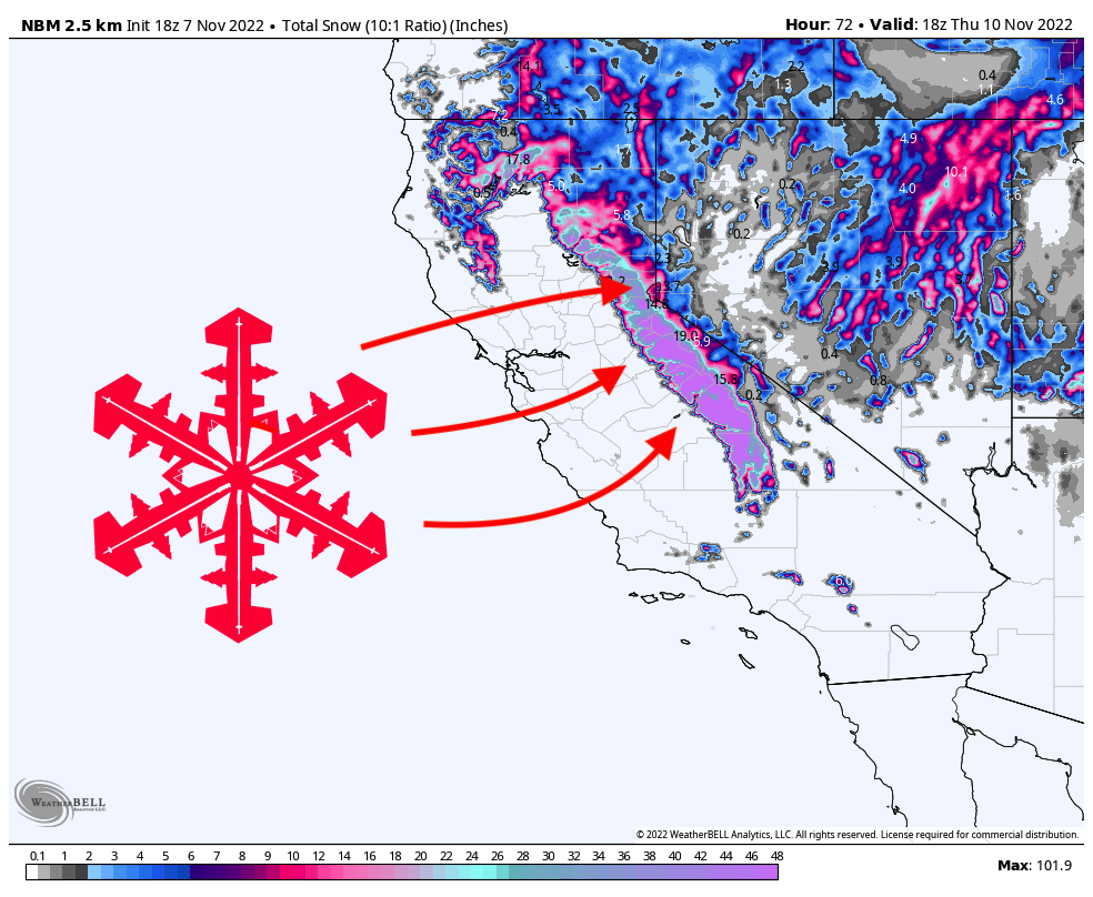
Monday night into Tuesday morning will bring moderate precipitation to the Tahoe region. During Tuesday morning, things will pick up quite a bit and bring heavier snowfall all the way down to lake level heading into the afternoon. Regions further south will get hammered even harder; the highest terrain of the central Sierra Nevada may hit snowfall rates exceeding 5″ per hour in the early afternoon.
The main surge of moisture will primarily move through California by Tuesday night, but lingering snow showers will stick around through Wednesday afternoon. By early Wednesday afternoon, here are what I see as realistic totals at roughly mid-mountain for resorts around the region (excluding totals before Monday afternoon; keep in mind that reported totals will be higher than these from the snow on Monday):
- Sugar Bowl (7500′): 27-33″
- Palisades Tahoe (8000′): 28-34″
- Mt. Rose (8700′): 22-27″
- Kirkwood (8700′): 35-42″
- Heavenly (9100′): 22-27″
- Mammoth (10000′): 40-50″
Looking ahead, things will likely remain dry until at least the weekend. Some models have a small storm moving through this weekend, while others have it a bit later. Either way, chances are that this system will arrive between Saturday and Tuesday and bring light accumulations to the region. I anticipate this storm to lean toward the latter half of that timeframe, but the models are still fairly torn on the timing. Either way, I expect a few inches at best, nothing huge. Stay tuned for another SnowBrains forecast with an update.

Hang in there Jimmy, the storms will come and the powder will be light and fun. California is used to this cycle of just 3 storms to last the season…an early choking snowfall to facilitate opening, a Christmas mega storm to renew the stoke, and a large dump in February after three weeks of spring skiing. The rest of the snowfall is just used to freshen up the snow so it looks white on the groomers and fluffy in the trees. The CA situation makes for breeding a different set of grooming artists who know how to stash snow for the burn-off times and they have a feel for the snow depth all over the mountain (except for Mammoth where they have electronics on board to tell snow depth). The locals know that the resorts will be slow to open after the storms, but visitors feel that a snow storm is a snowstorm regardless of the quantity so there are always complaints about not opening terrain following a storm.
Lucky. Meanwhile it’s 65 degrees at 8000ft across Colorado the past 4 days.