Snowfall is already kicking off across the Pacific Northwest, with the first storm wave bringing some accumulation to the region. More waves are expected, promising a solid week of snowfall.
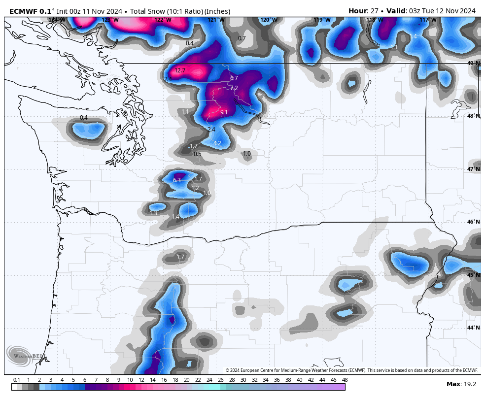
Mt. Baker has already seen about 9 inches at 4,200 feet, according to the NWAC station. Most of the snowfall so far has been concentrated in the northern Cascades, between Mt. Baker and Stevens Pass. Further south, the snow has been lighter, but that will change soon. Below is roughly how much snow has fallen through Monday evening:

First Wave: Snow Continuing Through Tuesday Evening
Snowfall will continue through Tuesday evening, with the highest totals expected in the Washington Cascades. Between Monday night and Tuesday evening, resorts across the region will receive varying amounts of fresh snow at mid-mountain elevations:
- Mt. Baker: 6-10 inches
- Stevens Pass: 3-7 inches
- Alpental: 2-6 inches
- Crystal Mountain: 2-5 inches
- Timberline: 6-10 inches
These numbers reflect ongoing accumulation as the first wave moves out, keeping conditions soft and fresh for those able to make midweek turns.
Second Wave: Warm and Wet from Tuesday Night to Friday Morning
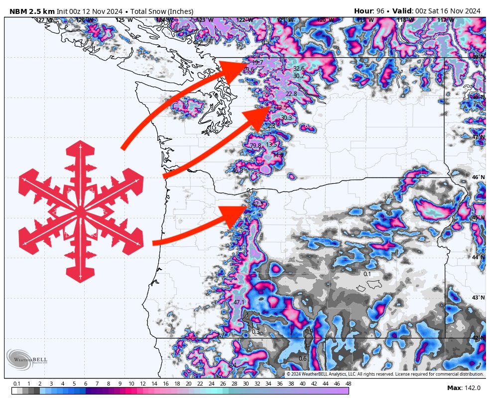
The next storm wave will move in Tuesday night and linger through Thursday, with some showers sticking around into early Friday. The big story with this wave is warmth and lots of moisture. Up north by Mt. Baker, snow will mostly stay above 5,000 feet, eventually dropping to around 3,250 feet at the tail end. Further south near Mt. Hood, expect snow levels to stay above 6,500 feet, coming down to roughly 4,250 feet later on.
Snowfall totals will vary significantly, due to a couple of factors. Sporadic rain and mixed precipitation may melt some of the snow, so reported final totals may be lower than forecasted below. Keep in mind that totals will vary significantly with elevation. Here’s what we’re looking at:
- Mt. Baker: 15-25 inches
- Stevens Pass: 8-16 inches
- Alpental: 2-5 inches (mostly accumulating towards the end of the storm as snow levels drop)
- Crystal Mountain: 15-25 inches (higher elevations will see significant benefit)
- Timberline: 8-16 inches
- Mt. Bachelor: 10-18 inches
Snow levels will play a big role in how these accumulations develop, so be prepared for mixed conditions, especially at lower elevations.
Below is the expected snowfall total from both waves combined. Looking good!

Looking Ahead: Weekend System on the Horizon
Looking toward the weekend, we expect another system to roll in around Saturday evening or night. We’ll monitor it as it develops and provide updates as we get closer. Stay tuned for more details.