Forecast by SnowBrains meteorologist Nathan Tarino — Updated 7 PM AM December 2nd
Forecast Summary
Two storms will bring freshies to Utah in the next six days. The first will hit Thursday night into Friday, with great skiing conditions Friday morning. The second will be a long-duration episode of snow from Sunday into Monday evening, mostly to northern Utah resorts.
The snow is already great across the state after 12-18″ of perfect blower pow fell Tuesday morning, and will hold at excellent through most of the next week. Most of Utah is sitting at 125-150% of the median snowpack for this time of year, so coverage is unusually great.
The long-range forecast continues to look solid. More shots at fresh snow should continue into the middle of December.
Short Term Forecast
Thursday will be warmer with gusty winds out of the south ahead of a cold front projected to sweep through the state early Friday morning. The wind is going to be ripping on Thursday. Here’s a snippet from NWS Salt Lake City’s Upper Cottonwood Forecast, which is a great resource: “Forecast for 75 mph at 11k indicates high confidence limit, but cannot rule out a few rogue gusts to 90 mph.”
Breezy.
A band of very heavy snow will bring quick accumulations statewide just before first chair on Friday, with the best accumulations falling in the northern half of the state. A few lingering snow showers will tack on additional accumulations into midmorning Friday, making for an excellent morning for skiing/riding.
I’m looking for pretty solid snowfall by the time things taper off midday Friday:
- Alta & Snowbird can expect 10-16″ of freshies.
- Solitude & Brighton should see 8-14″.
- Northern Utah Resorts (Pow Mow, Snowbasin, Beaver) can expect 7-12″.
- The Park City resorts are looking at 5-9″.
- In southern Utah, Eagle Point will pick up 3-7″, and Brian Head will be comparatively skunked with 2-3″.
In all, another great storm for Utah. Conveniently, I have Friday off and will be sure to be up there nice and early for some morning pow laps.
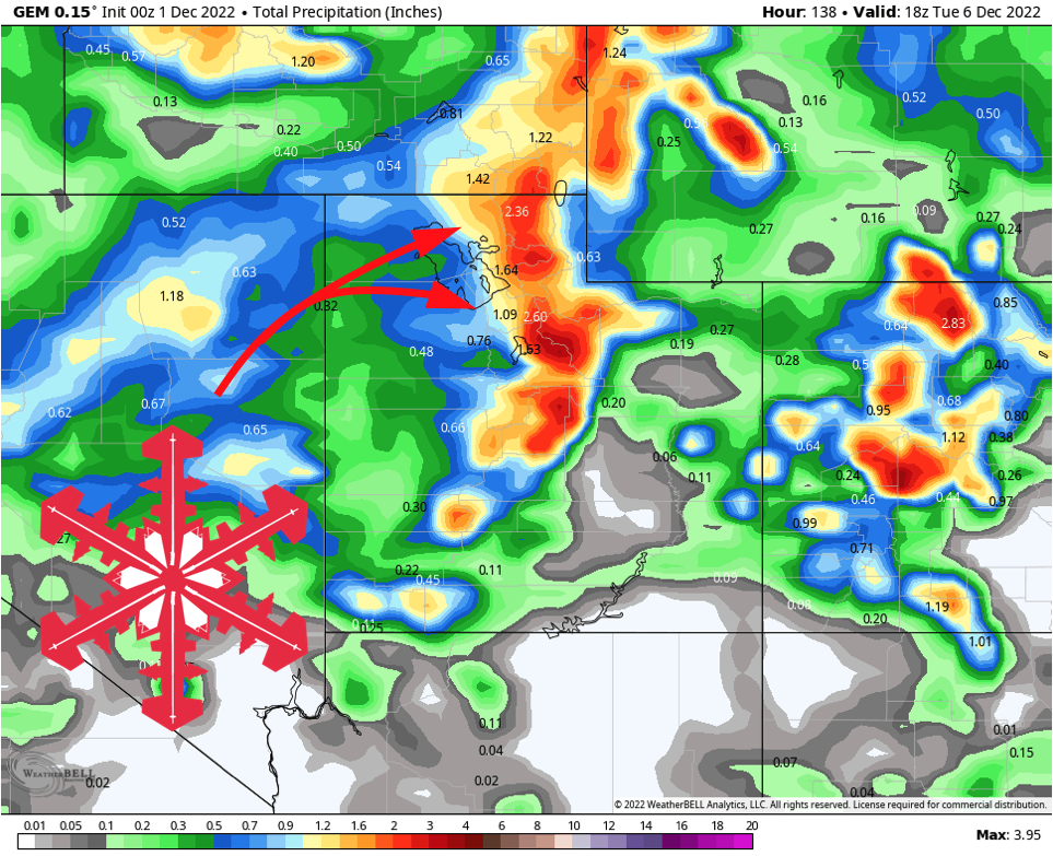
A few snow showers are likely on Saturday, and again on Sunday ahead of the next cold front’s arrival on Monday. Heavier snow will generally hold off until after resorts close for the day Sunday, but an inch or two in spots could help keep the snow fresh.
Monday will be another very good ski day, with snow falling through most of the day. By the time snowfall ends in the evening, expect another 6-10″ for all of the northern Utah resorts. Southern Utah will again lose out, but another couple of inches are likely from this second storm.
Dry for a bit thereafter.
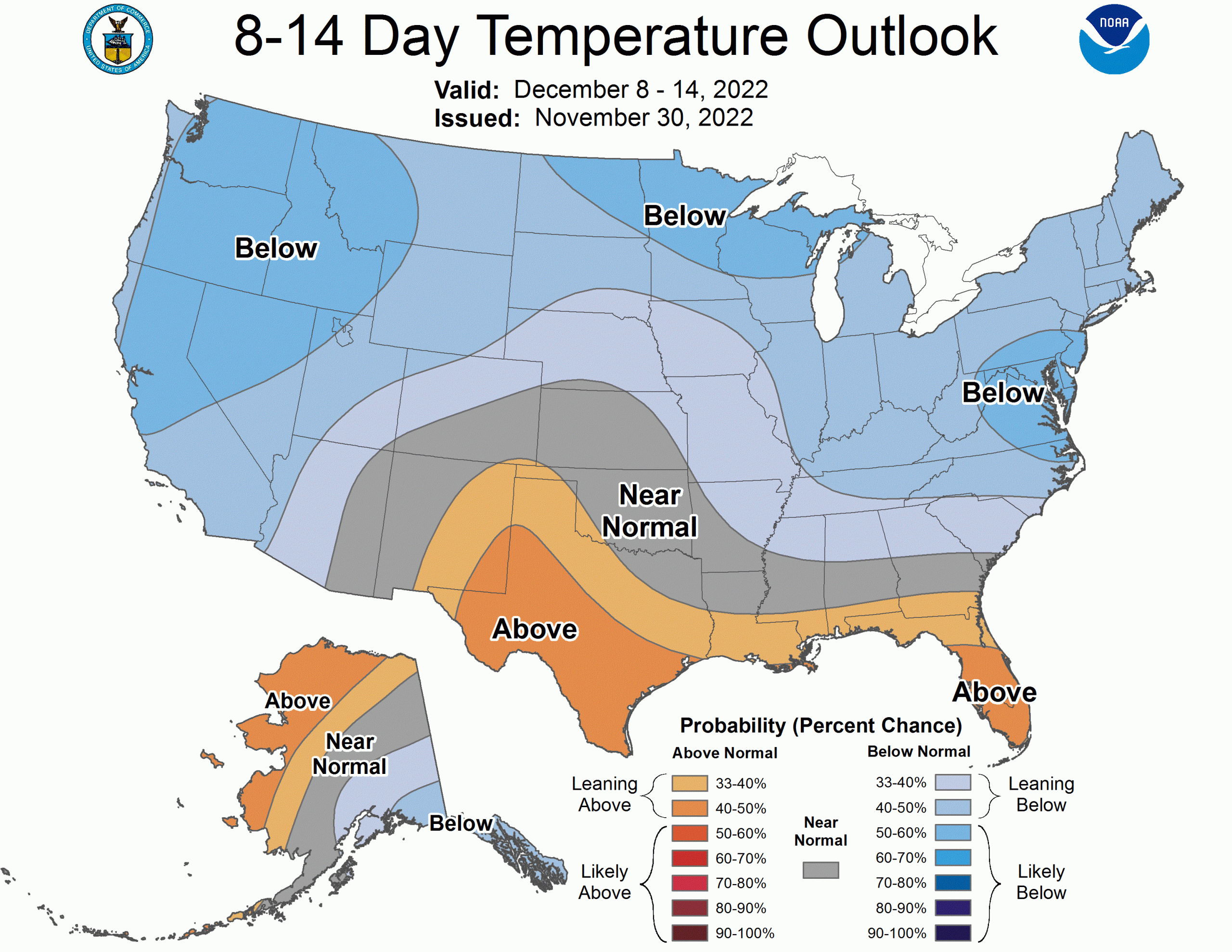
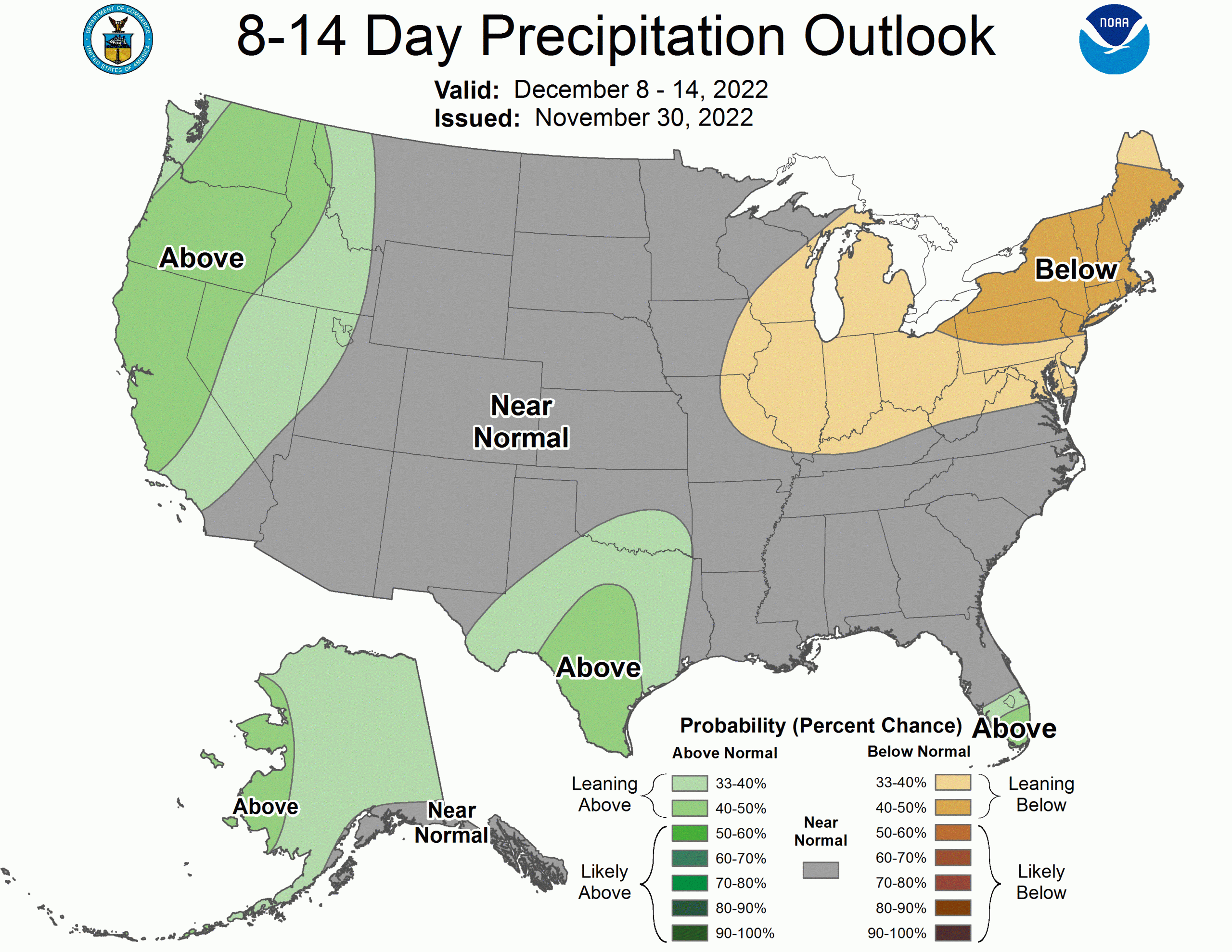
Long Range Prospects
Though we’ll see a short break after Monday’s storm, there’s a chance for more snow next weekend and a decent ensemble signal for another storm around the middle of December.
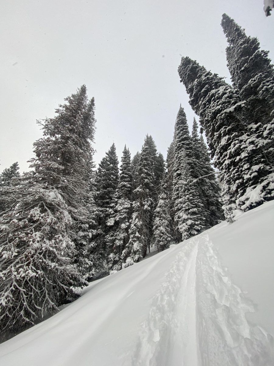
Let’s hope for continued snow. The Wasatch is especially beautiful after what’s already fallen. Here’s a shot from Tuesday morning, just as the last storm was breaking. I hope you all catch one of these upcoming storms. Thank you for reading.
The CPC’s long-range outlooks reflect the break after Monday and don’t necessarily capture that midmonth storm, but are promising nonetheless.