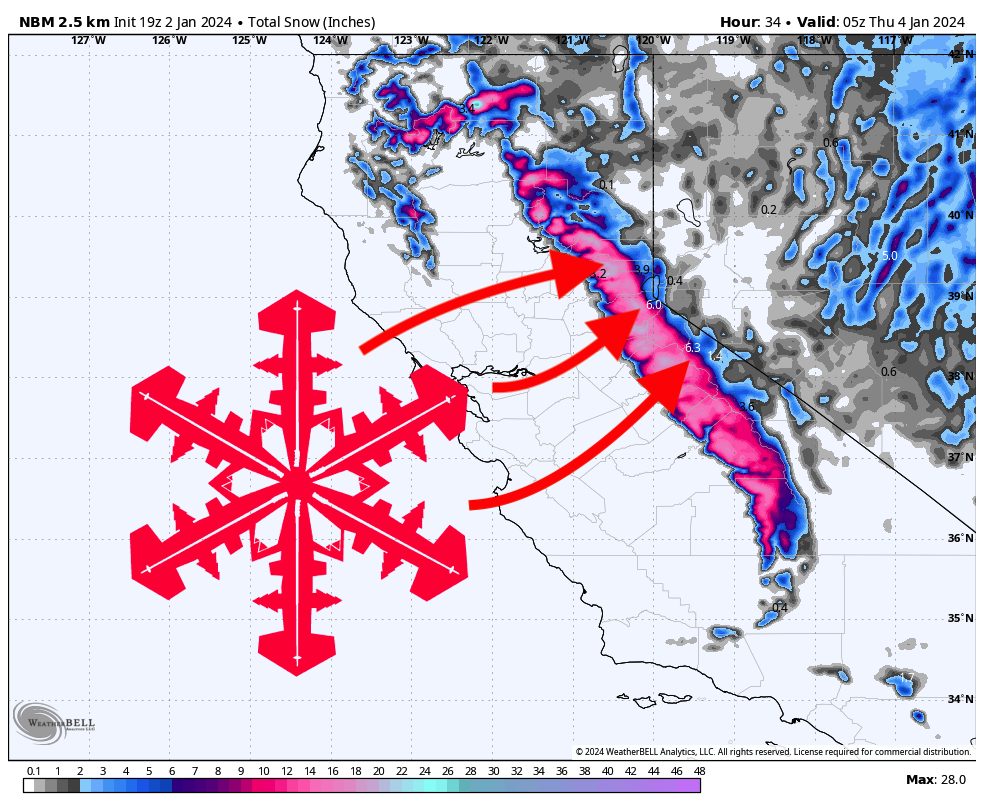
Finally, a major surge of moisture will push into California this week, dropping 6-18″ with localized high-elevation zones seeing as much as 2 feet of snow. The storm will last from Tuesday evening until Wednesday morning, with lingering snowfall into Wednesday night. The snow level will be below resort bases for the entire duration of the storm.
The most favorable area for snowfall will be the west Lake Tahoe basin along the Sierra Crest, where resorts will pick up 10-18″, favoring resorts further south (Kirkwood & Palisades). For other resorts in Tahoe, Northstar should pick up 4-8″ and Mt. Rose & Heavenly should see 2-5″.
Mammoth will see less precipitation, but should still see around a foot of fresh snow at mid-mountain. Higher elevation and thus lower temperatures will bring higher quality snow to Mammoth, so conditions should be excellent there on Wednesday.
Snowfall will linger in the region during the day on Wednesday and should be wrapped up by Wednesday night.
Looking ahead, the next opportunity for decent snowfall comes this weekend, with a storm that looks smaller than this week’s storm but should still bring some decent snowfall. Fingers crossed for an active pattern heading into the rest of the season!