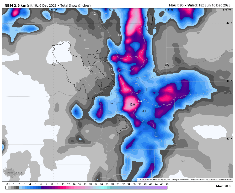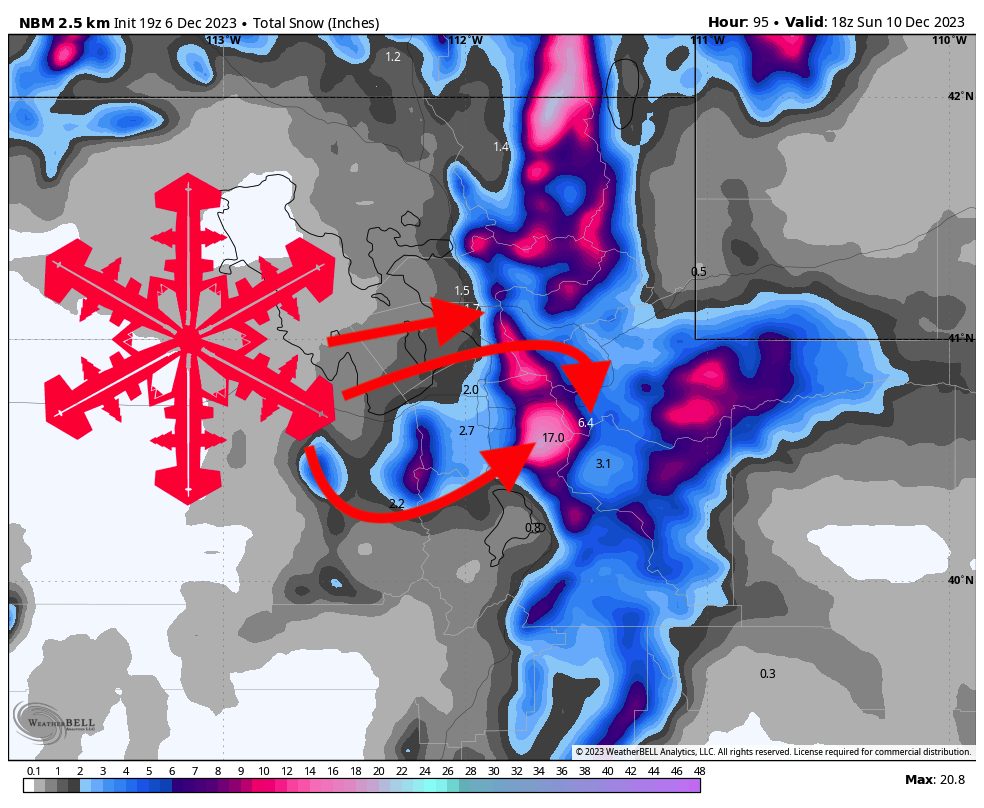
Yet another major winter storm will hammer Utah this week into this weekend, bringing as much as 2 feet of fresh snow to local resorts. The snowfall will last from Thursday morning until Friday night and cold temperatures will allow for extremely low density, blower powder. The best day for skiing will be Friday.
The first wave will arrive in the Wasatch on early Thursday morning and will be quite brief, lasting from Thursday morning to Thursday evening with most of the snowfall being concentrated early in the day. This wave should drop an inch or two for the Cottonwoods and Park City & Deer Valley. Northern Utah will do better with this first wave, and resorts like Snowbasin and Powder Mountain should see 3-6″ by Thursday evening (Pow Mow will likely win this wave with 4-8″ likely).
Snowfall rates will pick up on Thursday night with the arrival of the second and primary wave of this system. By Friday morning, we should be looking at 4-8″ of overnight snow for Cottonwood resorts, with 3-5″ at Park City and Deer Valley. Northern Utah will see 3-6″ of overnight snow on Thursday night.
Friday morning will see the highest snowfall rates of this system, with snowfall rates gradually decreasing throughout the day. During the day on Friday, the Cottonwoods should see 6-10″ of fresh snow, PC/DV should see 4-8″, and resorts in Northern Utah will see 1-3″.
Friday night will bring a couple more inches but no major accumulation.
Looking ahead, Utah looks dry until around the 18th, when models are indicating a window for snowfall to return. Fortunately, the high pressure setting up over the region for the next two-ish weeks looks like it will be decently cold, so it shouldn’t melt too much of the early-season snowpack away.