This forecast was created at 12:30 p.m. on Thursday, March 6, 2025
An active pattern will bring a quick shot of snow to California on Thursday, followed by a pleasant, warmer weekend. Then, stormy conditions will return next week, potentially with significant accumulations by midweek. Beyond that, the extended outlook favors continued colder-than-normal temperatures and above-average precipitation, keeping powder potential elevated well into mid-March.
Snow continues on Thursday as a quick-hitting storm moves through the Sierra. Lingering showers will taper off into the evening, with overall accumulations generally running in the 1–6 inch range across the higher elevations. Snow levels remain low enough for base-area snowfall, and snow ratios in the 10–17:1 range should yield fair to locally fluffy conditions. Brisk northwest to north winds may gust 20–30 mph over ridgelines, but this system wraps up fairly quickly by late day.
Friday features drier weather and a fresh coating of snow for the mountains. Temperatures will stay cool, supporting decent snow quality before warming sets in this weekend. Saturday and Sunday bring mild days with light winds and increasingly spring-like conditions on the slopes, creating a comfortable window for cruisers and anyone looking to enjoy softer afternoon snow.
A minor system may brush the southern Sierra on Monday into Tuesday. Amounts look modest, especially across Alpine and Mono Counties, but any fresh dusting could improve surface conditions. Elsewhere across the range, impacts appear limited, though snow ratios near 7–12:1 could still deliver fair-quality snowfall where the system tracks most directly.
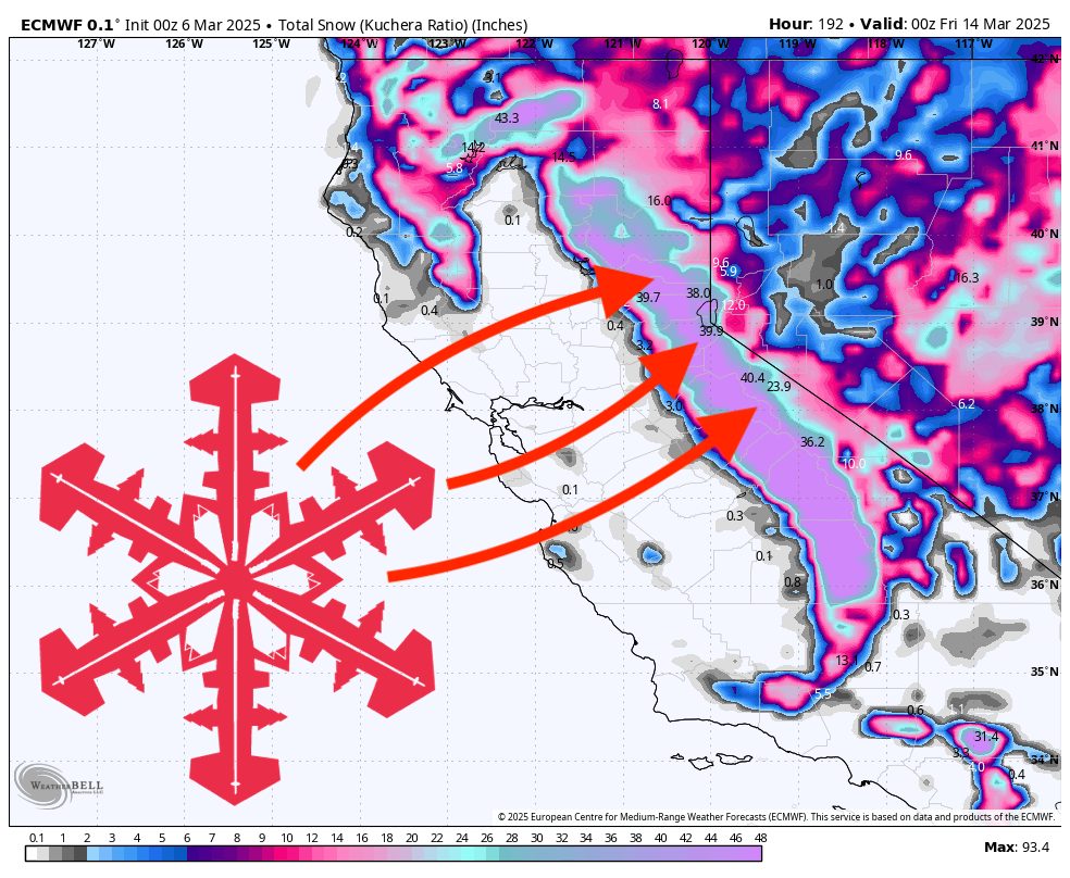
The main event arrives Wednesday into Thursday as a stronger storm affects the entire Sierra. Current projections point to widespread double-digit totals along the crest, with potential for 1–2 feet or more. Winds could be quite powerful, particularly at higher elevations where gusts may top 60 mph. Snow ratios should increase during the latter part of the storm, occasionally exceeding 15:1, helping create lighter, fluffier powder in many areas. In the medium and long range, colder-than-normal temperatures and above-average precipitation continue west of the Continental Divide, so expect the storm track to stay favorable for additional snowfall opportunities beyond this seven-day window.
7-Day Resort Forecast Totals
- Kirkwood – 27”–55” total (2”–3” Thu (03/06) – Fri (03/07) + 25”–52” Mon (03/10) – Thu night (03/13))
- Mammoth – 25”–51” total (2”–3” Thu (03/06) – Fri (03/07) + 23”–48” Sun night (03/09) – Thu night (03/13))
- Sugar Bowl – 22”–46” total (1”–3” Thu (03/06) – Fri (03/07) + 21”–43” Mon night (03/10) – Thu night (03/13))
- Palisades Tahoe – 21”–42” total (2”–3” Thu (03/06) – Fri (03/07) + 19”–39” Mon night (03/10) – Thu night (03/13))
- Heavenly – 11”–23” total (2”–3” Thu (03/06) – Fri (03/07) + 9”–20” Mon night (03/10) – Thu night (03/13))
- Northstar – 10”–23” total (1”–2” Thu (03/06) – Fri (03/07) + 9”–21” Tue night (03/11) – Thu night (03/13))
- Mt Rose – 7”–16” total (1”–2” Thu (03/06) – Thu night (03/06) + 6”–14” Tue night (03/11) – Thu night (03/13))