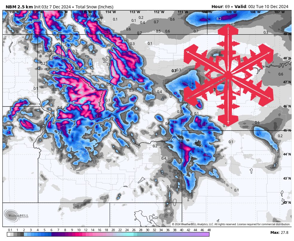
Source: maps.weatherbell.com
This forecast was written at 12 a.m. MST on Saturday, December 7, 2024
Forecast Summary
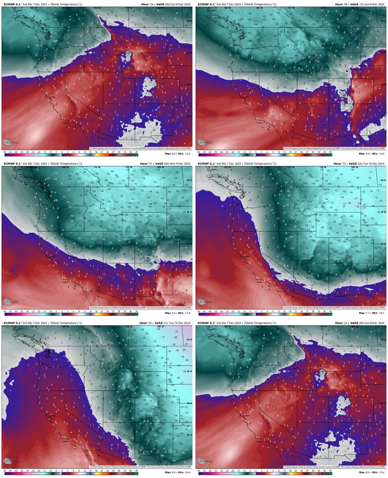
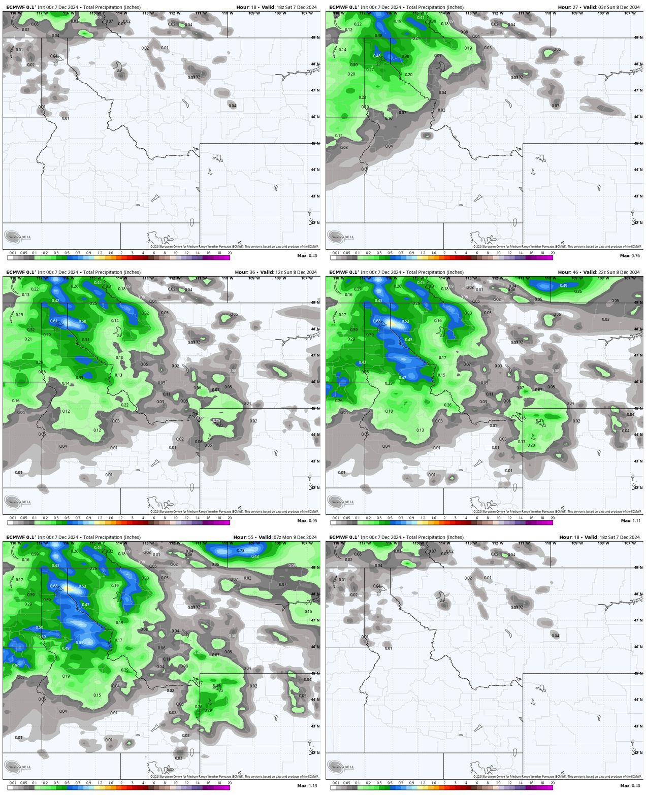
- A cold front brings cooler air, strong winds, and widespread snow to the Northern Rockies Saturday PM thru Monday AM.
- Many valleys are currently inverted, with colder temperatures on valley floors compared to mountain tops thousands of feet higher up. This storm will mix out the inversions, restoring more ‘normal’ temperatures.
- This begins a more unsettled pattern that should help build up the snowpack.
Source: maps.weatherbell.com
A trough finally breaks down the ridge that has dominated the Western U.S. for the last week. The trough arrives in the form of a cold front that pushes across the Northern Rockies on Saturday and Saturday night.
This storm is not particularly moisture-laden, but it will have enough moisture to produce some decent mountain snow. For Idaho, the majority of snow will fall in a line that gradually moves North-South Saturday PM. The Tetons will see snow beginning around midnight Sunday AM, continuing as snow showers that end on Monday.
Source: maps.weatherbell.com
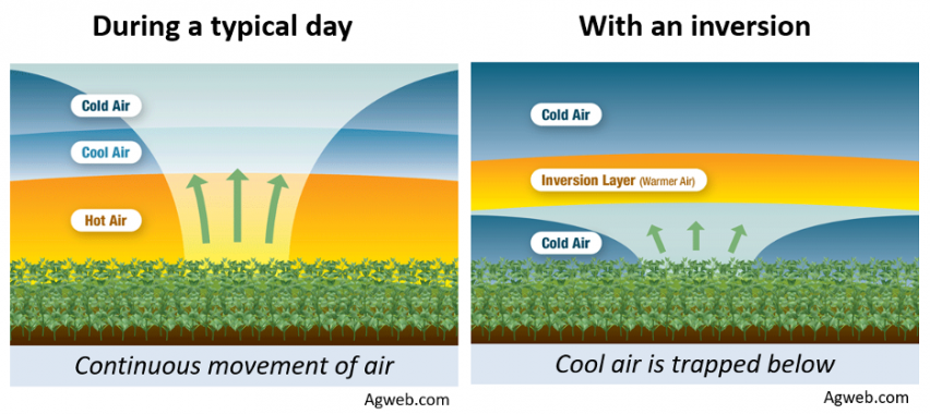
Winds have been remarkably calm over the past week as a ridge of high pressure has been keeping the atmosphere stable. A ridge as strong as the one that has been sitting over the Western U.S. for the last week, particularly in winter, results in very little ‘mixing’ of air in the lower atmosphere. This has caused many valleys to become inverted, meaning temperatures, mostly at night, actually get colder at lower elevations.
Source: https://crops.extension.iastate.edu/blog/terry-basol/be-watch-temperature-inversions
However, this cold front will shake things up, bringing an unstable airmass that will force air to rise out of valleys, and allow winds to further assist in moving stagnant air over and around the mountains. This will cause many valleys to actually become warmer overnight than they were prior to the cold front.
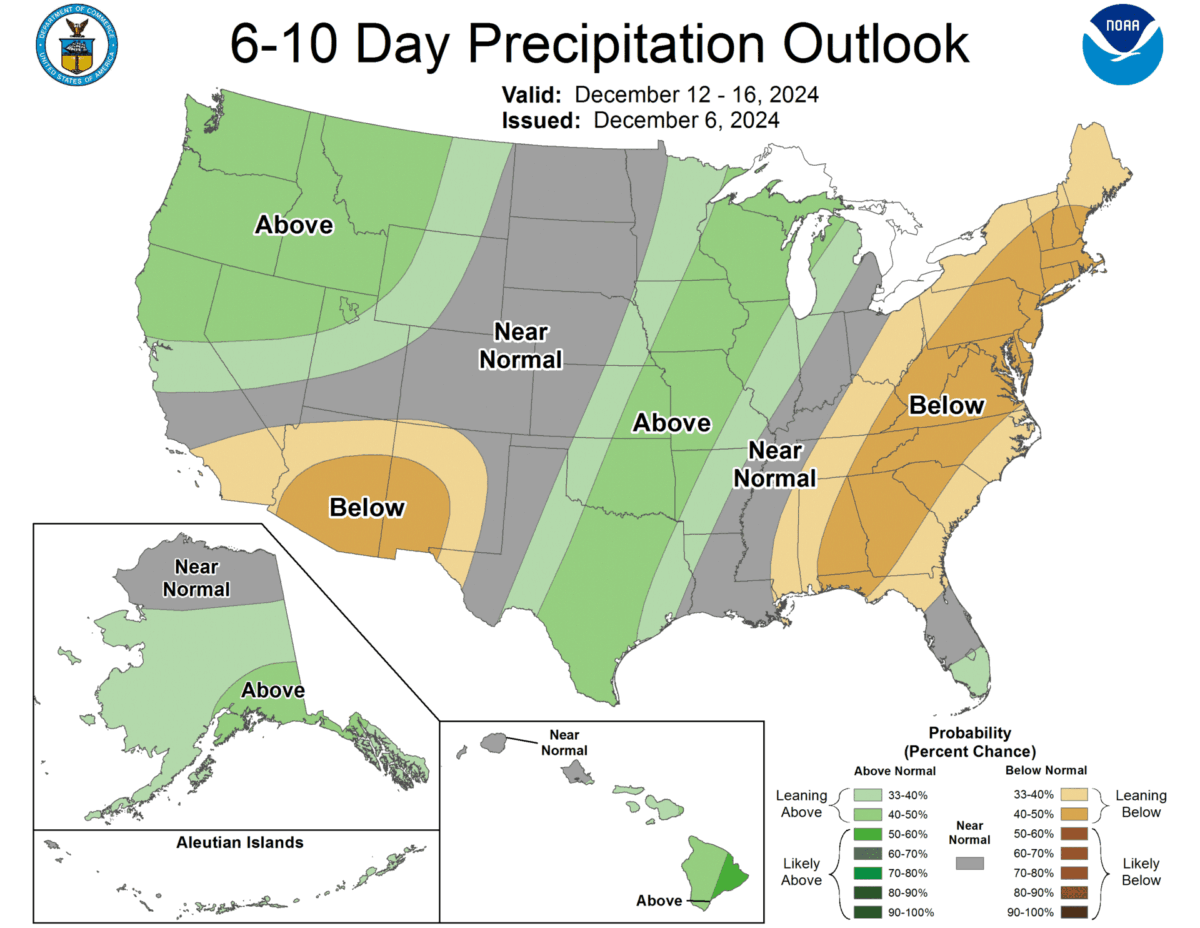
There doesn’t appear to be another substantial ridge of high pressure headed towards the Northern Rockies anytime soon. There are a few smaller storms that are lining up to hit the region later this week and into the following week. While these storms individually don’t look too impressive, the cumulative snowfall should be enough to keep the snowpack near normal for this time of year.
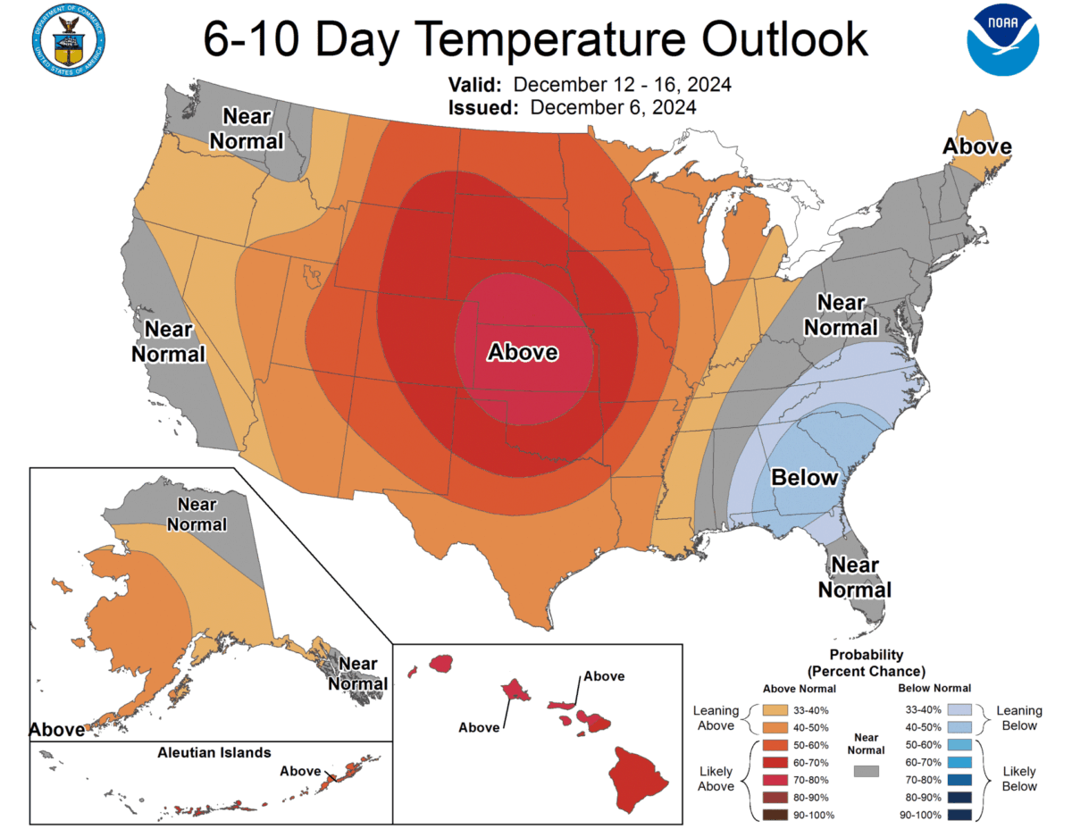
Source: https://www.cpc.ncep.noaa.gov/products/predictions/610day/
