This forecast was prepared at noon MST on Wednesday, January 1, 2025
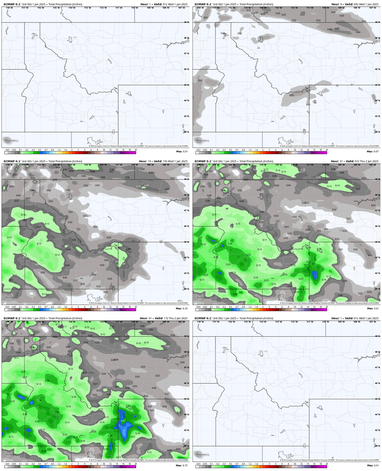
Snow started falling across much of the Northern Rockies just as the clocks struck midnight on New Year’s Eve and will continue to fall steadily until at least Thursday morning. This round of snow is the result of a moisture-laden storm that is passing directly over Idaho this morning and will gradually move into Montana later today before moving out entirely Thursday night.
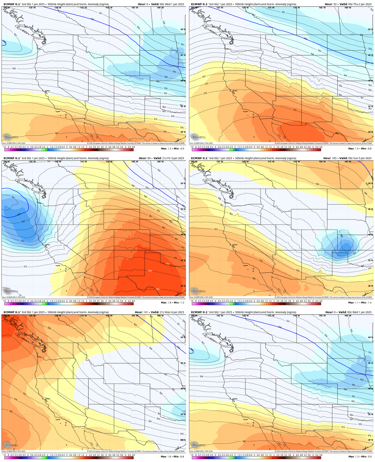
The direction of this storm produces a unique combination of cold temperatures and westerly flow, which will result in higher snow totals for slopes that are exposed to the west. This is a bit unusual because storms that are this cold typically have moisture flowing in from the northwest and produce higher snow totals for mountains that are exposed more to the north. This flow direction will particularly favor the Boise Mountains and the Tetons because both ranges are much higher than any other terrain to their west. Snow levels will be low enough that all resorts should see only snow, without any rain mixing in, throughout Wednesday and Thursday.

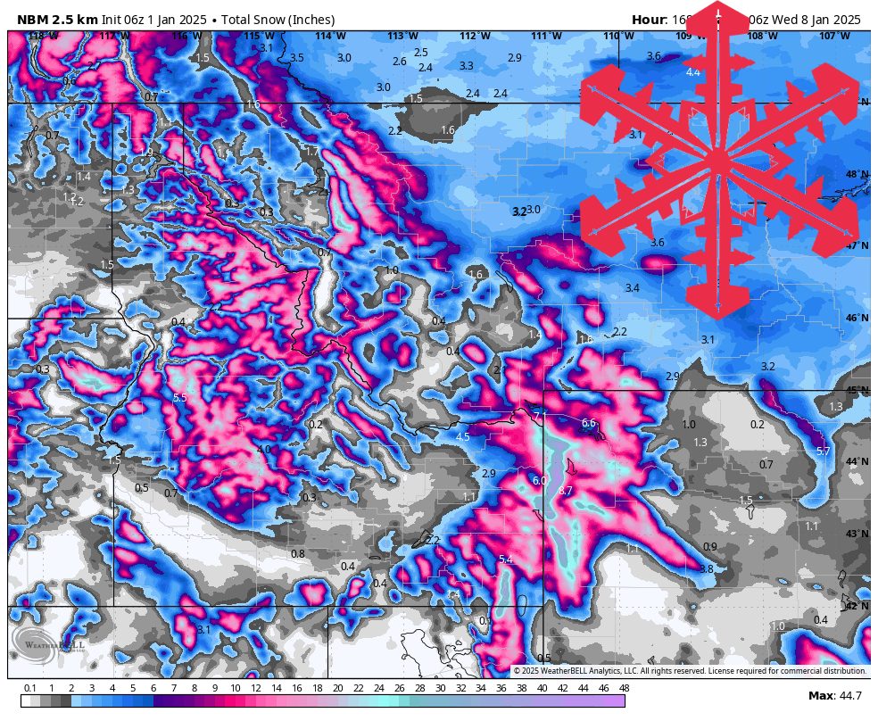
Forecast Snow Totals Jan 1- Jan 2:
- Tamarack (ID): 4-8″
- Schweitzer (ID): 1-3″
- Sun Valley (ID): 2-5″
- Big Sky (MT): 2-5″
- Jackson Hole (WY): 10-22″
- Grand Targhee (WY): 15-25″
Northern Idaho will barely see a break between that first storm and a second, which will arrive on Friday. This second storm is much different from the first in a few key ways: flow is out of the northwest, temperatures are a few degrees warmer, and precipitation is much less organized but will continue much longer. This storm will create conditions that allow at least some snow showers to continue over the mountains through early next week. Based on those factors, this will bring widespread mountain snow to the entire Northern Rockies but will probably be a bigger storm for Northern Idaho than anywhere else.
Friday and Saturday will see the heaviest snowfall from this storm, with reasonably steady snow falling across much of Idaho and Northwest Montana. Expect scattered snow showers in the Tetons during that time, with all of the Northern Rockies seeing light snow showers through Monday or Tuesday.
Forecast Snow Totals Jan 1- Jan 7:
- Tamarack (ID): 10-18″
- Schweitzer (ID): 4-10″
- Sun Valley (ID): 6-12″
- Big Sky (MT): 8-16″
- Jackson Hole (WY): 22-36″
- Grand Targhee (WY): 28-44″
