Forecast by SnowBrains Meteorologist – Andrew Park
11:30 AM MST, 10/2/2021
Forecast Summary
Today:
- Flow interaction with higher terrain across the Uinta Mountains in Utah and Central/SW Colorado will drive thunderstorms, precipitation, and chances for snow above treeline.
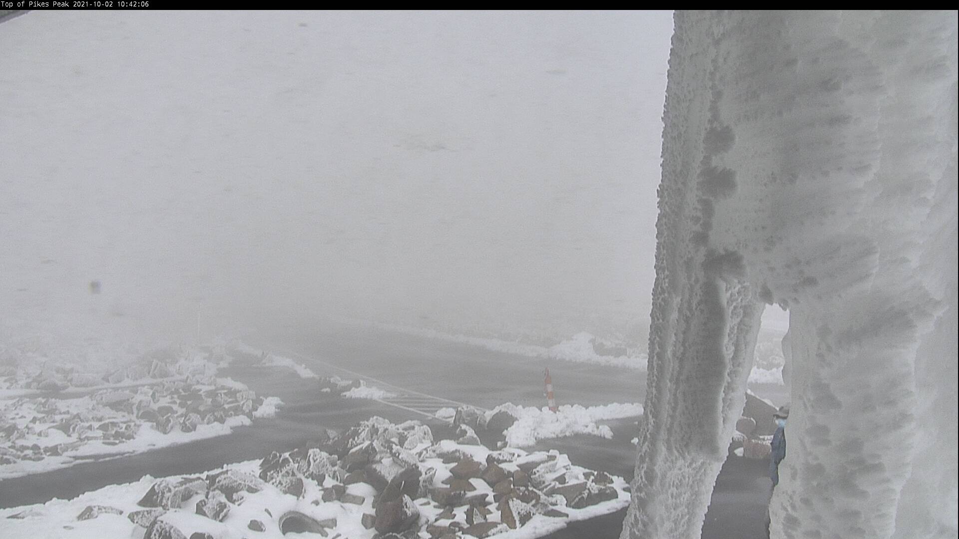
- Pikes Peak is already at it today with snow and riming.
Monday into Wednesday:
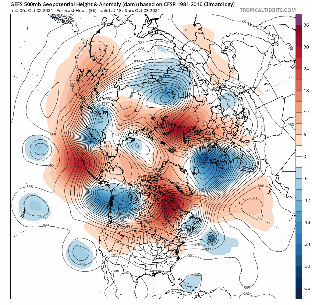
- A cutoff low will push moisture into the Southwest for Monday and lift across AZ/CO by Tuesday ahead of a more robust trough.
The remainder of the week:
- A longwave trough will begin to impact the western US resulting in a major, much more fall-like, pattern change.
- Precipitation for higher terrain moving into the weekend, uncertainty on snowfall.
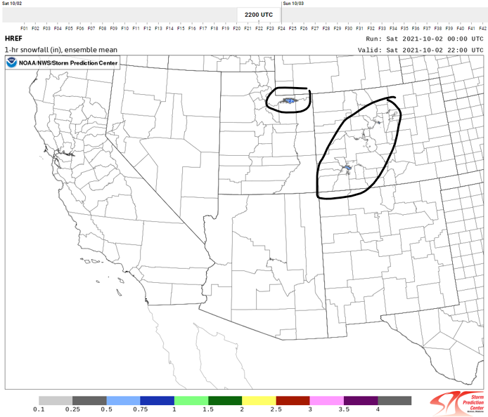
Today: Uinta, San Juan, and Central Colorado Mountains
As flow interacts with orography, thunderstorms will form. While mainly rain is expected for most of the region, I wouldn’t be surprised to see snow dusting in areas above treeline. Pikes Peak is an outlier of what to expect across higher terrain.
SPC HREF snow means below:
Monday into Wednesday
Euro and American Ensemble systems in agreement with the position of cut-off low. This will help steer moisture from Baja into the desert Southwest.
This pattern will result in a moist airmass moving into the Southwest as the trough lifts. Expect the wettest regions to be Northern Arizona, Southern Utah, and Southwest Colorado.
Confidence is low regarding any significant snow.
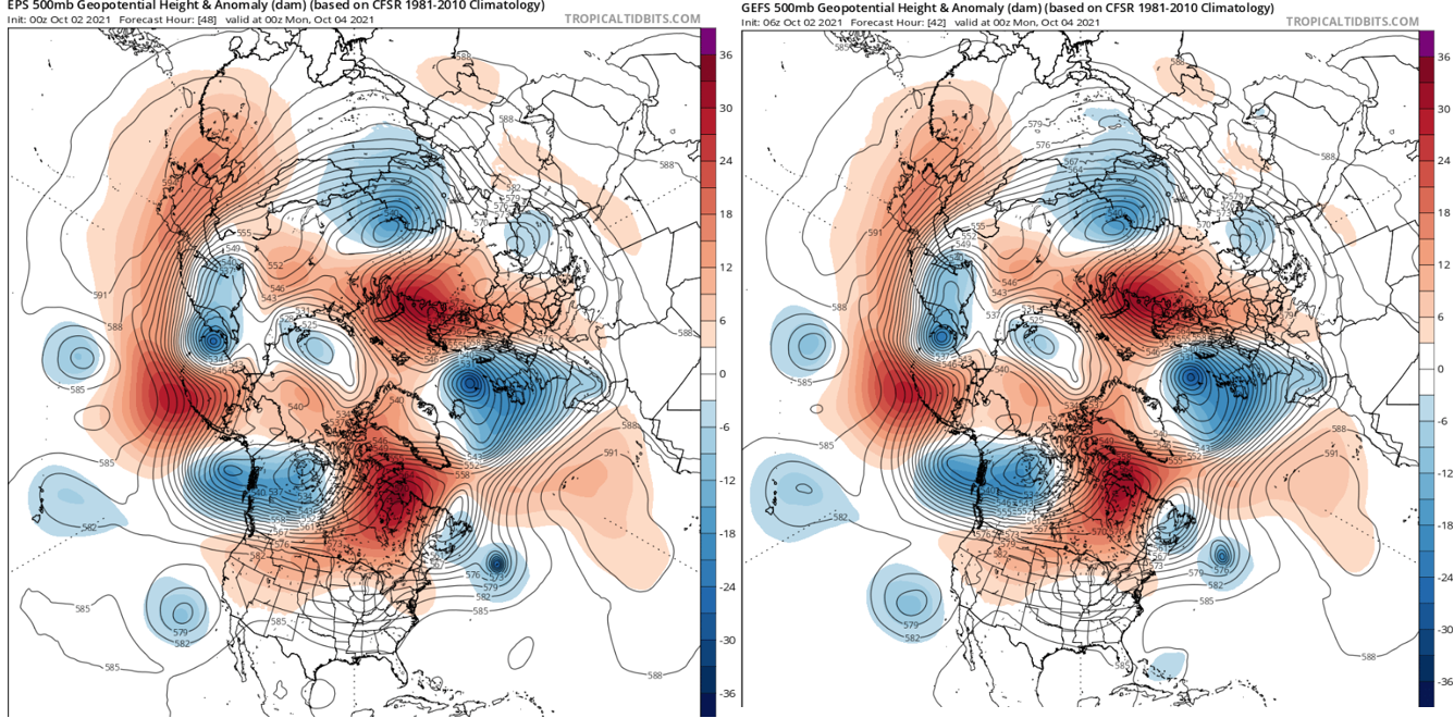
Wednesday into the Weekend
As the cutoff low ejects across the Southwest, a more robust trough will position itself across the western seaboard. Ensemble guidance (NBM, GEFS, EPS) showing agreement on location, but uncertainty exists in the depth of the trough. Long Range Ensemble guidance mainly suggests rain with this event. Stay tuned as we move closer.