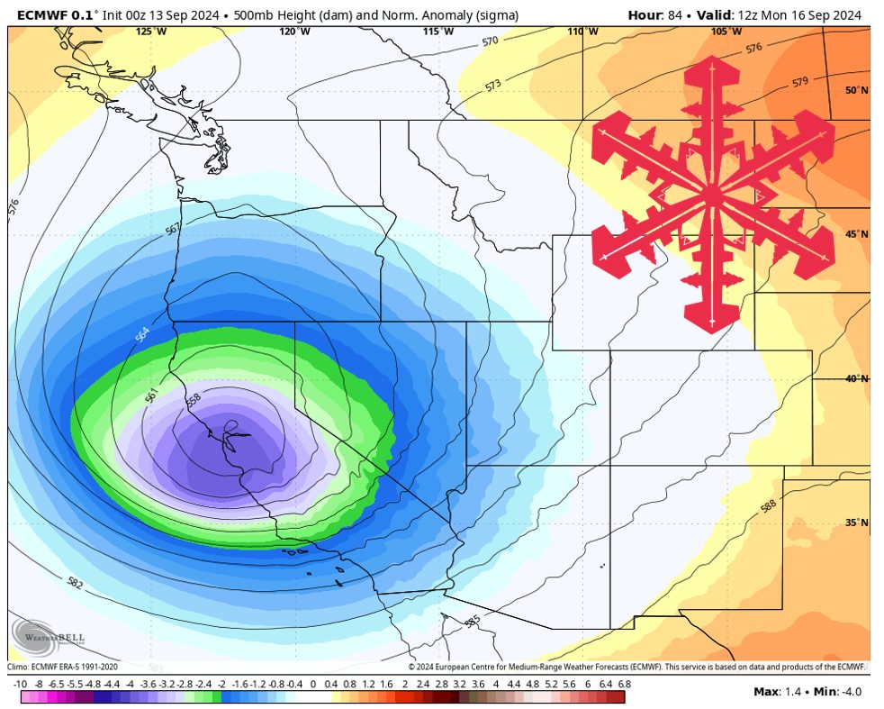
A storm will develop over California on Monday, kicking off a cold and wet week. Source: maps.weatherbell.com
Forecast Summary
Forecast written on Friday, September 13, 2024, at 10 p.m. MST
- A robust low-pressure system will move down the West Coast this weekend, bringing much cooler temperatures and precipitation to California/Nevada, including snow in the High Sierra.
- That system then moves up through Northern Utah and across Montana, bringing snow to the higher peaks of the Northern Rockies, before gradually decreasing in strength.
- Another low-pressure system then forms over Northern California, which will continue to generate rain/snow and transport cooler air across the SW U.S. late next week.
- Temperatures will be well below seasonal norms across the SW next week, with above-normal precipitation across much of the west.
Storm #1 (MON-TUE)
Storm #1 strengthens over Northern California before tracking NE. Source: maps.weatherbell.com
An active week of weather across the western U.S. begins with a low-pressure system diving down the west coast, eventually reaching peak strength just as it reaches Northern California. The low then starts receding back northward, hitting Utah, Montana, Wyoming, and Idaho on its way out.
Precipitation begins Sunday night in the Sierra and continues through at least Monday afternoon. Peaks as high as 10,000ft could see precip start out as rain, but snow levels will drop to 6-7,000ft by Monday morning.
Utah will see rain beginning Monday afternoon, with snow levels dropping down as low as ~9,000ft on Tuesday morning.
A similar pattern is seen in Idaho and Western Montana, with snow falling mainly on Tuesday evening.
Forecast Snowfall Totals for Storm #1:
- 1-4″ above 7,500ft in the Sierra
- 1-3″ above 10,000ft in Utah
- Trace-2″ above 10,000ft in Idaho, Western Montana, and Western Wyoming
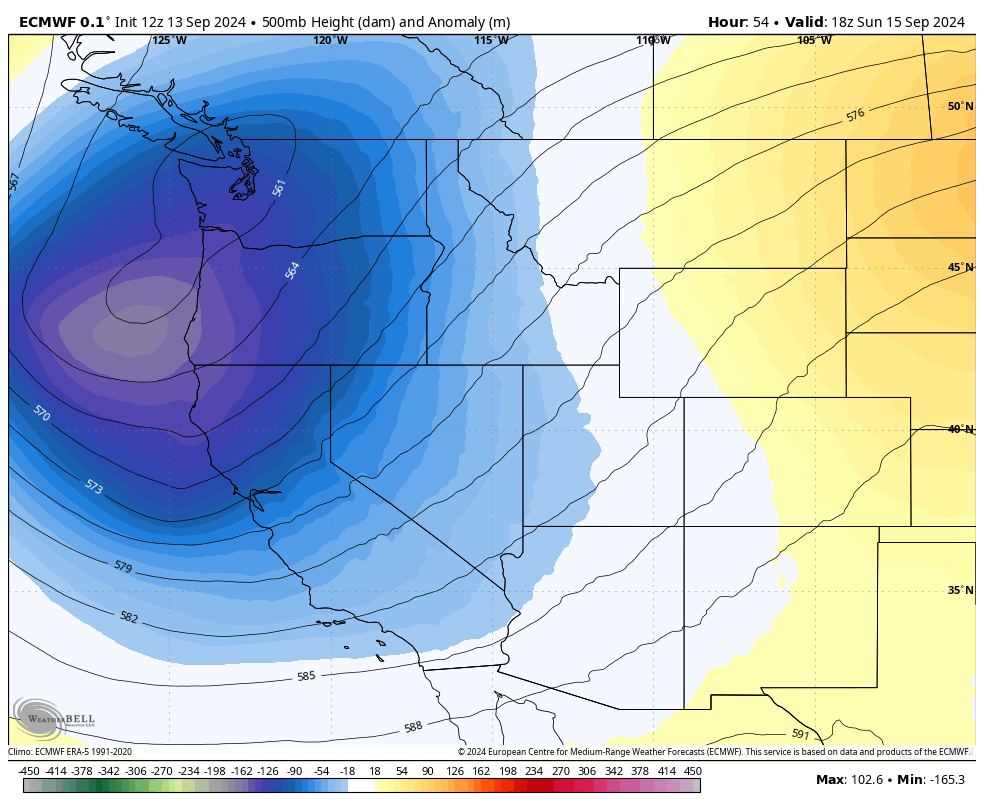
Storm #2 (WED-FRI)
Storm #2 intensifying over Southern CA and moving across the SW. Source: maps.weatherbell.com
A second low-pressure system immediately follows behind the first, this time dropping even further south over Southern CA and Arizona.
Precipitation begins Wednesday morning in the Sierra, and peaks Wednesday afternoon/evening before mostly moving off by Thursday morning. Snow levels could drop down to ~7,000ft on Wednesday, providing another window for snow across the higher elevations.
Precipitation then moves over Northern Utah on Wednesday night and Thursday. Snow levels should be at their lowest on Thursday morning, dropping down to ~9,000ft once again.
Western Colorado may also see a chance for snow from this storm, with the current forecast showing some showers over the mountains on Thursday and Friday. However, snow levels may not drop much below 11,000ft at any point, limiting the snowfall potential significantly.
Forecast Snowfall Totals for Storm #2:
- 1-5″ above 8,000ft in the Sierra
- Trace-2″ above 10,000ft in Utah
- Trace-1″ above 11,000ft in Western Colorado
Overall, expect below normal temps and above normal precip this week west of the Rockies.
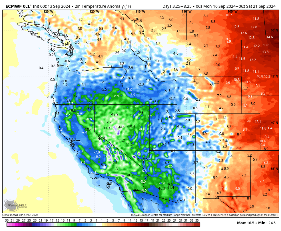
Below normal temperatures expected from Monday-Friday. Source: maps.weatherbell.com
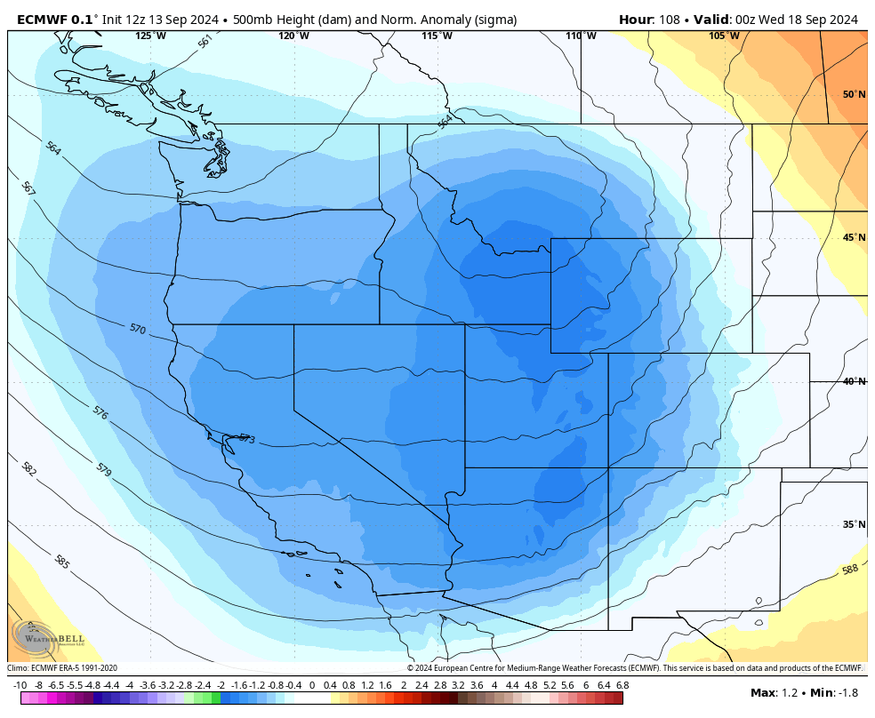
Extended Forecast
Models are showing yet another storm moving down over the Rockies on Saturday, but there is a lot of disagreement on how far south that will track. Regardless, it should be a good chance for more snow across the Northern Rockies.
There is a growing consensus that La Niña will develop this winter. In general, La Niña favors wetter and cooler weather for the Pacific NW and the Northern Rockies, and the opposite for the SW.
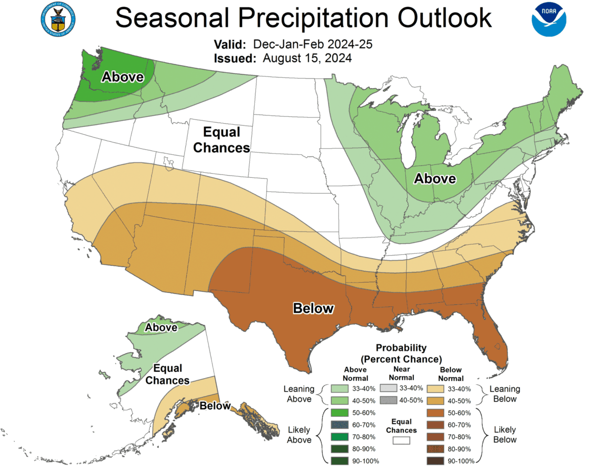
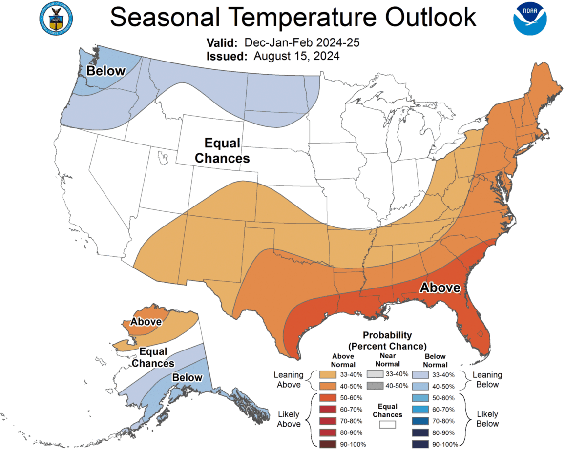
Climate Prediction Center winter outlook. Source: https://www.cpc.ncep.noaa.gov/products/predictions/long_range/seasonal.php?lead=4