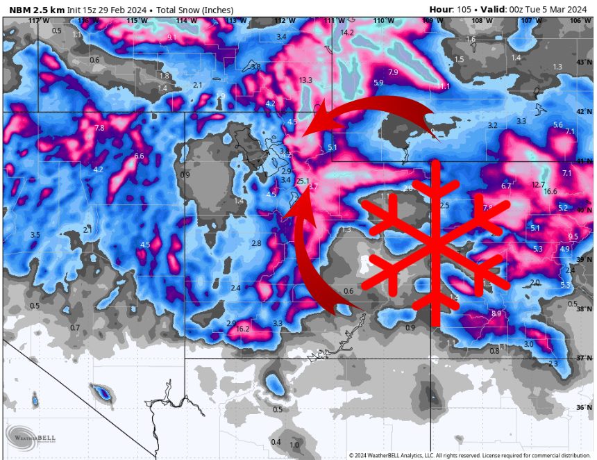
The latest Utah snowstorm. Source: maps.weatherbell.com
Forecast Summary
A large trough dives down across the Western U.S. over the next few days. California will see several feet of snow, while Utah receives the leftovers.
Snow starts over far Northern Utah on Friday, with a few inches of snow expected at Snowbasin and Powder Mountain through Friday afternoon. Measurable snow likely stays north of the Cottonwoods initially.
Some light snow starts up over the Cottonwoods Friday night and continues Saturday morning.
The heaviest snow falls Saturday afternoon when a cold front sweeps through and brings a band of heavy snow for a few hours. Expect snowfall rates in excess of 1″/hr Saturday afternoon, decreasing Saturday evening. Light snow continues at times through Monday afternoon before drying out.
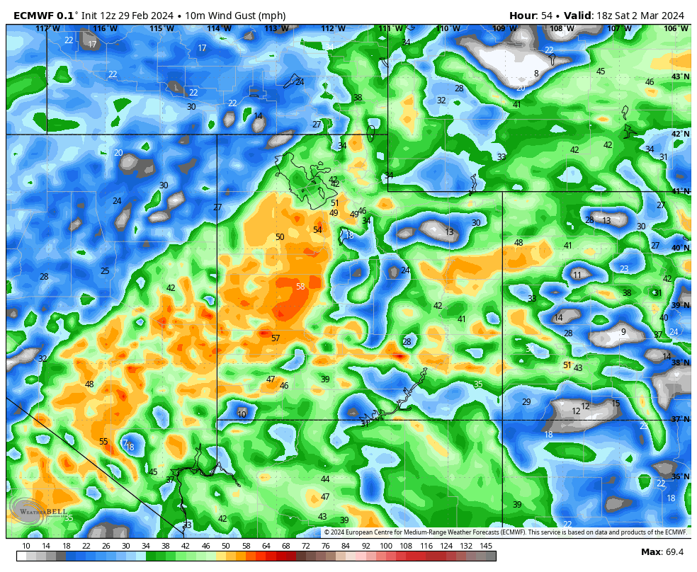
Strong winds will be present ahead of the cold front, with gusts to 50+ mph possible at times in the mountains. Once the front moves through, winds should decrease substantially. Sunday and Monday should be fantastic powder days across Utah, with lighter winds and fresh snow.
Estimated Snow Totals:
- Alta/Bird: 12-24″
- Solitude/Brighton: 10-18″
- Park City/Deer Valley: 7-14″
- Sundance: 6-12″
- Snowbasin/Powder Mtn: 10-20″
- Brian Head: 8-14″
- Eagle Point: 5-10″
Snowpack Update
Utah is already having a strong 23-24′ winter season, with the statewide snowpack sitting at ~115% of normal before this storm. That is well ahead of most other regions of the US this season, a result of atmospheric river events earlier in the season that targeted Utah (and Eastern Nevada) from the SW.
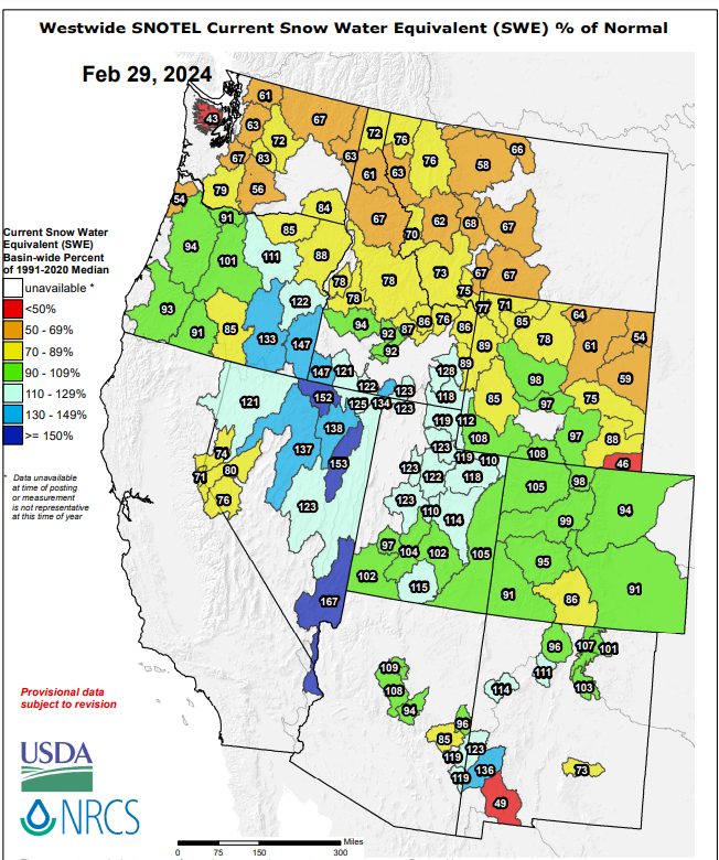
Western US snowpack. Source: https://www.wcc.nrcs.usda.gov/ftpref/data/water/wcs/gis/maps/west_swepctnormal_update.pdf
Alta, in particular, is having another great season. The graph below shows this season’s snowpack compared to the 19-20′ season, which ended up with 542″ of snow, near the long-term average. With another 1-2′ of snow coming up, Alta will sit near 470″ for the season, with plenty more to come over the next couple months.
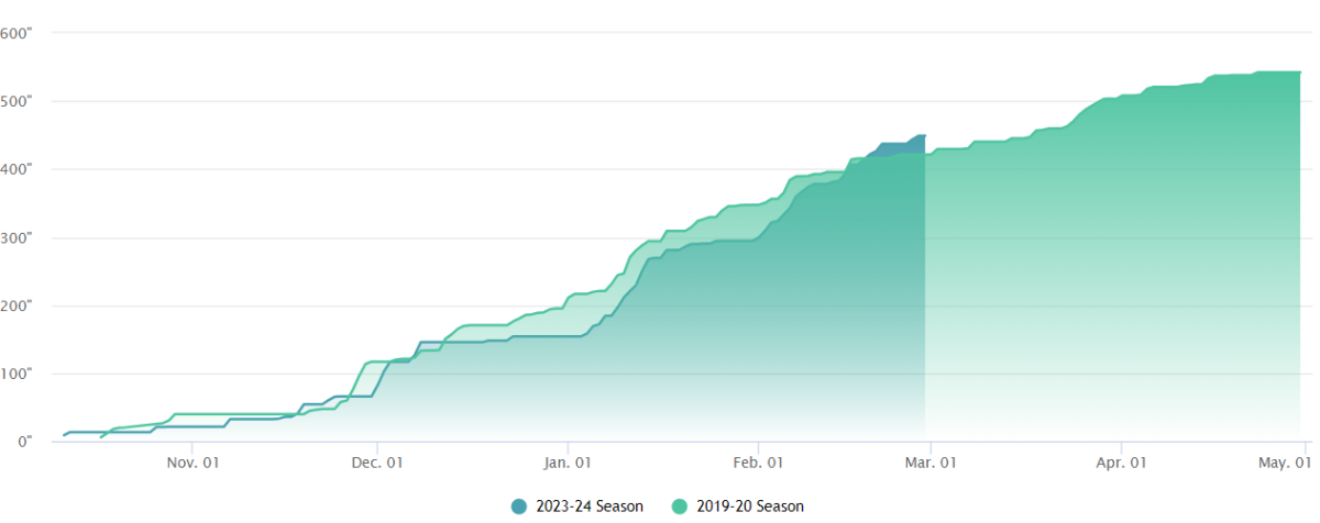
Alta’s current snowpack compared to an ‘average’ year. Source: https://www.alta.com/weather