Forecast By SnowBrains Chief Meteorologist – Eric McNamee
7:10 pm MST, 12/19/2021
Forecast Summary:
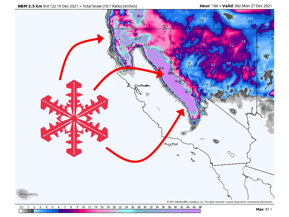
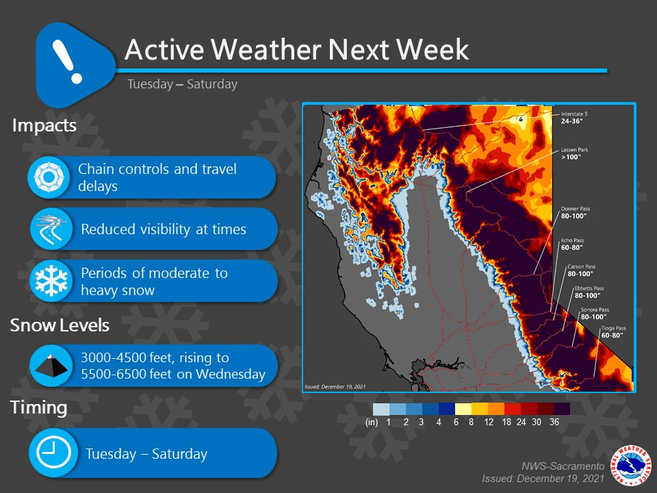
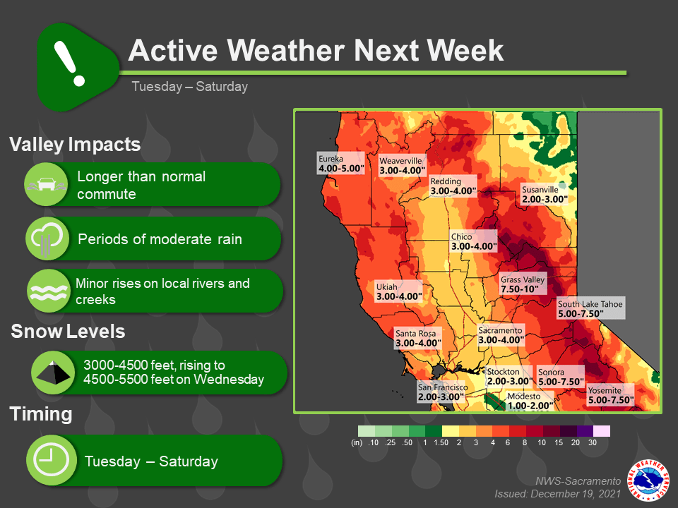
A long-duration Atmospheric River will bring up to 100″ of snow to the Sierra through Sunday of next week.
Snow will get started Tuesday as moisture from the atmospheric river slams into the Sierra to start things off.
Snow will then pretty fall nonstop through the weekend with a brief break on Friday.
Resorts that will see the most snow are Heavenly, Homewood, June, Kirkwood, Palisades Tahoe, Alpine Meadows, Northstar, Sierra at Tahoe, Sugar Bowl, and Mammoth.
Short-Term Forecast:
Monday-Wednesday:
A trough over the eastern Pacific will slam an Atmospheric River into the Sierra to begin this event and bring up to 100″ of snow through the weekend.
Snow will start Tuesday as moisture from the atmospheric river gets drawn into the state.
Initially, snow levels will start out around the 3000′-4500′ range and rise up to 4500-‘5500’ by Wednesday.
During this time is when the heavier precipitation will begin.
Snow will continue through Wednesday with 1-2 FEET of snow falling during this time.
Long-Term Forecast:
Thursday-Sunday:
Heavy precipitation will continue through the remainder of the week as deep moisture is slammed into the Sierra.
Snow levels will remain high through the day Thursday before snow levels drop again as colder air filters into the area.
Another 1-3 FEET is possible during the day Thursday.
There will be a brief break in the action during the day Friday before another trough moves in Friday night.
Snow will then continue through the remainder of the week with a few more FEET of snow possible.
Extended Forecast:
Friday and Beyond:
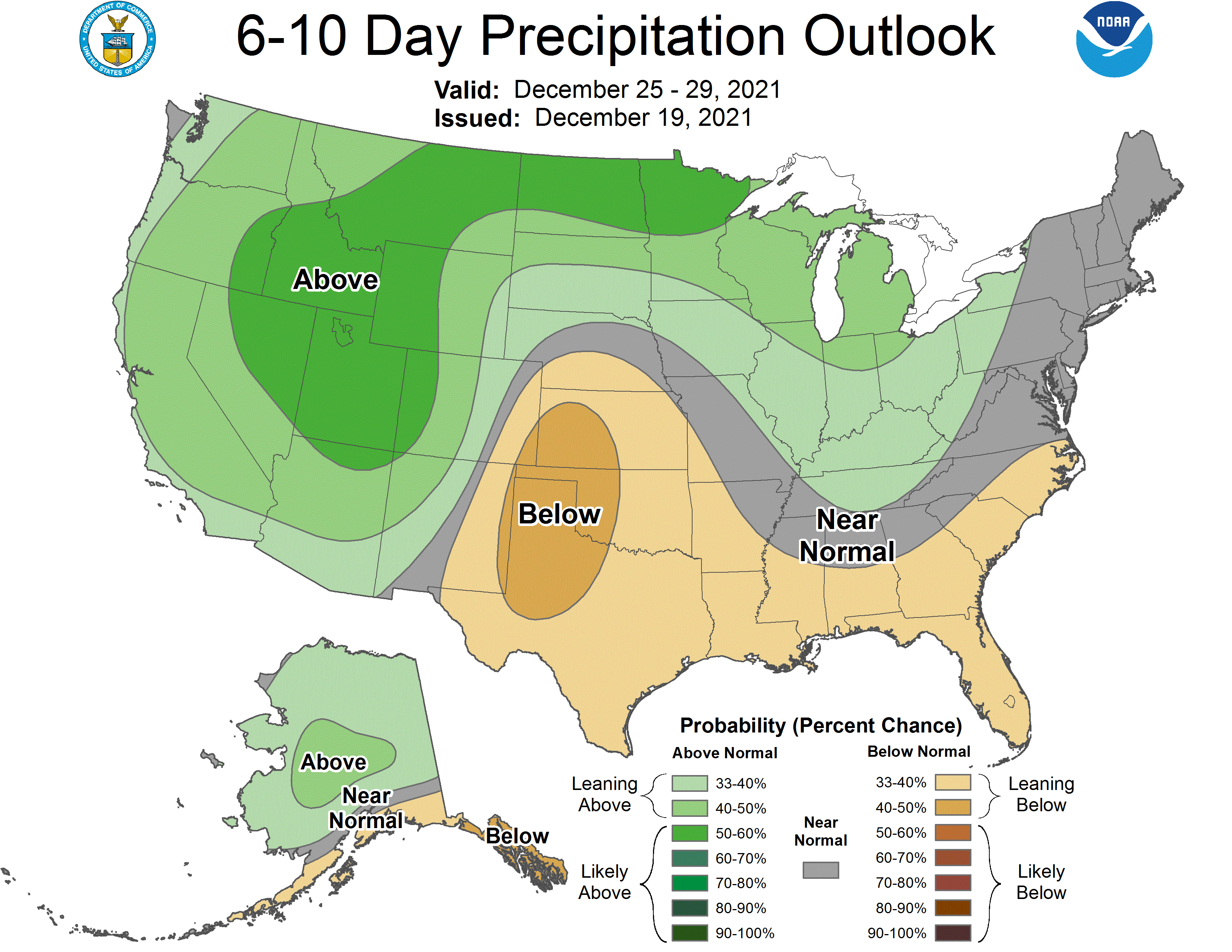
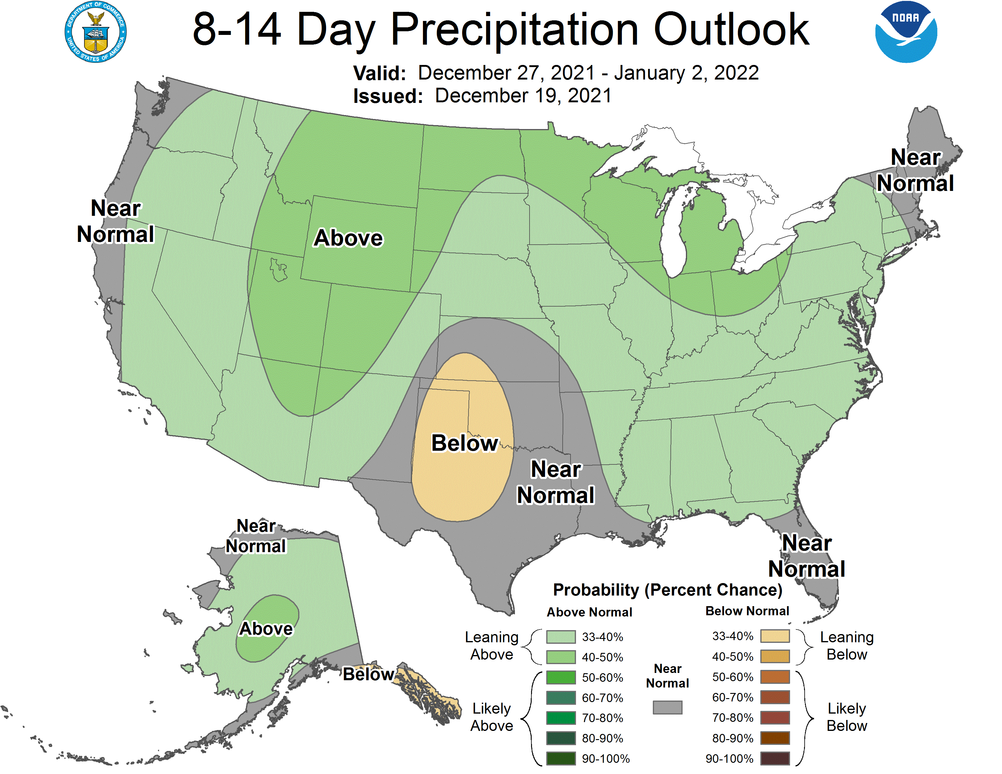
Global ensembles are indicating an active pattern to continue with above-average precipitation across California through the extended.
