Forecast By SnowBrains Chief Meteorologist – Eric McNamee
9:45 PM MST, 11/18/2021
Forecast Summary:
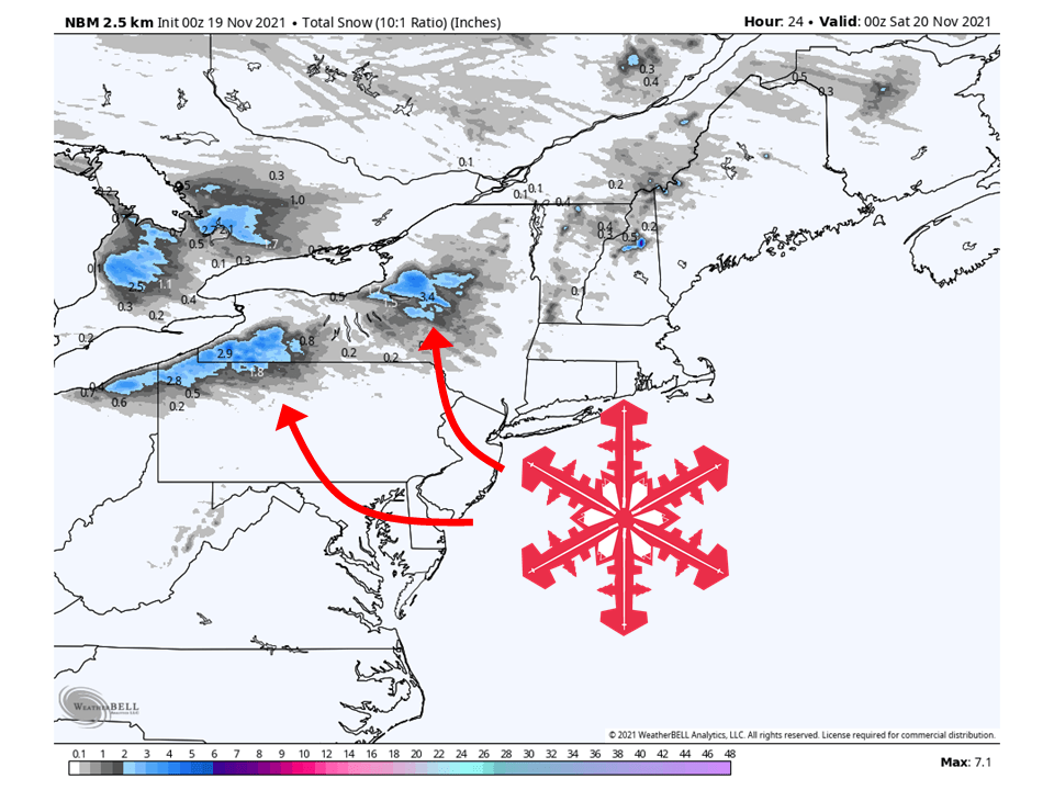
A deep upper-level low will bring up to 8″ of snow across portions of the northeast through Friday.
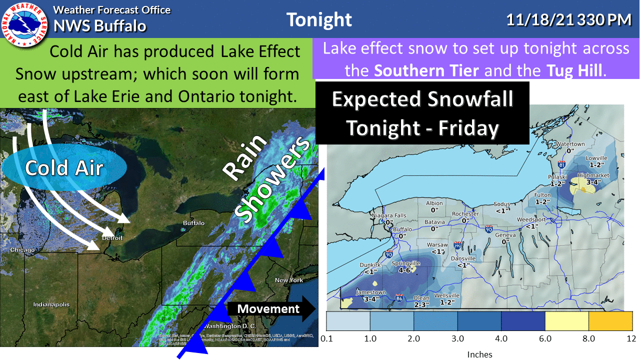
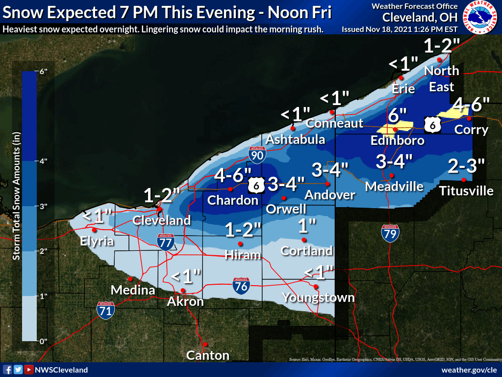
Cold air moving over the Great Lakes will initiate lake-effect snow across the region Thursday night through Friday.
The highest totals will be found in the Tug Hill Plateau of New York.
Short-Term Forecast:
Thursday-Saturday:
Lake-effect from a deep upper-level low will bring up to 8″ of snow across portions of the northeast through Friday.
Cold Candian arctic air will move over the Great Lakes Thursday night and get lake-effect snow bands to develop downwind of Lake Erie and Lake Ontario.
These bands will keep going through the night and into Friday morning before tapering off in the afternoon.
Lighter snow will fall in other parts, but the heaviest snow will be found in these areas downwind, with the Tug Hill Plateau seeing the most.
Winter Weather Advisories have been issued because of this.
Long-Term Forecast:
Saturday- Wednesday:
Another system will move through the area this weekend, bringing some additional snowfall.
Right now, snowfall totals are not sure, so we will keep an eye on how this unfolds.
Extended Forecast:
Sunday and Beyond:
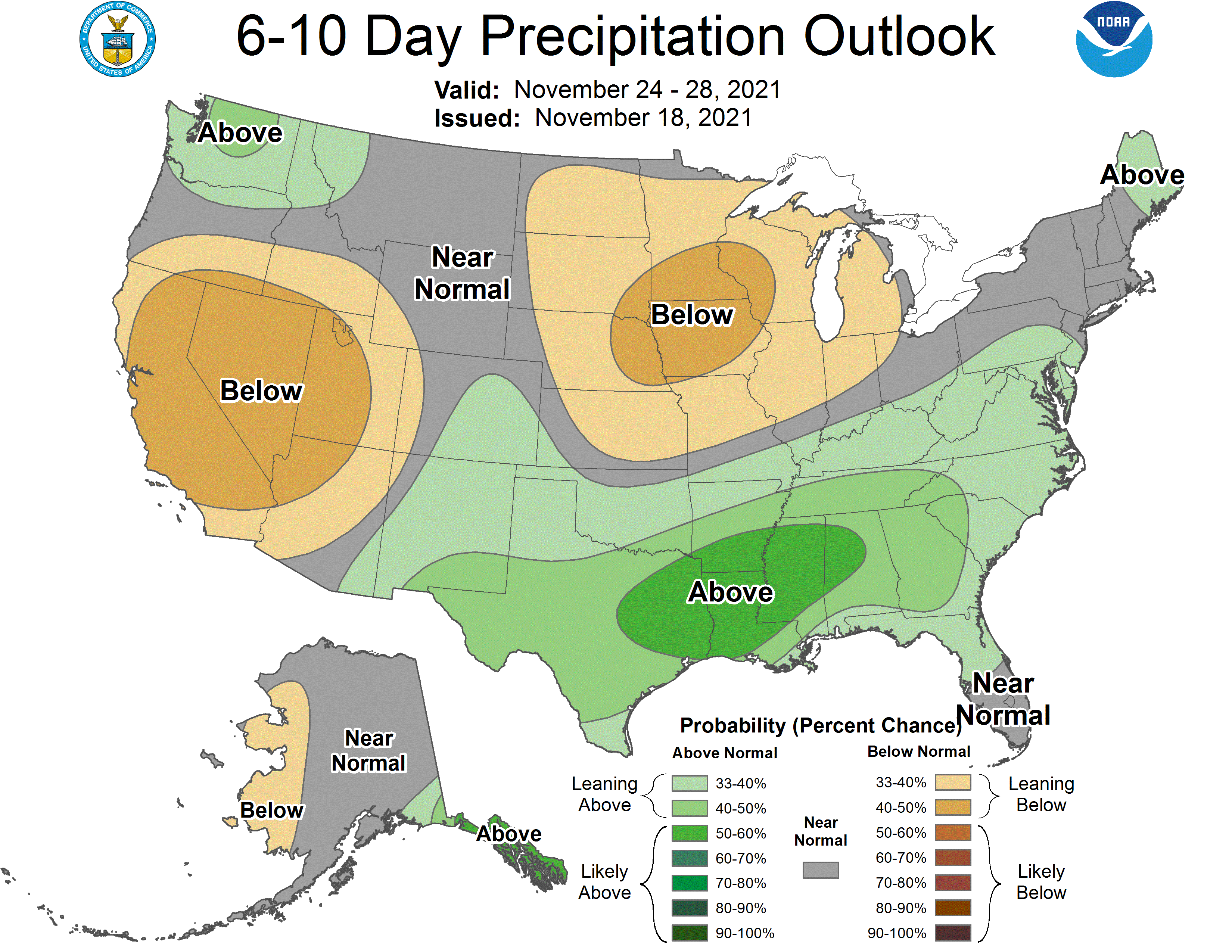
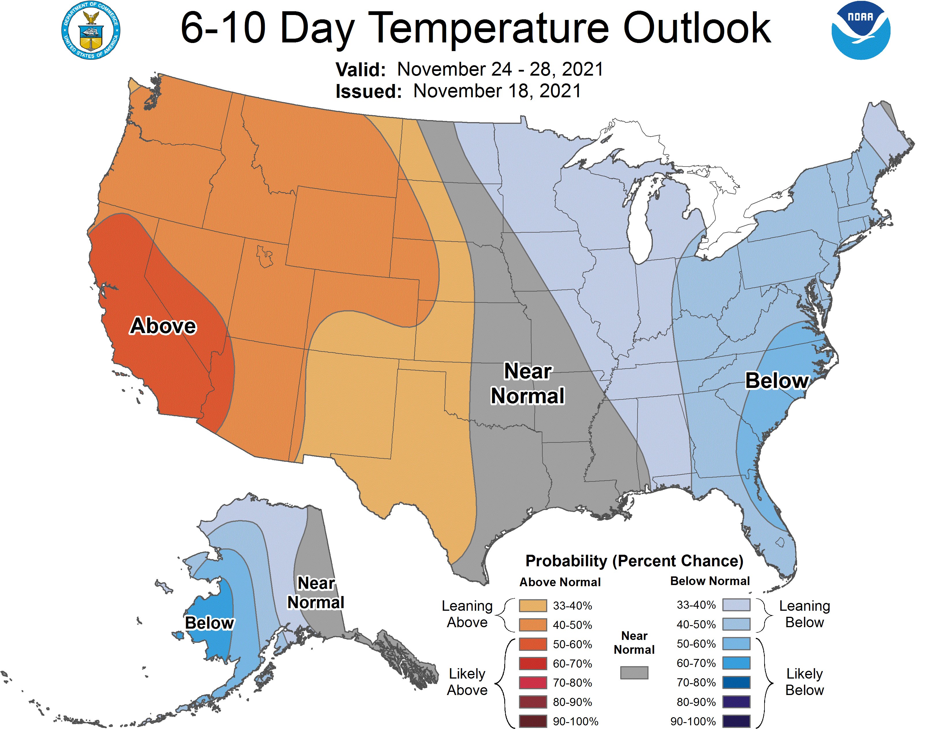
Global ensembles are indicating near to near-average precipitation and below-average temperatures across the region in the extended.
