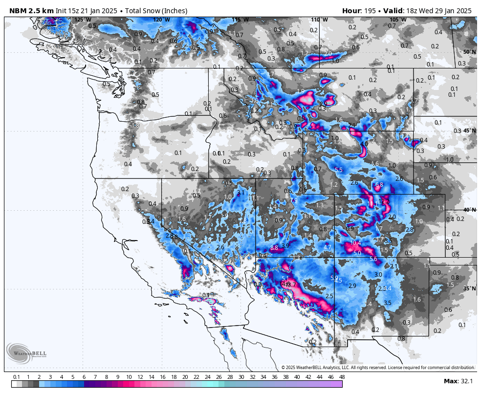
An arctic air mass has settled over much of the Western United States, delivering some of the coldest temperatures of the season thus far. Many high-elevation basins in the Rockies dipped well below zero, with spots hitting -30°F and colder early Tuesday morning. But the pattern is changing, and we’re on the cusp of a slow warm-up along with a return to a more active storm cycle, especially heading into the weekend.
Midweek: Gradual Warming, Light Snow in the Northern Rockies
In the short term, we’ll see lingering cold air hold strong across mountain valleys and low-lying basins while a ridge of high pressure tries to nose in from the Pacific. This interplay means some spots—in places like Montana’s Bridger Range and Big Sky country—could get fleeting shots of very light snow (on the order of a trace to a few inches) Wednesday. Most resorts across Idaho, northern Wyoming, and western Montana will see only minor accumulations midweek.
Meanwhile, the Pacific Northwest looks fairly quiet. We may see tiny dustings (generally an inch or less) around the northern Cascades (e.g., Mt. Baker) late in the week, but overall, Washington and Oregon ski areas remain mostly dry with some passing high clouds and modest temperature rebounds.
California: Weekend System Bringing Modest Sierra Totals

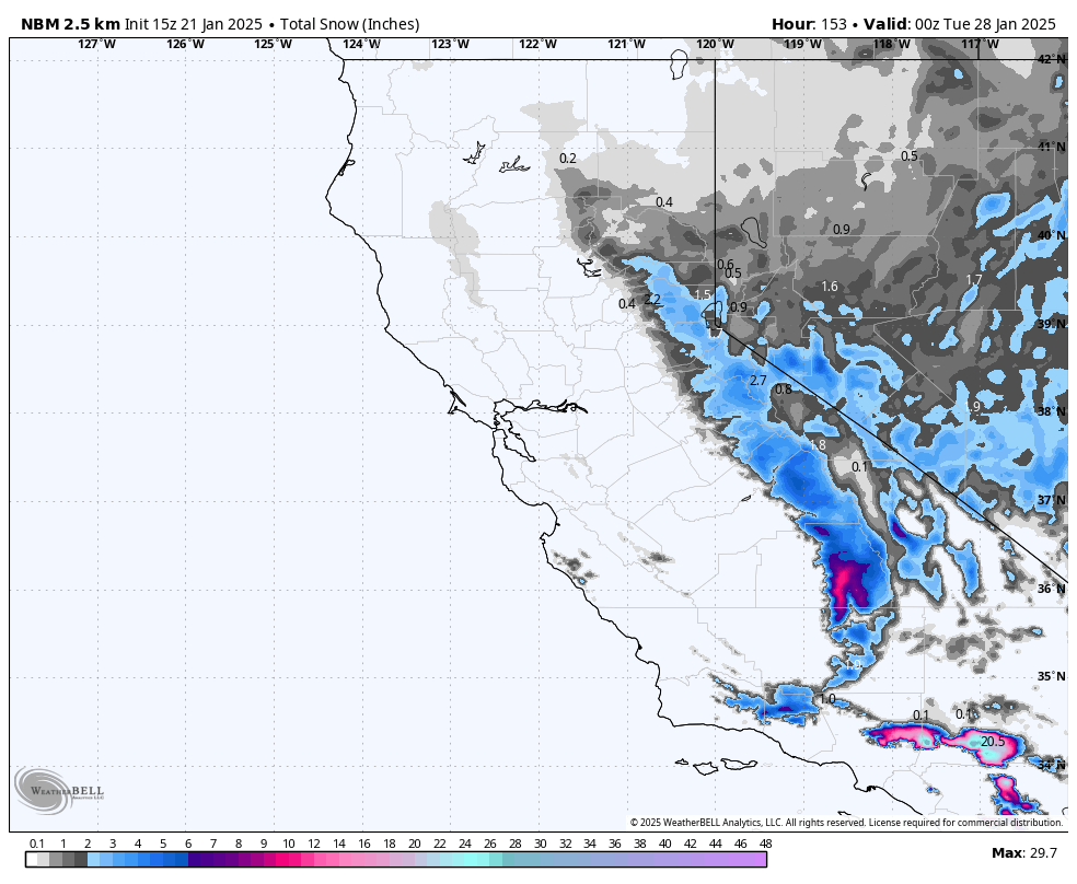
As temperatures moderate, the next notable system sets its sights on the Sierra heading into Saturday. Early projections point to modest snowfall for the northern Sierra—on the order of a few inches. Resorts around Lake Tahoe may pick up somewhere in the 1-4 inch range. Farther south, Mammoth could see slightly higher totals (3-6 inches) between Saturday and Sunday night, thanks to a more favorable track of the storm. These accumulations aren’t huge but will be a welcomed refresh given the recent dry, cold pattern.
Utah: Watching Late Week/Weekend Snow

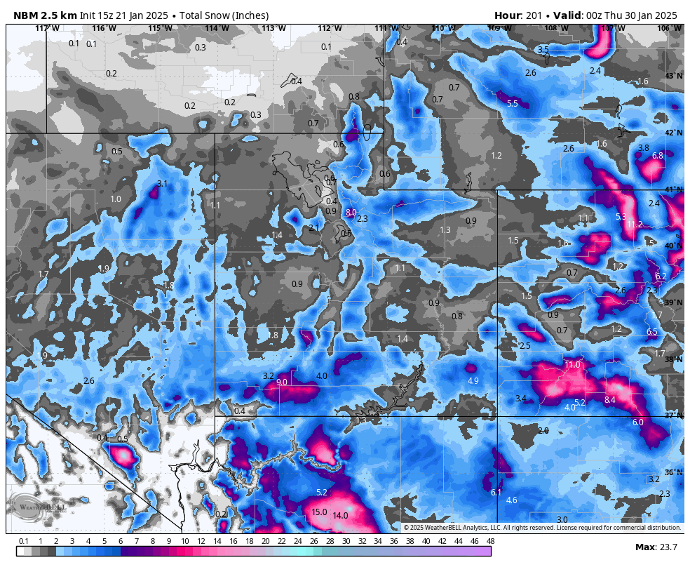
Utah’s mountains stay cold through midweek, but things warm up slightly as we approach Friday. A system dropping south from the Pacific Northwest looks poised to undercut the ridge, pulling moisture across the Great Basin. Northern Utah’s Cottonwood resorts could see a boost of a few inches heading into the weekend—forecasts hint at roughly 3-6 inches in the upper elevations. Park City/Deer Valley and Eagle Point may see similar or slightly lighter amounts. This won’t be a massive event, but new snow will help after an extended stretch of high pressure and arctic cold.
Colorado: Best Weekend Potential

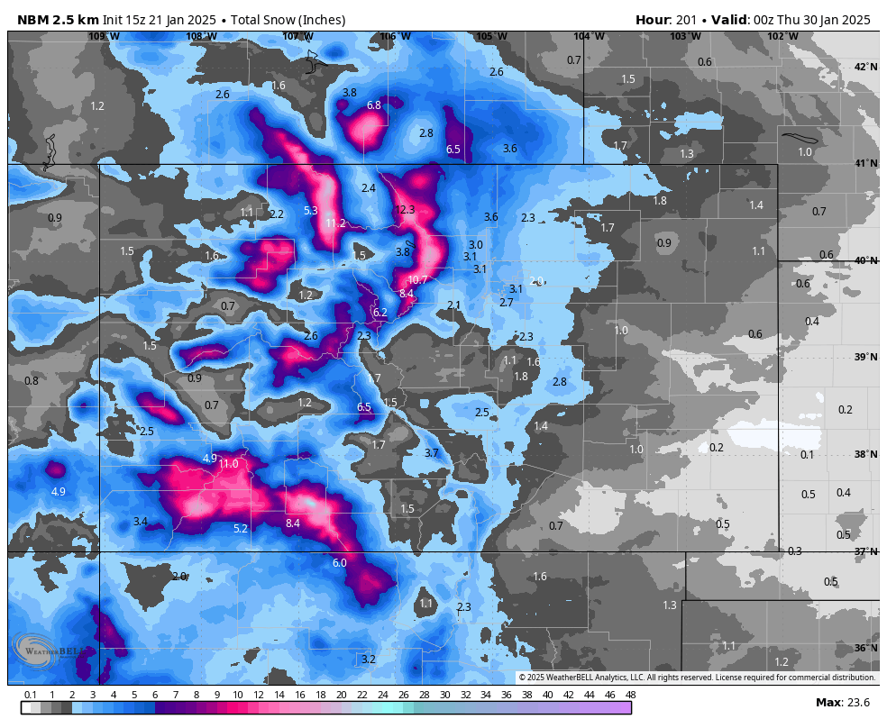
After a bitterly cold start to the week, Colorado is on track for a more pronounced warm-up at the mid and lower elevations. A small disturbance Wednesday could brush the northern mountains with light snow (on the order of a dusting to 2 inches). The bigger story arrives Friday into the weekend, as a more robust trough digs southward. Totals look respectable in many areas, especially the central and southern mountains. Wolf Creek and Crested Butte could nab upward of a half foot or more (generally 4-8+ inches, with some pockets of 6-11 inches possible). The I-70 corridor and northern mountains (Vail, Beaver Creek, Steamboat) may pick up around 3-7+ inches by Sunday, with locally higher amounts where orographics line up best. While not a massive dump, this will be the most widespread snow event Colorado has seen in a couple of weeks.