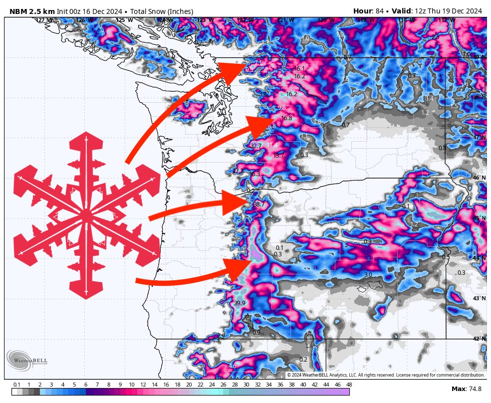
Unsettled weather will bring multiple rounds of mountain snowfall across the Pacific Northwest over the coming week. A prolonged storm from Sunday night through midweek will deliver substantial snow accumulations at upper elevations, followed by another moderate storm next weekend. Rising snow levels and variable conditions will shape ski quality day-to-day, favoring higher elevations for the best new snow totals.
The first half of the week will feature a series of storms delivering periods of rain and snow to the mountains. Initially, snow levels will hover around 1500-2500 feet on Sunday night, gradually rising to 4000 feet or higher by Monday and Tuesday. This will lead to significant snowfall accumulations primarily at the mid and upper elevations of the Cascades, while lower slopes and foothills may see a mix of rain and wet snow.
From Sunday night into Wednesday, a slow-moving, moisture-rich system will impact the region. Heavy snow is expected at higher elevations, with consistent snowfall rates continuing through Tuesday night and even into Wednesday morning in some areas. Winds may be breezy during peak storm passages, but sustained high winds are not anticipated to be a major issue outside of exposed mountain ridges.
Snow levels will be fluctuating, generally rising by Tuesday night into Wednesday, possibly pushing above 5000-6000 feet at times. After a relative lull late in the week, another round of snowfall is likely next weekend (Saturday into Sunday), though totals look much lighter than the first major storm. Expect modest accumulations confined to higher elevations once again. While the storm this weekend will not be as intense as the early-week system, it should still provide a refresh for upper mountain conditions. Snow levels may remain elevated, likely limiting accumulation to mid-mountain elevations and above. Stay tuned for an updated forecast for that storm later this week.
Storm Resort Snowfall Totals (PNW)
Sunday night (December 15)-Wednesday (December 18)
Mt Bachelor: 19-32”
Timberline: 18-32”
Stevens Pass: 14-25”
Mt Baker: 14-24”
Crystal Mountain: 13-23”
Snoqualmie Pass: 10-18”