A powerful spring storm is hitting Oregon & Washington. The system will stick around through Monday with another storm arriving Tuesday morning.
14-20″ of snow is expected to fall in the warning area. 8-14″ of snow is expected to fall in the advisory area.
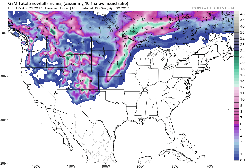
Snow levels will fall down to 4500ft throughout the storm, but the heaviest snow accumulations will be above 5500ft.
Additional Storm Information:
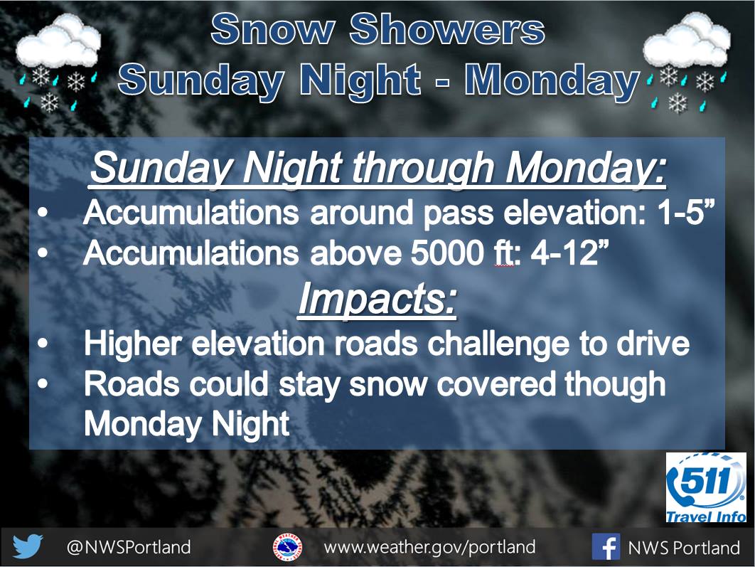
OR Warning Area: 14-20″ of Snow Through Monday
* Snow accumulations in the warning area...14 to 20 inches.
- NOAA Medford, OR


OR/WA Advisory Area: 8-14″ of Snow Through Monday
* Snow accumulations in the advisory area...8 to 14 inches.
- NOAA Medford, OR
Winter Storm Warning:
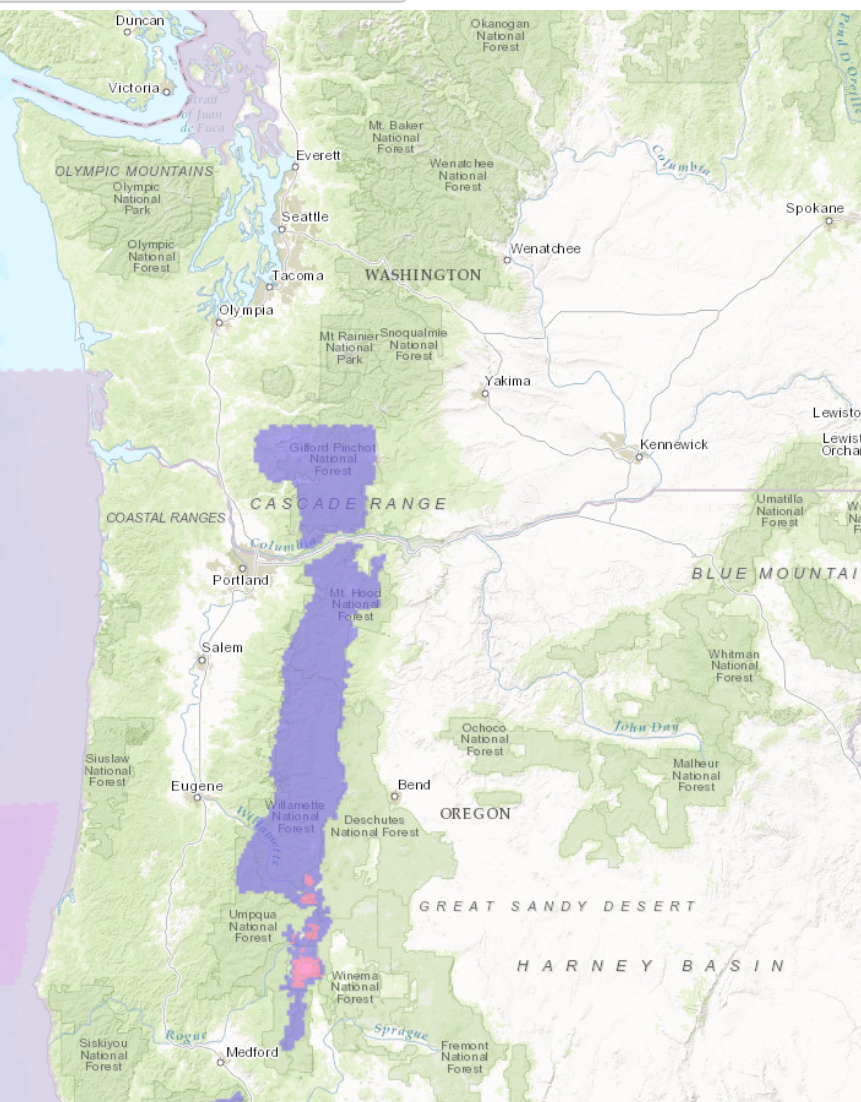
URGENT - WINTER WEATHER MESSAGE
National Weather Service Medford OR
109 PM PDT Sun Apr 23 2017

...Heavy Snow Over The High Cascades Tonight and Monday...

.A very wet and cool spring system will bring heavy, wet snow to
the high Cascades tonight and Monday. Strong westerly flow will
enhance snowfall over the west facing slopes including much of
Crater Lake National Park. The highest elevations, such as Crater
Lake Rim, will be the hardest hit with over a foot of snow.
Strong winds will also create blowing snow and white out
conditions over exposed areas.

South Central Oregon Cascades-
Including the city of Crater Lake
109 PM PDT Sun Apr 23 2017

...WINTER STORM WARNING IN EFFECT FROM 11 PM THIS EVENING TO
11 PM PDT MONDAY...
...WINTER WEATHER ADVISORY IN EFFECT FROM 11 PM THIS EVENING TO
11 PM PDT MONDAY...

The National Weather Service in Medford has upgraded the Winter
Storm Watch to a Winter Storm Warning for Heavy Snow...which is
in effect from 11 PM this evening to 11 PM PDT Monday. A Winter
Weather Advisory has also been issued. This Winter Weather
Advisory for Snow...is in effect from 11 PM this evening to 11 PM
PDT Monday.

* Snow accumulations in the warning area...14 to 20 inches.

* Snow accumulations in the advisory area...8 to 14 inches.

* Winds...West winds of 20 to 30 mph will create areas of
  blowing and drifting snow and significant reductions to
  visibility at times.

* Elevation...The heaviest accumulations will occur above 5500
  feet, although snow will fall as low as 4500 feet at times.

* Timing...Snow will begin this evening and become heavy at
  times overnight into Monday. The heaviest snow will fall
  Monday morning.

* Locations in the warning area include...Crater Lake National
  Park. Although most of the snow will occur inside the park,
  higher portions of highway 62, 138, and 230 may be affected at
  times.

* Locations in the advisory area include...Highway 138 near
  Diamond Lake and near the intersection of highway 230 and
  highway 138.

* Impacts...Travel will become difficult or impossible due to
  heavy, wet snow. Travelers planning to visit the park early
  this week should be prepared for very hazardous winter-like
  conditions. Do not be caught off guard by recent mild weather,
  winter weather is still occurring in the high country.
One thought on “Spring Has Definitely Not Sprung In The PNW | 14-20″ of Snow Through Monday”