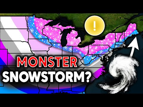
Direct Weather looks again at the snowstorm about to hit the East Coast. Models now show a historic snowstorm next week. Will it happen?
Here are the brief highlights of the forecast, but check out the full video for more details:
A prolonged period of cold air is expected to move into the Eastern United States, potentially lasting for several weeks. This pattern, characterized by a negative EPO (Eastern Pacific Oscillation) and positive PNA (Pacific/North American), will likely keep warm air centered over the West while pushing Arctic air into the East.
Potential Major Snowstorm
A significant snowstorm is being tracked for the days following Thanksgiving, primarily Friday (Black Friday) into Saturday. This system could affect the Ohio Valley, Great Lakes, Mid-Atlantic, and Northeast regions. While it’s still early for precise predictions, the National Weather Service has indicated a chance of heavy snowfall in these areas.
Snowfall Outlook
- Northwest: Heavy snowfall is expected for the northern Cascades and northern Rockies.
- Midwest and Great Lakes: Potential for significant snowfall, with lake effect snow likely to enhance totals.
- Northeast: The Adirondacks, Green Mountains, White Mountains, and northern Maine could see 10-15 inches of snow.
- Mid-Atlantic: West Virginia and Pennsylvania areas might receive 10-15 inches of accumulated snow.
Temperature Trends
Temperatures are expected to be well below normal for much of the Eastern U.S., with some areas potentially seeing temperatures 15-25 degrees below normal. This cold pattern could persist from Thanksgiving through early December.
Long-Range Outlook
Models suggest the cold pattern could continue into mid-December, with potential for additional storm systems. However, long-range forecasts are subject to change.
For skiers and boarders, this forecast suggests an early and potentially strong start to the ski and snowboard season in many areas across the Eastern U.S. and parts of the Northwest. Keep an eye on daily updates as the forecast evolves.