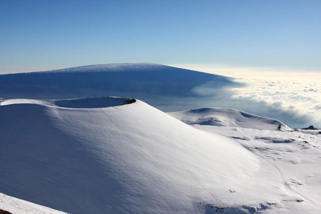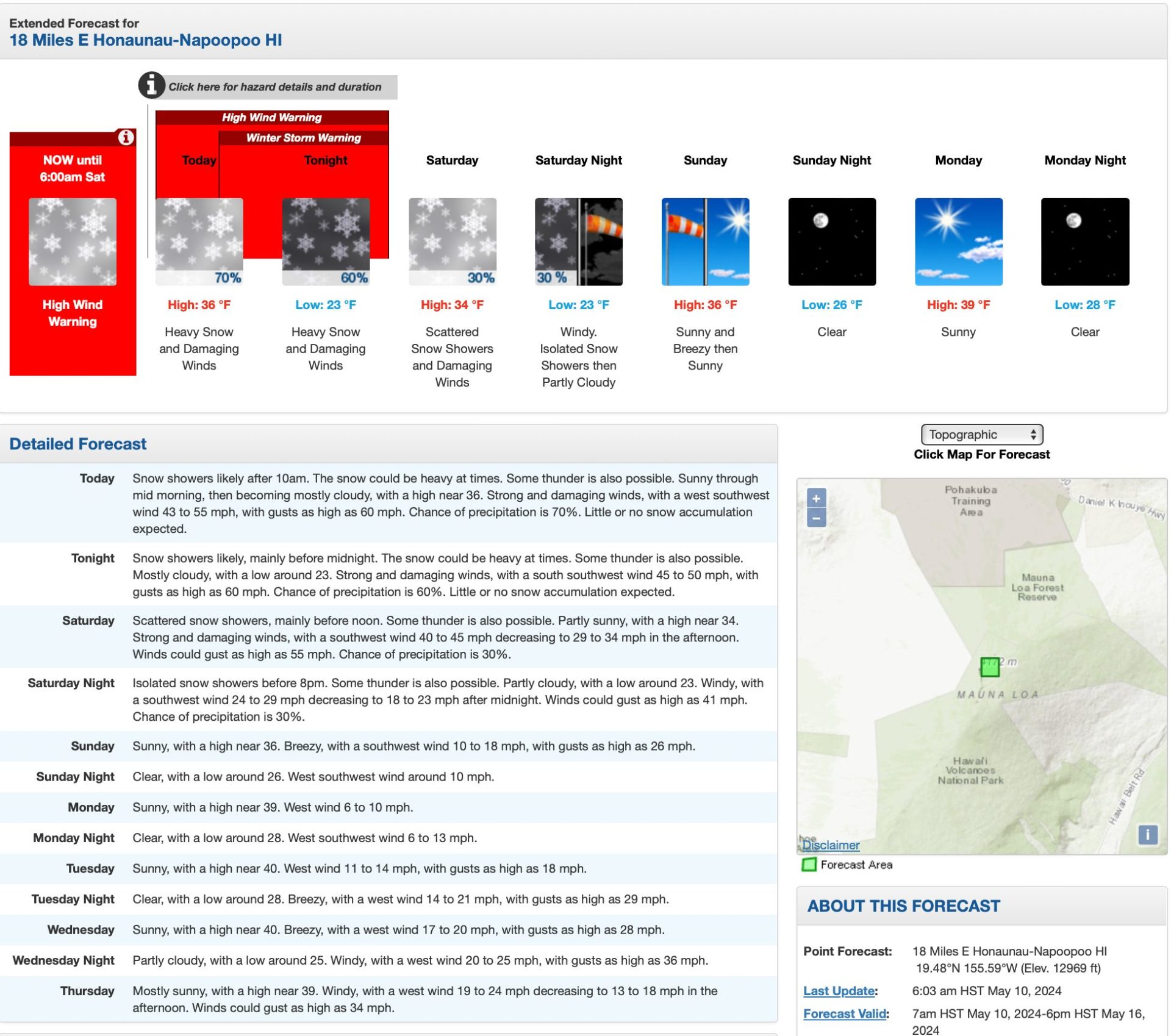
A potent weather system is drenching the Hawaiian Islands on Friday, triggering flash flooding alerts across the state, a Winter Storm Warning, and up to 6″ of snow for the mountain summits along the Big Island.
- Related: Yes, You Can Actually Ski in Hawaii
URGENT – WINTER WEATHER MESSAGE…CORRECTED
National Weather Service Honolulu HI
353 AM HST Fri May 10 2024
HIZ028-110245-
/O.COR.PHFO.WS.W.0003.240510T2200Z-240511T1600Z/
Big Island Summits-
353 AM HST Fri May 10 2024
…WINTER STORM WARNING REMAINS IN EFFECT FROM NOON TODAY TO 6 AM
HST SATURDAY…
* WHAT…Heavy snow and very strong winds are expected. Total
snow accumulations of up to 6 inches. Winds gusting over 70 mph.
* WHERE…Big Island Summits.
* WHEN…From noon today to 6 AM HST Saturday.
* IMPACTS…Travel could be very difficult to impossible.
Blowing snow will significantly reduce visibility at times,
with periods of zero visibility.
PRECAUTIONARY/PREPAREDNESS ACTIONS…
A Winter Storm Warning means significant amounts of snow, sleet,
and ice are expected or occurring. Strong winds are also
possible. This will make travel very hazardous or impossible. Any
travel plans to the summits should be postponed until the threat
diminishes.
While blizzard conditions are rare in Hawaii, snow is not uncommon on the two tallest volcanoes in the island chain. Snow is often associated with a Kona low, when winds that typically blow out of the northeast shift and begin to blow from the southwest, over the leeward or “Kona” side of the islands. As the air, laden with moisture from the tropical Pacific, is forced up by the mountainous topography, the moisture precipitates as heavy rain and snow. Kona storms are common between October and April.
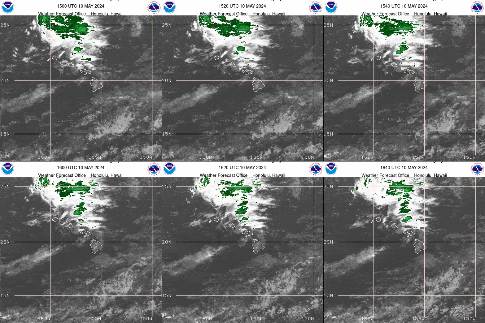
A potent upper-level low-pressure center swirling just north of the islands is providing copious amounts of tropical moisture and atmospheric instability, producing strong thunderstorms that may even reach severe criteria with 50 mph wind gusts and large hail.

According to the NWS Honolulu, the greatest threat for severe storms on Friday is on the smaller islands, spreading east into the Big Island Friday night.
Aside from frequent lightning and gusty winds, torrential rains with some storms’ rain rates up to 3 inches per hour will present an islands-wide flash flood threat. Already, 2-3 inches of rain fell across the windward sides of Oahu on Thursday night, with more on the way as rain spreads across the rest of the state on Friday.
Flood Watches cover all the islands through late Friday night, though the heaviest rains are expected Friday through Friday evening. Flood-prone roads and other low-lying areas are under threat to close due to runoff and overflowing streams. Rapid runoff could also cause property damage in urban areas.
Perhaps even more surprising is the wintry weather heading for the higher elevations of the Big Island. The NWS said Winter Storm Warnings are in effect for all mountain summits into Saturday morning, with as much as 6 inches of snow likely, along with blistering winds of 40-60 mph and gusts over 70 mph.
The storms will gradually diminish from west to east late Friday into Saturday and then taper off as the storm weakens and moves northeast. However, a moist pattern will remain into the new week, with long-range models suggesting another period of stormy weather looming later in the week.
