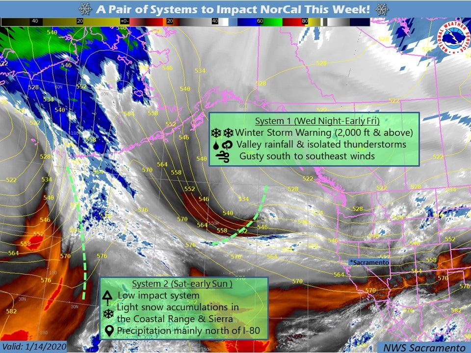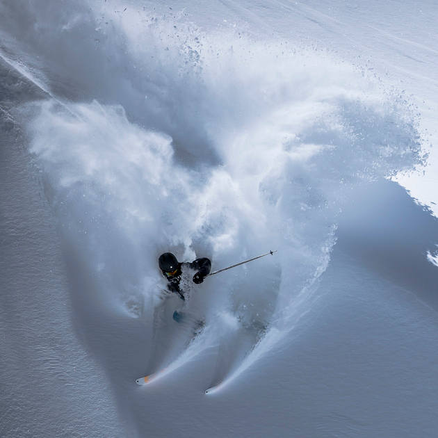
After a break in the weather today, a strong winter storm will move through the Greater Tahoe Area tonight through Thursday. This storm will bring heavy mountain snow, strong gusty winds, and plenty of travel headaches. Ski areas could see up to 2-FEET of fresh snow before the weekend. This is a BIG one, and SnowBrains drove from Salt Lake City, UT straight to Squaw Valley, CA yesterday in anticipation!
...WINTER STORM WARNING IN EFFECT FROM 7 AM TO 10 PM PST
THURSDAY...

* CHANGES...Upgraded the Winter Storm Watch to a Winter Storm
  Warning.

* WHAT...Heavy snow and strong winds expected. Total snow
  accumulations of 6 to 12 inches, except 10 to 18 inches above
  7000 feet with up to 24 inches along the Sierra crest. Winds
  gusting as high as 55 mph with ridge wind gusts over 100 mph.

* WHERE...Greater Lake Tahoe Area.

* WHEN...From 7 AM to 10 PM PST Thursday.

* IMPACTS...Travel could be very difficult. Very strong winds
  could cause tree damage and periods of white out conditions.
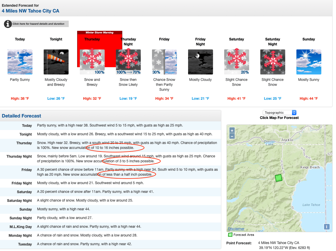
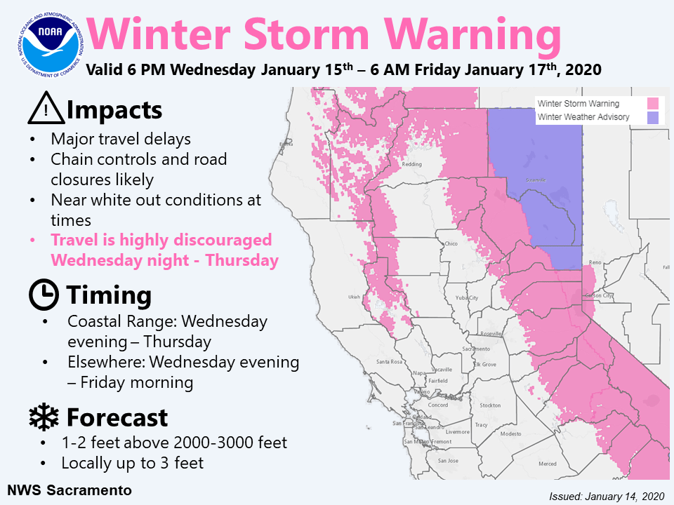
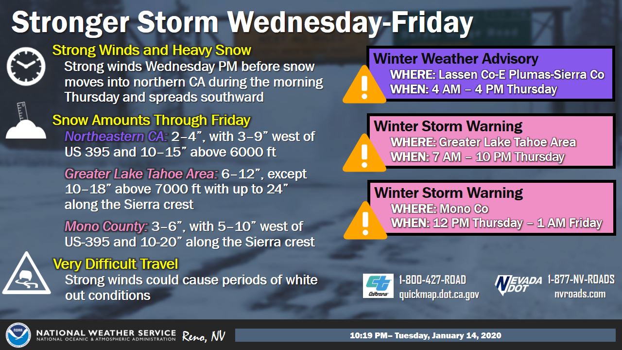
A Winter Weather Advisory is in effect from 4 am to 4 pm Thursday for Lassen-Eastern Plumas-Eastern Sierra Counties. A Winter Storm Warning is in effect from 7 am to 10 pm Thursday for the Greater Lake Tahoe Area, and 12 pm Thursday to 1 am Friday for Mono County. Travel could be very difficult. Very strong winds could cause tree damage and periods of whiteout and blizzard conditions.
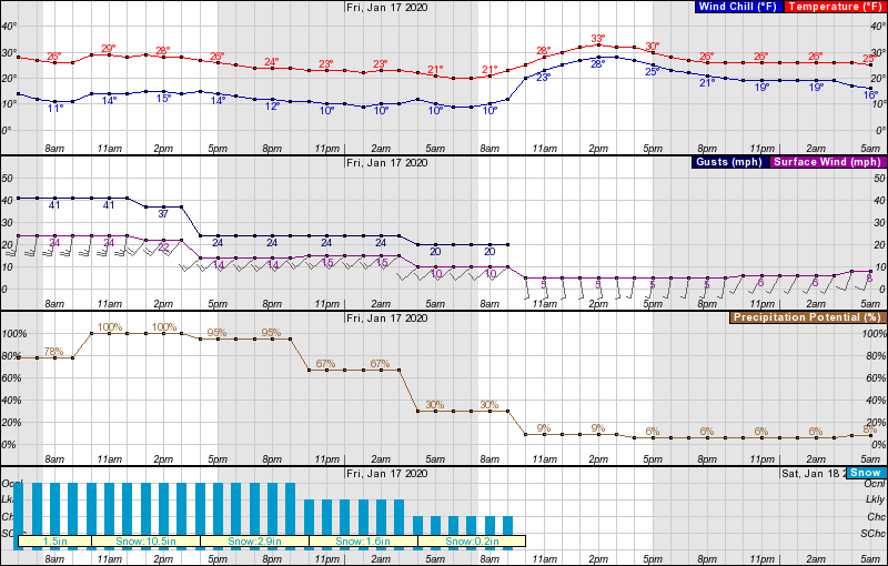
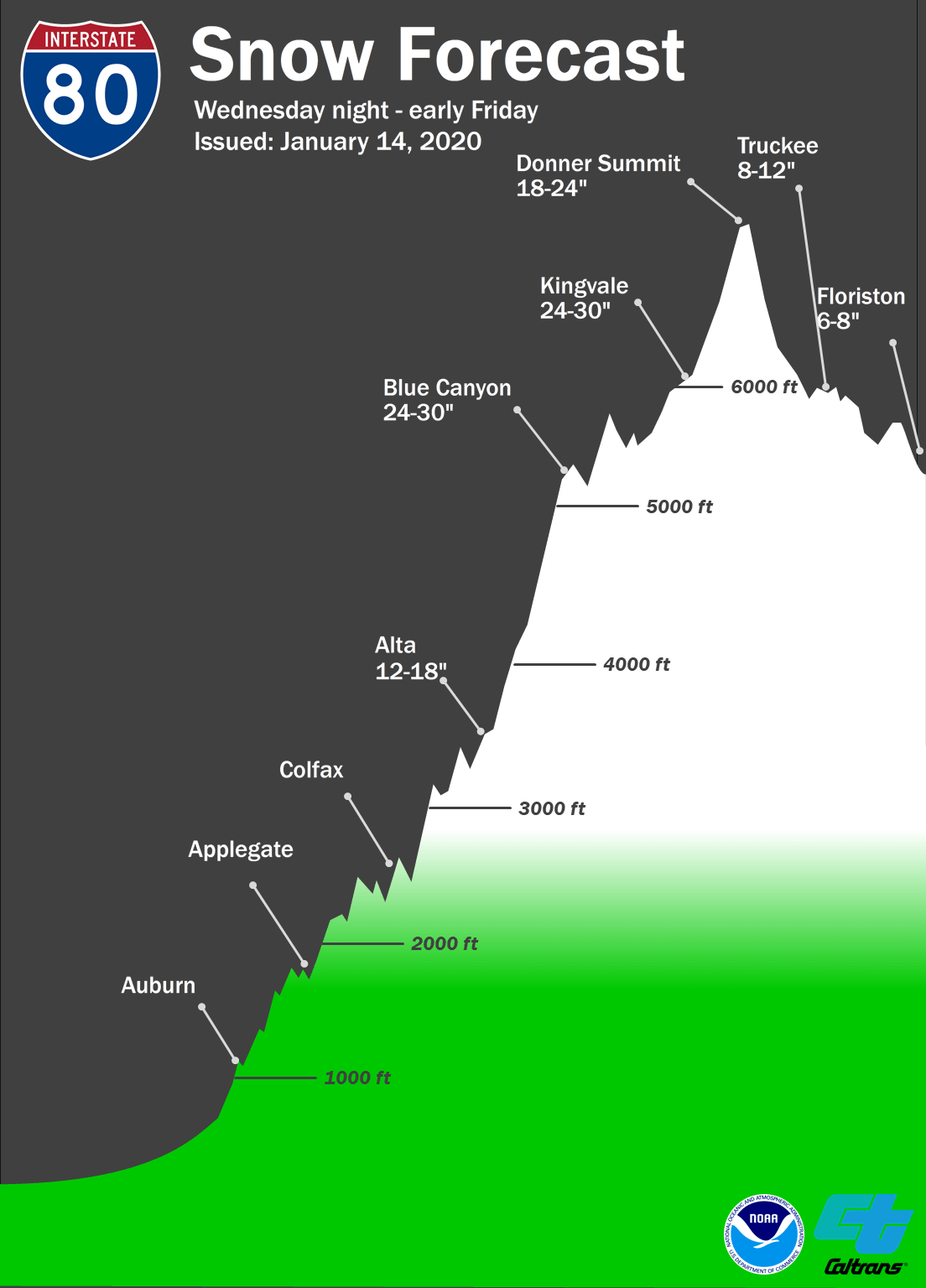
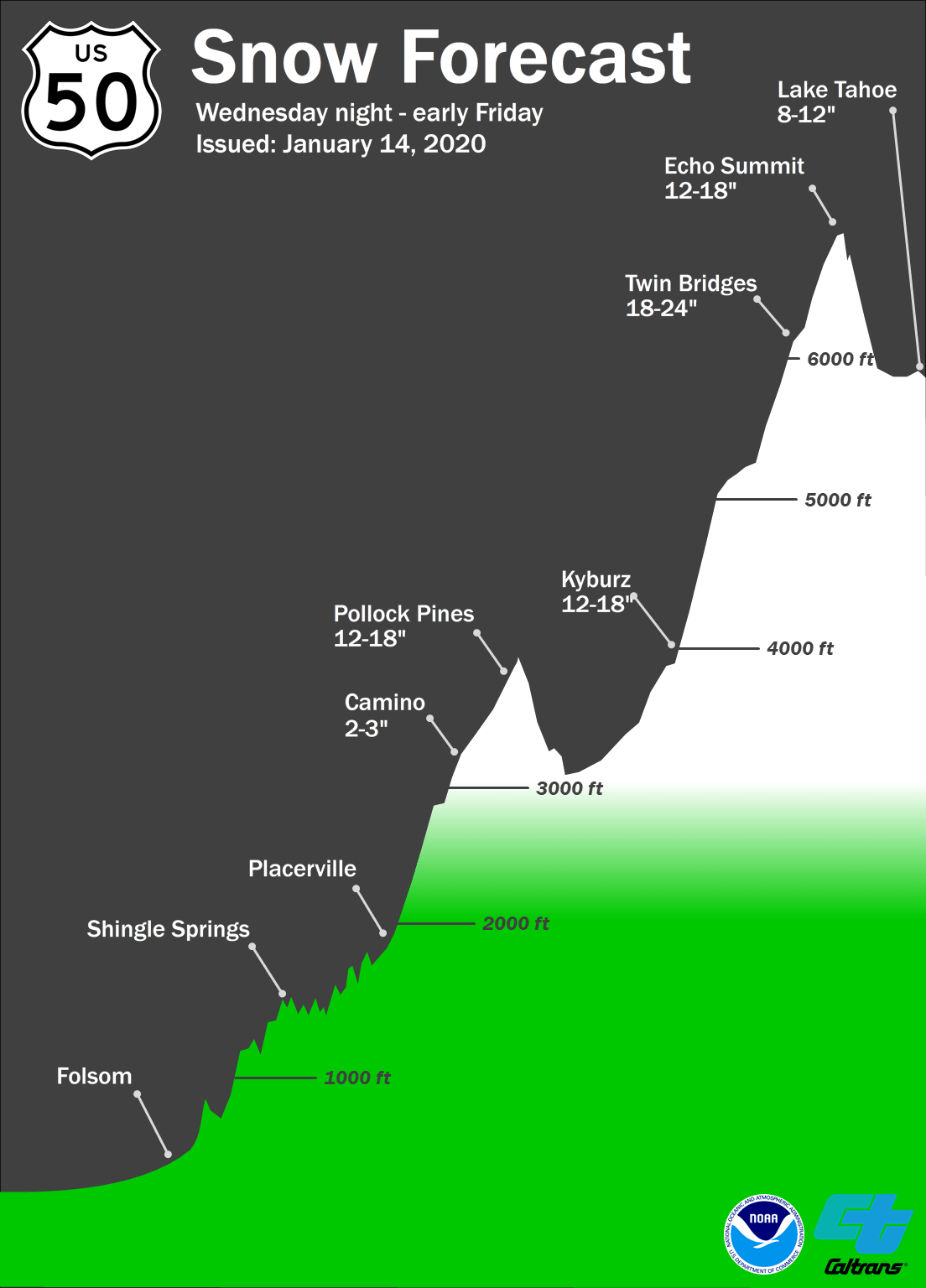
The major winter storm will create hazardous mountain travel Wednesday night – early Friday morning. Periods of moderate to heavy mountain snow will produce multiple feet of snow above 2000-3000 feet with accumulations possible at lower elevations.
Expected snowfall totals for Tahoe ski areas:
- Alpine Meadows: 18-24″
- Heavenly: 8-12″
- Kirkwood: 18-24″
- Northstar California: 8-12″
- Sierra-at-Tahoe: 18-24″
- Squaw Valley: 18-24″
- Sugar Bowl: 20-26″
Friday will be THE powder day, but conditions throughout the holiday weekend should be awesome.
The Sierra Avalanche Center in Truckee has issued a BACKCOUNTRY
AVALANCHE WATCH for the following areas:

Greater Lake Tahoe

* TIMING...In effect from 7 AM PST Thursday to 7 AM PST Friday.

* AFFECTED AREA...Central Sierra Nevada mountains between Yuba
  Pass (Hwy 49) on the north and Ebbetts Pass (Hwy 4) on the
  south, including the greater Lake Tahoe area.

* AVALANCHE DANGER...Periods of HIGH avalanche danger may occur
  from Thursday morning through Friday morning.

* REASON/IMPACTS...Forecast heavy snow and high wind may result in
  widespread avalanche activity in the mountains.

* PRECAUTIONARY / PREPAREDNESS ACTIONS...Very dangerous avalanche
  conditions may occur. Travel in avalanche terrain is not
  recommended during HIGH avalanche danger. Large destructive
  avalanches could occur.
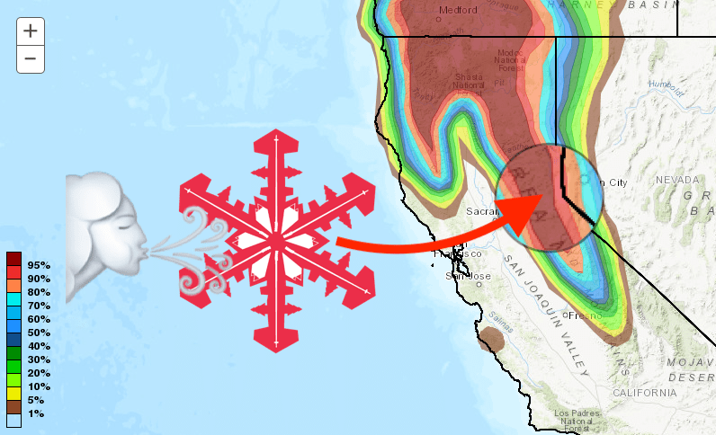
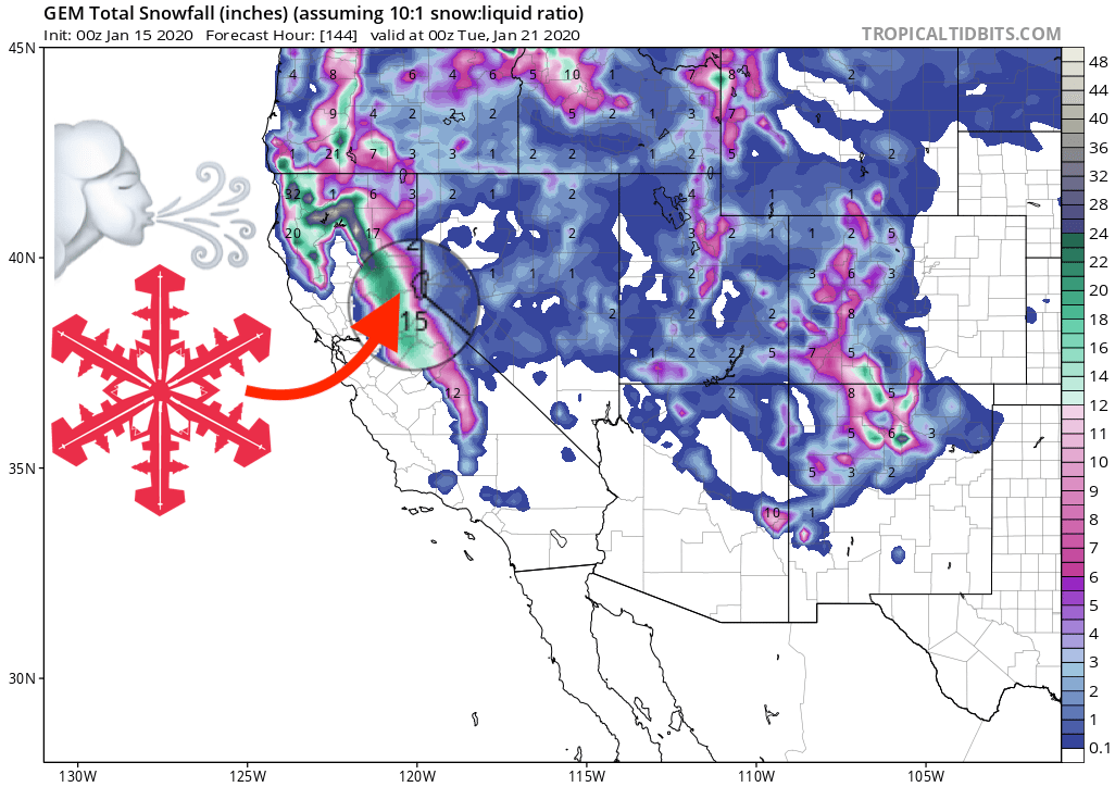
GEM Snowfall forecast model
Other Info