[iframe id=”https://www.facebook.com/plugins/video.php?href=https%3A%2F%2Fwww.facebook.com%2FAMHQonTWC%2Fvideos%2F1558510680846090%2F&show_text=0&width=560″]
Winter Storm are in effect throughout the East Coast area. Along with a few Blizzard Warnings in the New England area. Winter Storm Orson has the potential to still strengthen as low pressure continues.
12-18″ of snow is forecasted in Northern Maine throughout the day today.
NOAA Has Issued Winter Storm Warnings For:
- New York
- Connecticut
- Massachusetts
- Vermont
- Maine

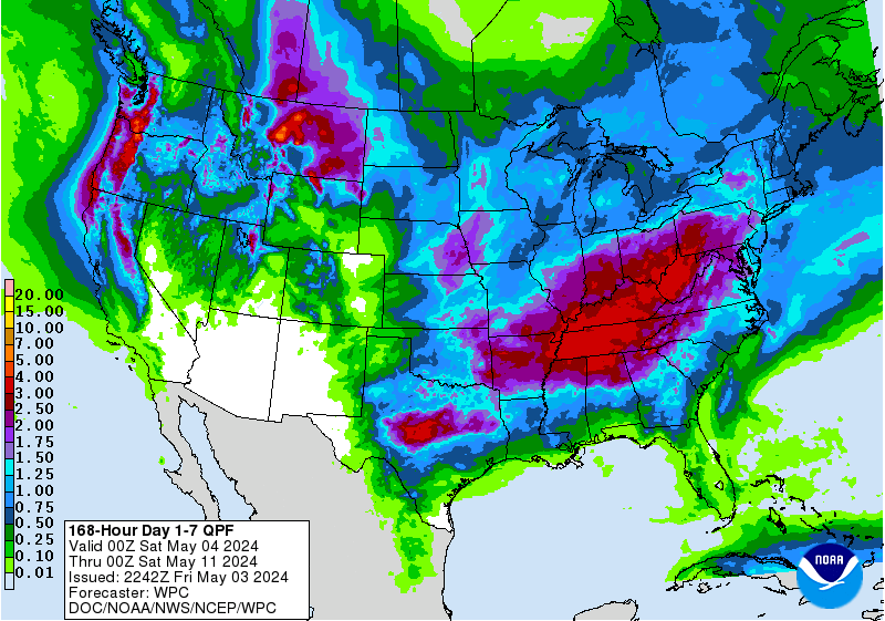
Plenty of snow is expected to fall in the Eastern United States throughout the next 7 days. Storm cycles have been pounding the area as of late.
More Storm Information:
New York: 1-4+” of Snow Throughout Today
An additional 1 to 4 inches is expected through this afternoon...with localized higher amounts over the northern Adirondacks and central and northern Green Mountains.
- NOAA Albany, NY
Connecticut: 1-3″ of Snow Throughout Today
* Snow Accumulations...An additional 1 to 3 inches of snow is possible this morning,
mainly in localized squalls.
- NOAA Albany, NY
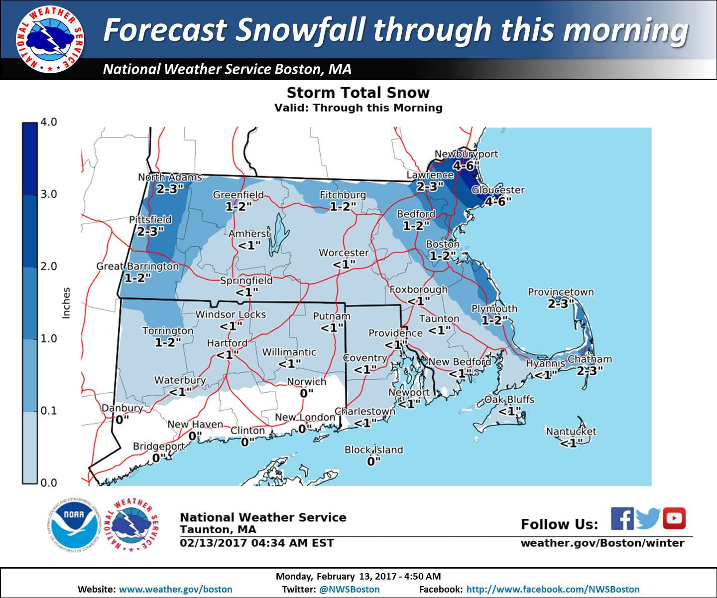
Massachusetts: 2-4″ of Snow Throughout Today
* Snow Accumulations...An additional 2 to 4 inches is possible with the greatest amounts in localized squalls.
- NOAA Boston, MA
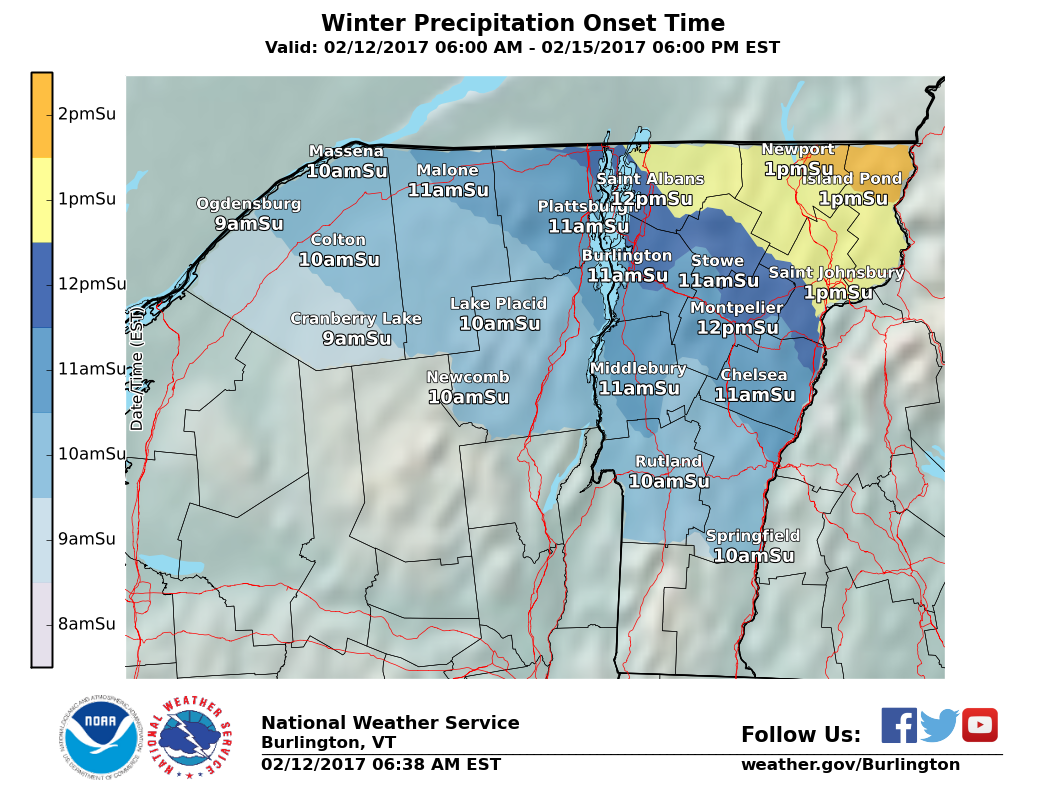
Vermont: 1-4+” of Snow Throughout Today
* Accumulations... An additional 1 to 4 inches is expected through this afternoon...
with localized higher amounts over the northern Adirondacks and central and northern
Green Mountains.
- NOAA Burlington, VT
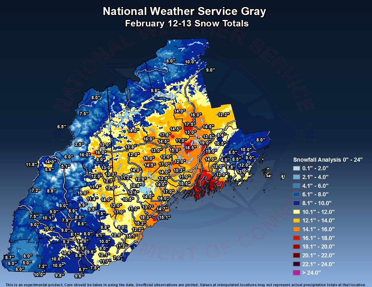
Maine: 18-24″ Storm Total
* SNOW ACCUMULATIONS... 18 to 24 inches.
- NOAA Gray, ME


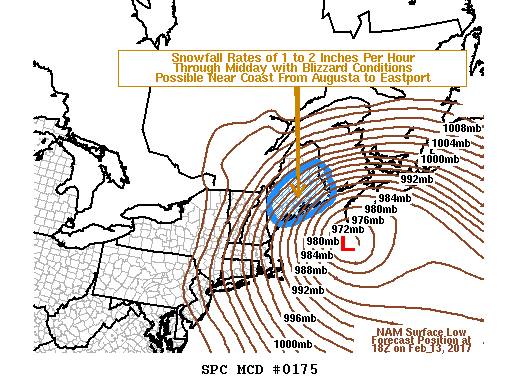
Blizzard Warning For Maine:
Blizzard Warning
URGENT - WINTER WEATHER MESSAGE...UPDATED
National Weather Service Caribou ME
911 AM EST Mon Feb 13 2017

...Major winter storm continues to impact the region through
tonight...

.Strong low pressure moving across the Gulf of Maine will move
south of Nova Scotia this evening. Heavy snowfall is expected
along with strong winds. The combination of heavy snow and strong
winds will produce blizzard conditions...especially early this
morning through tonight in the Bangor and Downeast region.

Southern Penobscot-Interior Hancock-Central Washington-
Coastal Hancock-Coastal Washington-
Including the cities of...Bangor...Brewer...Orono...Old Town...
Amherst...Aurora...Dedham...Eastbrook...Great Pond...Orland...
Deblois...Grand Lake Stream...Meddybemps...Pembroke...Perry...
Princeton...Ellsworth...Bar Harbor...Blue Hill...Eastport...
Machias...Cherryfield

...BLIZZARD WARNING REMAINS IN EFFECT UNTIL 5 AM EST TUESDAY...

* LOCATIONS...The Bangor region and Downeast.

* HAZARD TYPES...Heavy snow along with significant blowing and
  drifting snow.

* SNOW ACCUMULATIONS...18 to 24 inches.

* SNOWFALL RATES...2 inches per hour in heavy snow bands.

* TIMING...Through tonight. The worst conditions are expected
  early this morning through the day today.

* IMPACTS...Strong winds will lead to blowing snow with whiteout
  conditions. Extremely hazardous travel can be expected later
  tonight through Monday, with travel near impossible at times.
  Drifting of snow could easily exceed 5 feet. Power outages are
  expected with the strong winds.

* WINDS...North 25 to 35 mph with gusts up to 60 mph.

* VISIBILITIES...less than one quarter of a mile at times.

* TEMPERATURES...In the lower 20s.
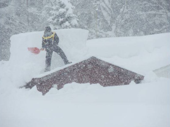
These Nor’easter storms hit the coast harder than the mountains.