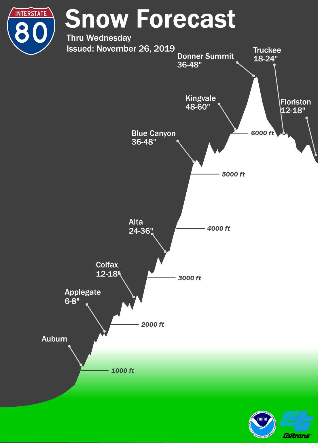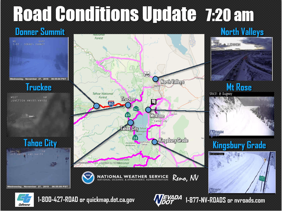
Squaw Valley, CA woke up to 18″ of fresh snow this morning, and that’s not even the best news! The storm is expected to continue right through Thanksgiving, breaking a little Friday afternoon, before coming back with a vengeance through the weekend. Totals after Sunday could exceed 5-FEET.
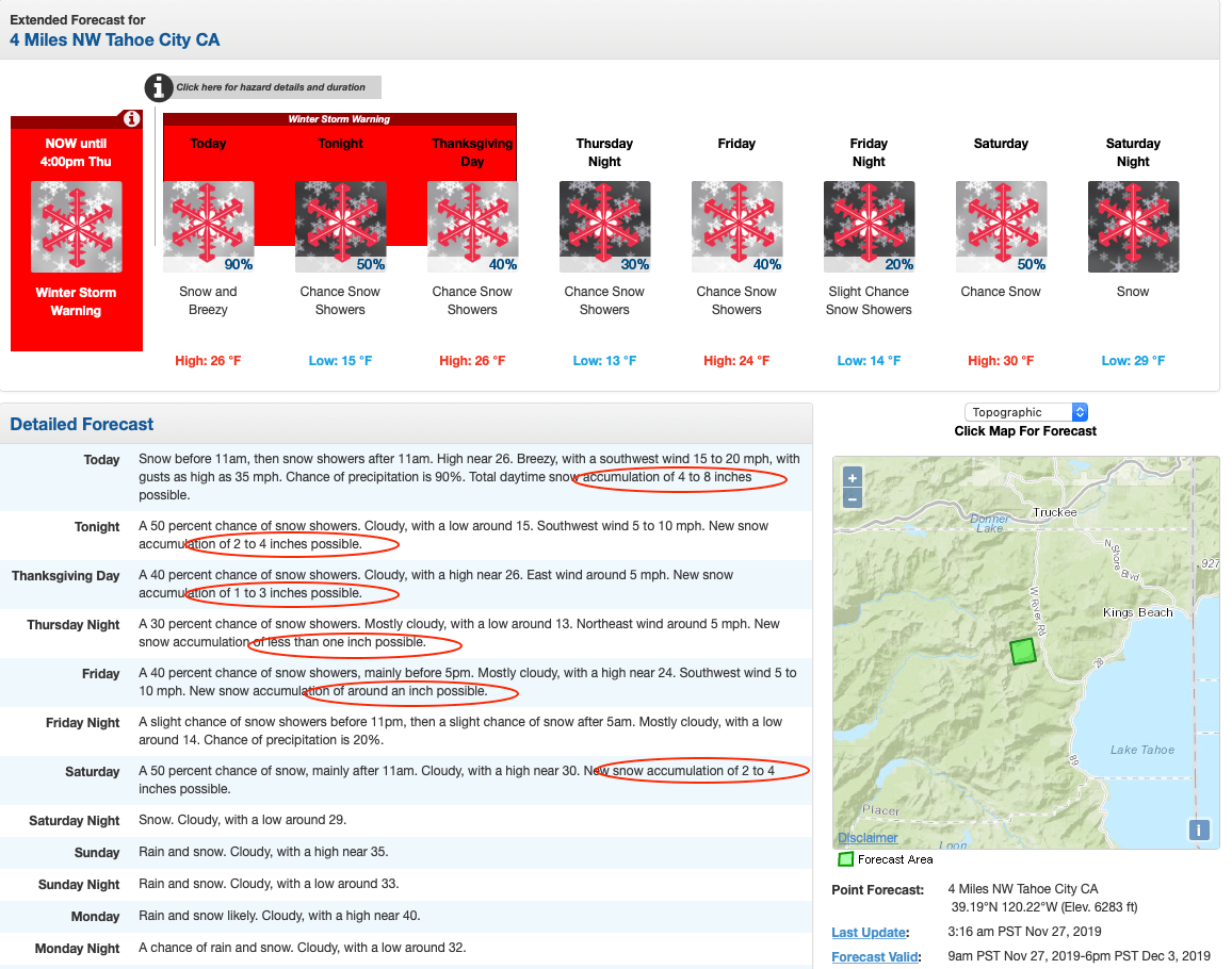
A winter storm warning is in effect until 4 pm Thursday, with 18″ of fresh snow expected.
...WINTER STORM WARNING REMAINS IN EFFECT UNTIL 4 PM PST
THURSDAY...

* CHANGES...Reduced the additional snowfall amounts, and removed
  mention of blizzard conditions.

* WHAT...Heavy snow. Additional snow accumulations of 5 to 10
  inches, with 10 to 18 inches above 7000 feet.

* WHERE...Greater Lake Tahoe Area.

* WHEN...Until 4 PM PST Thursday.
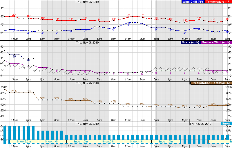
The overnight snow enabled the resort to open Exhibition, and with so much more snow in the forecast, expect to see further terrain and lifts open as the weekend progresses. 2-3 feet of heavy snow is likely at higher elevations and a few inches at lake level Saturday night before a change to rain.
Forecast discussion for the weekend:
WHAT WE KNOW: Heavy snowfall in the Sierra (feet for high
elevations) with moderate precipitation into western Nevada. The
precipitation will begin as all snow Saturday into Saturday night
due to cold air damming as mentioned above. Water equivalent
amounts Saturday through Monday could be anywhere from 3-6 inches
along the Sierra crest and 0.5 to 1.5 inches across western Nevada
(highest near and west of Highway 395). Gusty ridge winds are
also likely, with periods of gusty winds in the Sierra valleys.
Winds in western Nevada will be light.
After super windy conditions Tuesday and Wednesday, the winds will die down to a breeze on Thursday, before picking up again as the weekend storm begins. Temperatures will hang around in the teens for the remainder of the week.
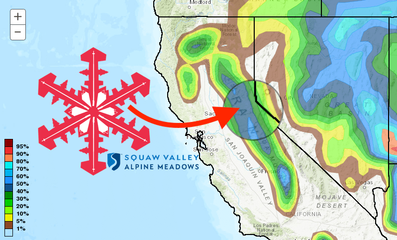
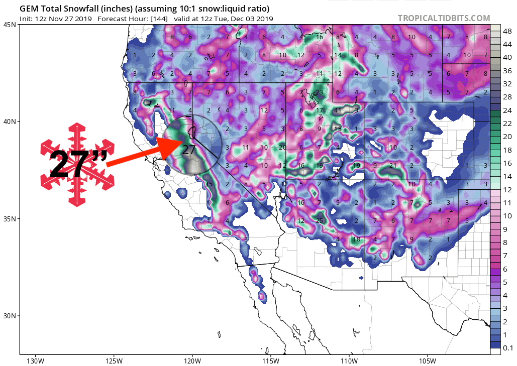
GEM Snow Total Forecast Model:
Other Info:
