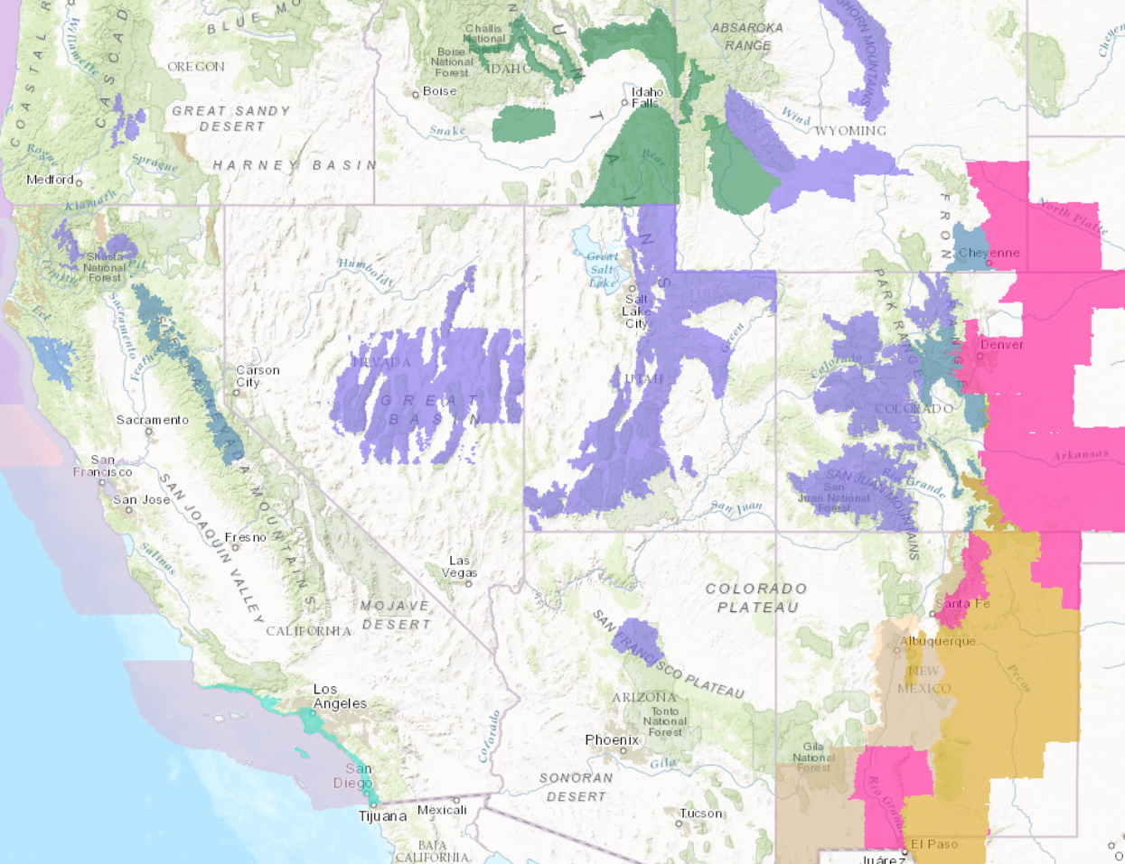
Winter Storms are expected to hit the West today through tomorrow. Heavy snow and high winds are expected to impact the area. Powder hounds are going to rejoice from this storm.
7-14″ of snow is expected to fall in Colorado Today-Friday AM.
NOAA Has Issued Winter Weather Advisories For:
- California
- Nevada
- Arizona
- Utah
- Colorado
- Wyoming
NOAA Has Issued Winter Storm Watches For:
- Colorado
- Wyoming
- California

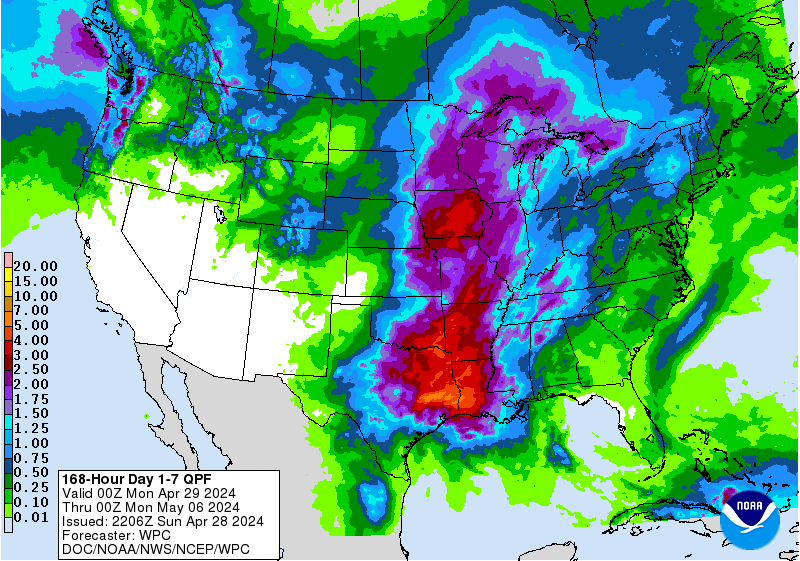
Colder temperatures are expected to arrive with these storms, which will keep snow levels at or below 6000ft for much of the area.
Additional Storm Information:
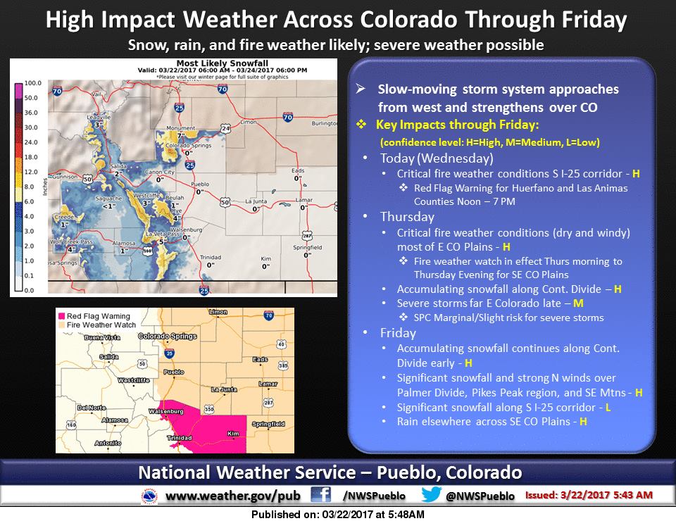
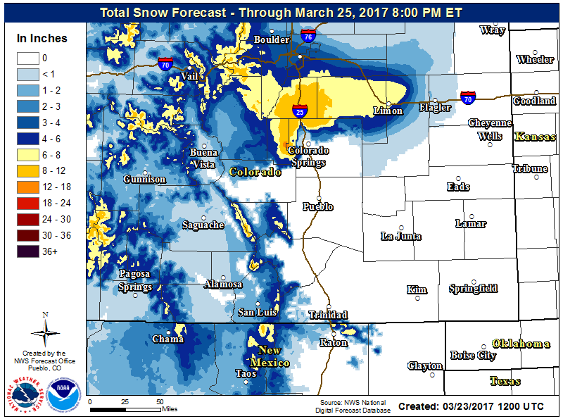
Colorado: 7-14″ of Snow Thursday-Friday Morning
* SNOW ACCUMULATIONS...7 to 14 inches over the high mountains and
  southern foothills. Snowfall rates up to two inches per hour
  will be possible in the mountains and southern foothills early
  Friday morning.
- NOAA Boulder, CO
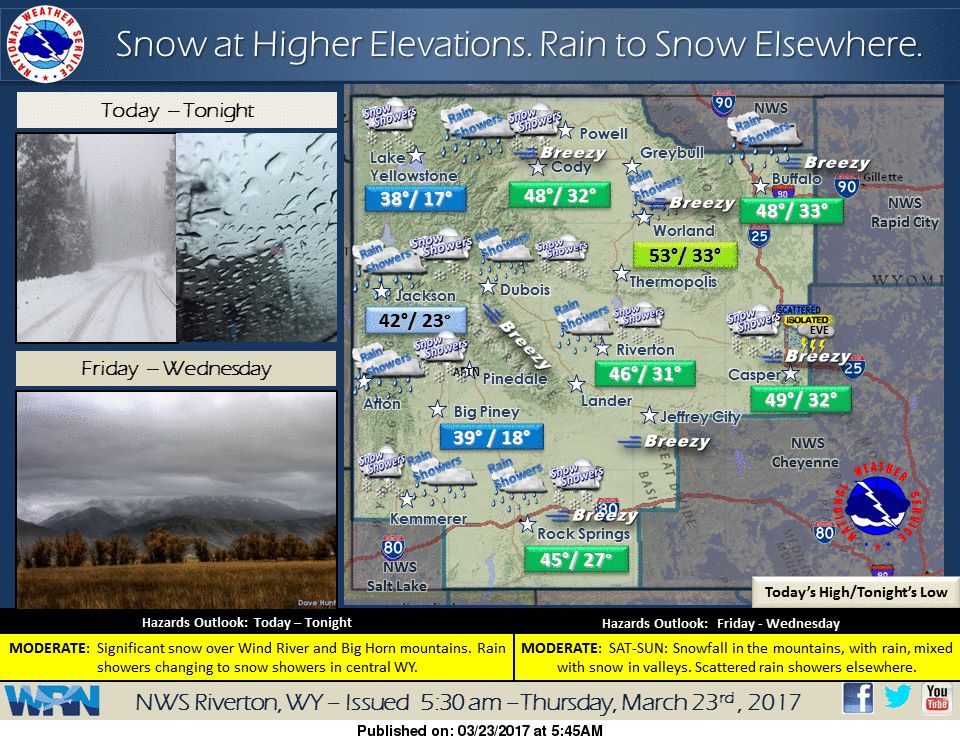
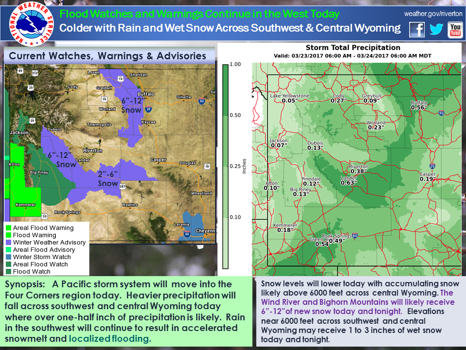
Wyoming: 6-12″ of Snow To Fall Throughout Thursday
* Snow Accumulations...total event accumulations of 6 to 12
  inches, with the highest amounts generally above 8000 feet.
- NOAA Riverton, WY


California: 8-13″ of Snow Friday-Saturday AM Above 6000ft
* SNOW AMOUNTS...8 TO 13 INCHES ABOVE 6000 FEET.
- NOAA Reno, NV
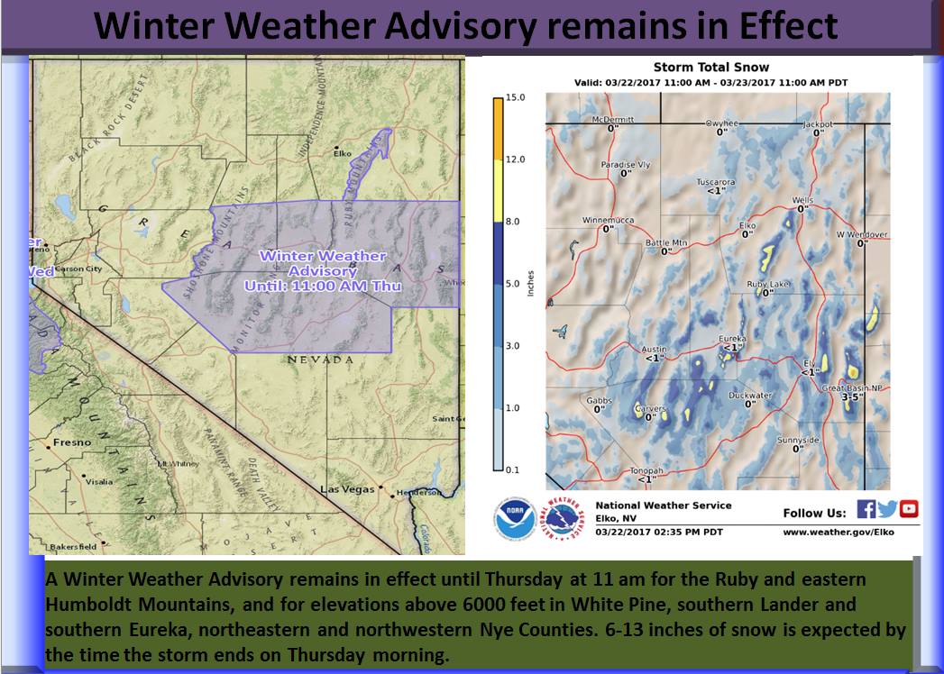
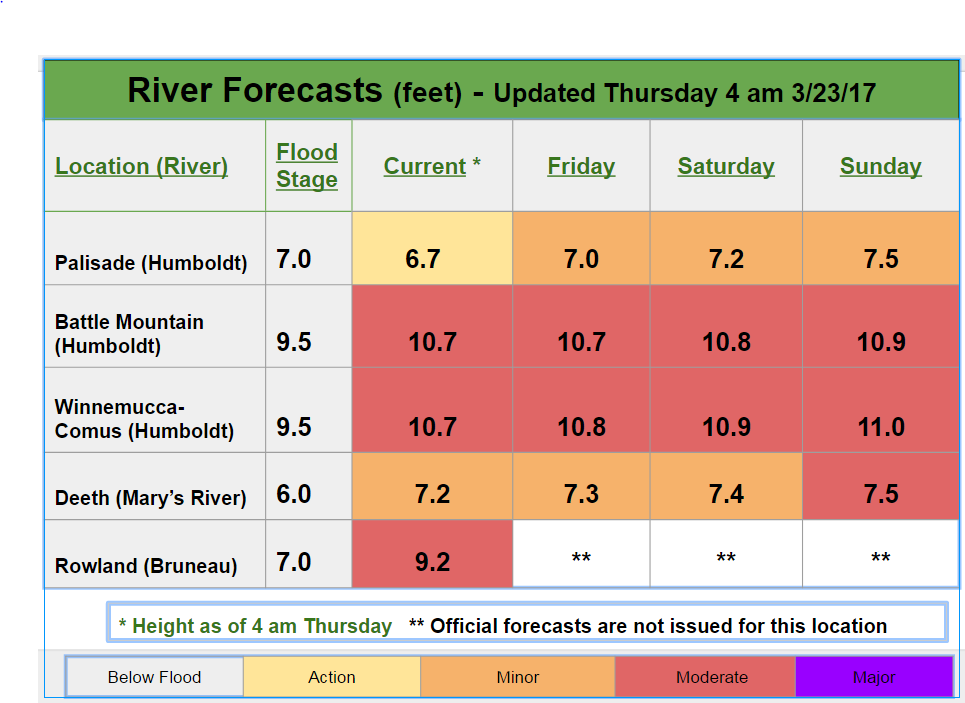
Nevada: 6-13″ of Snow Through Thursday Morning
* SNOW ACCUMULATIONS...6 to 13 inches.
- NOAA Elko, NV
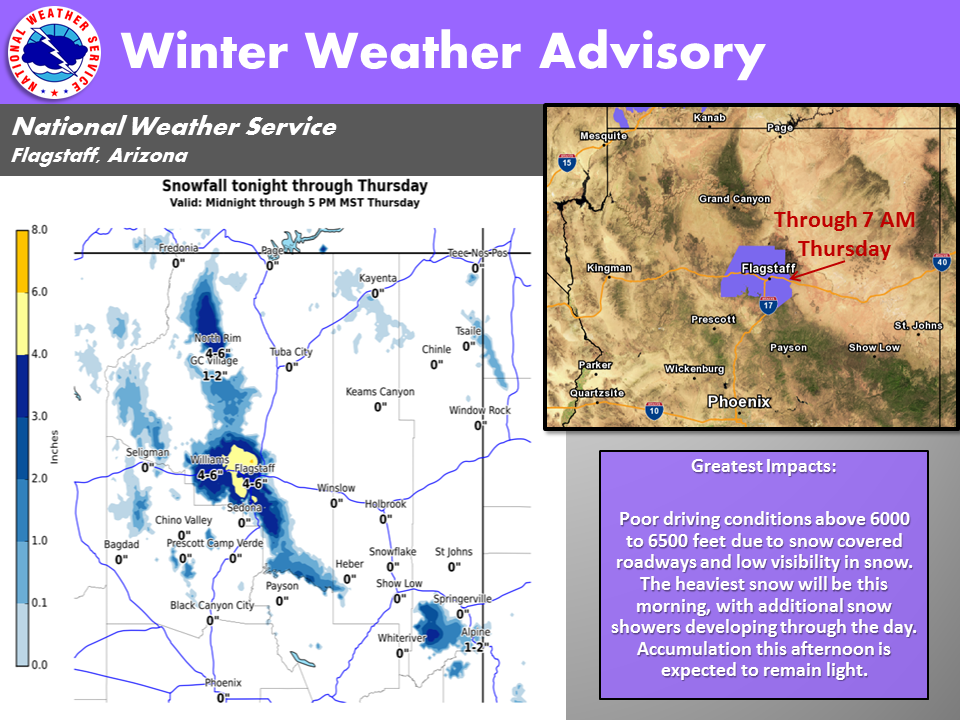
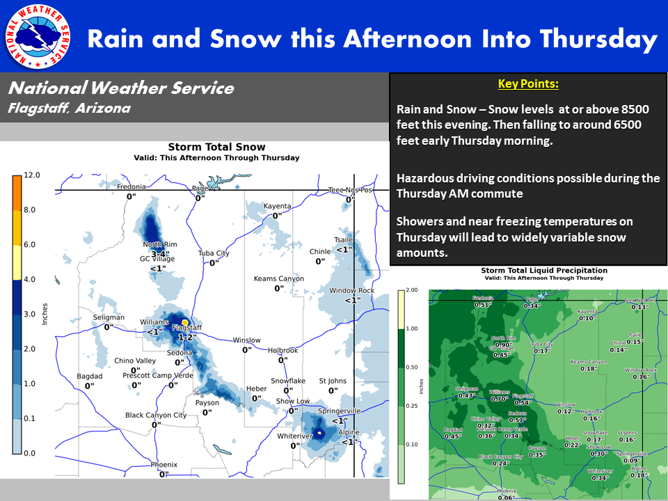
Arizona: 2-4″ of Additional Snow Accumulation Today
Total snow accumulation of 4 to 8 inches through 7 AM MST. 2-4" of additional snow
accumulation through Thursday.
-NOAA Flagstaff, AZ
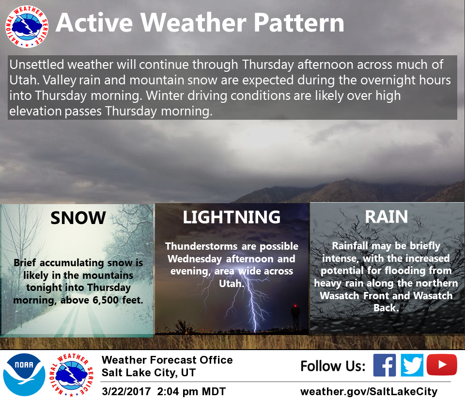
Utah: 6-12+” of Snow Expected To Fall Through Today
* SNOW ACCUMULATIONS...6 to 12 inches above 8000 feet with higher
  amounts in areas favored by northwest flow. Mountain locations
  below 8000 feet can expect 2 to 6 inches of accumulation.
- NOAA Salt Lake City, UT


Colorado Winter Weather Advisory:
URGENT - WINTER WEATHER MESSAGE
National Weather Service Denver/Boulder CO
500 AM MDT Thu Mar 23 2017

...Blizzard conditions possible late tonight through
Friday morning across the Palmer Divide towards the Limon
area...

A spring storm will bring much needed precipitation to northeast
and north central Colorado. Precipitation is expected to develop
across the forecast area tonight and then intensify late tonight
through Friday morning as the storm system strengthens over
southeast Colorado. Moderate to heavy snowfall will be possible
over the mountains, foothills and Palmer Ridge late tonight into
Friday morning, heaviest along and south of of the I-70 corridor.
Very strong northerly winds will develop late tonight and
continue through midday Friday across the plains with blizzard
conditions possible from the Palmer Divide towards Limon with zero
visiblities at times.

South and Southeast Grand/West Central and Southwest Boulder/
Gilpin/Clear Creek/Summit/North and West Park Counties Above
9000 Feet-
Jefferson and West Douglas Counties Above 6000 Feet/Gilpin/Clear
Creek/Northeast Park Counties Below 9000 Feet-

...WINTER STORM WATCH NOW IN EFFECT FROM LATE TONIGHT THROUGH
FRIDAY MORNING...

* TIMING...Snow will increase in intensity over the mountains and
  southern foothills after midnight and continue through Friday
  morning. The heaviest snowfall is likely from late tonight
  through Friday morning.

* SNOW ACCUMULATIONS...7 to 14 inches over the high mountains and
  southern foothills. Snowfall rates up to two inches per hour
  will be possible in the mountains and southern foothills early
  Friday morning.

* WIND/VISIBILITY...Northerly winds from 15 to 25 mph with gusts
  to 35 mph are expected over the southern Foothills late tonight
  through Friday morning. Speeds will be much lighter in the
  mountains with gusts up to 20 mph at times. Visibilities could
  be under one quarter of a mile in the windiest areas.

* IMPACTS...Heavy snow, strong winds and poor visibilities will
  create hazardous winter driving conditions. Roads will be icy
  and snow packed.
One thought on “Spring Storms To Hit WY, CA, AZ, NV, CO, & UT | 7-14″ of Snow For Colorado Thursday – Friday AM”