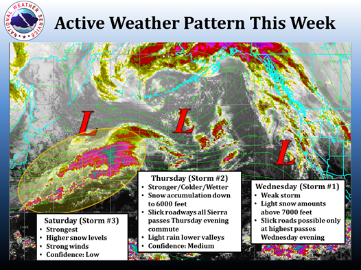
NOAA is forecasting three storms this week in Tahoe. The third storm rolls in on Saturday and looks like it has the potential for some big snow up high. We’ll let them do the talking:
NOAA Sacramento:
Dry weather will continue through late tonight as high pressure moves off to the east. A series of 3 weather systems will impact the area Wednesday, Thursday, and again late Friday into Saturday. Saturday looks to feature the wettest system. Precipitation totals for the 3 systems will range from around 0.2 – 0.5” in the Valley to 0.75 – 1.75” in the foothills and mountains. A few inches of mountain snow are possible as snow levels drop to around 5000 feet. Locally higher amounts are possible at the highest elevations.

NOAA Reno:
The weather pattern will become more active this week as the ridge breaks down and allows for several Pacific storms to push through the area. The first storm will be weak with only light precipitation Wednesday. A second colder system will bring better chances for Sierra snow and valley rains on Thursday. This will likely affect travel over Sierra passes Thursday afternoon and evening. There is more uncertainty with the third storm with regard to precipitation amounts and snow levels. However, there will likely be another round of precipitation with strong winds Friday night and Saturday. The yellow oval is highlighting the moisture with the third storm (see top image of this post).


