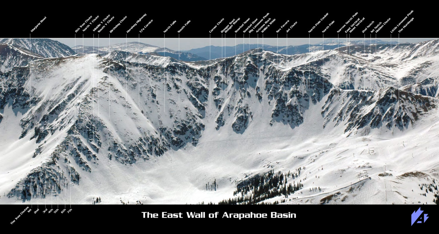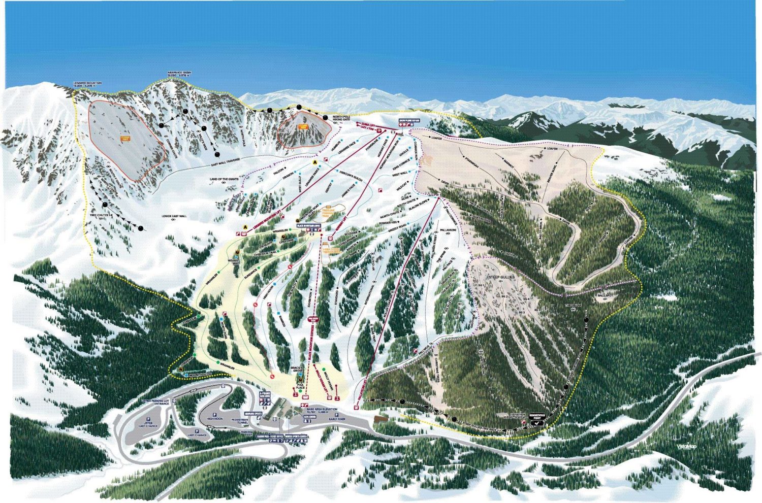
“The new trail map is here !!! The new trail map is here !!! The new trail map is here !!! We have some beautiful, new artwork that includes The Beavers and The Steep Gullies. This map also includes the new trail names. We chose these names for a variety of reasons. A couple of the more commons names, Marmot and Ptarmigan, were chosen because those two specific areas are crawling with marmots and ptarmigan. Some of the trail names like Beaver Bowl, The Steep Gullies and Christmas Trees are nomenclature that has been used to describe these same areas for years. Other names, like Loafer, Davis, Bailey Brothers and Alex, have significant historical meaning for The Basin. In the coming weeks and months, I will share specific details about what some of these names mean.
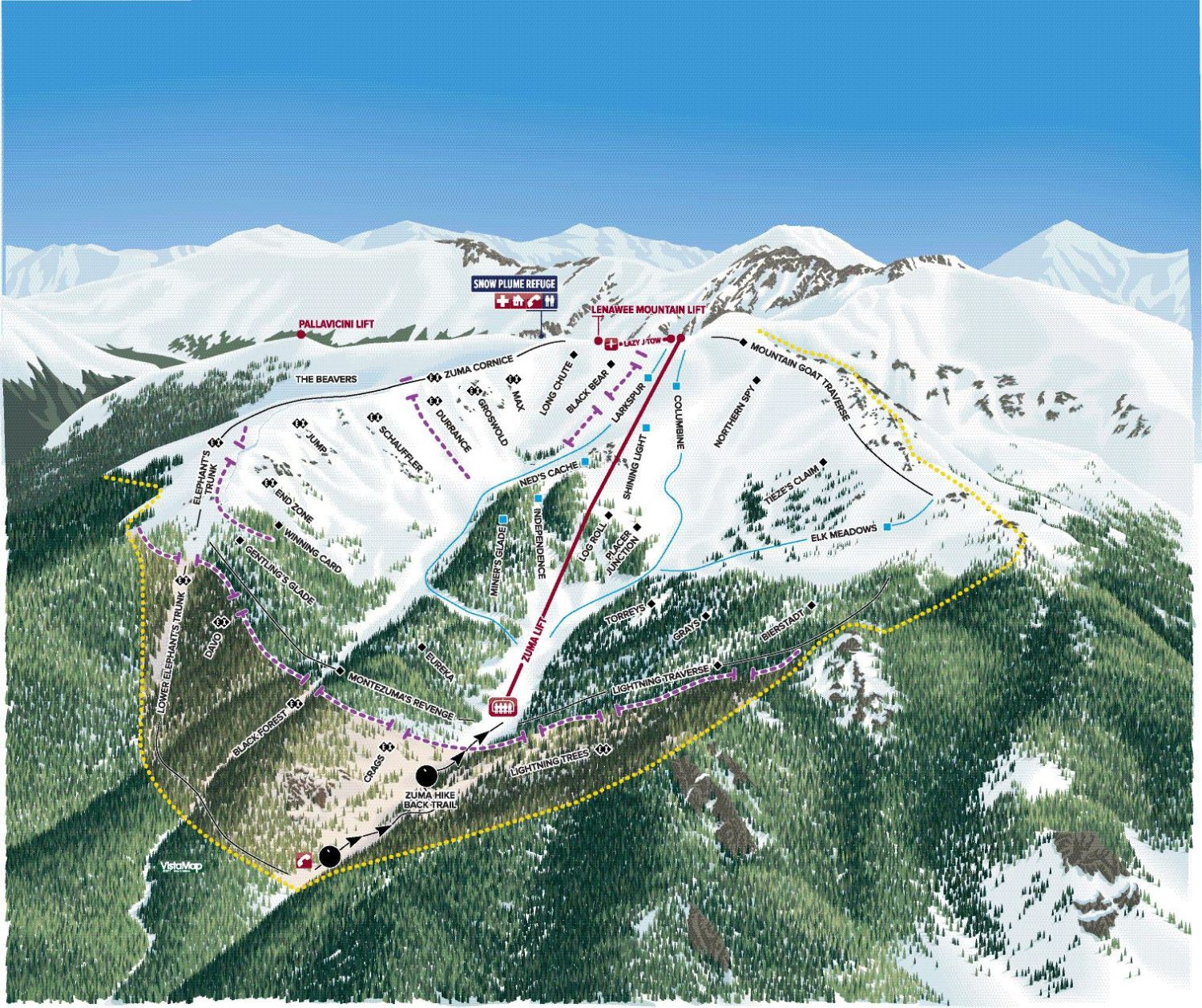
This map is very specifically for the 2017/18 season and does not include the chairlift that will be installed for the 2018/19 season. For the 2017/18 season, all the areas in The Beavers and Steep Gullies require a hike at the end of the ski.” – Al Henceroth, CEO Arapahoe Basin, CO