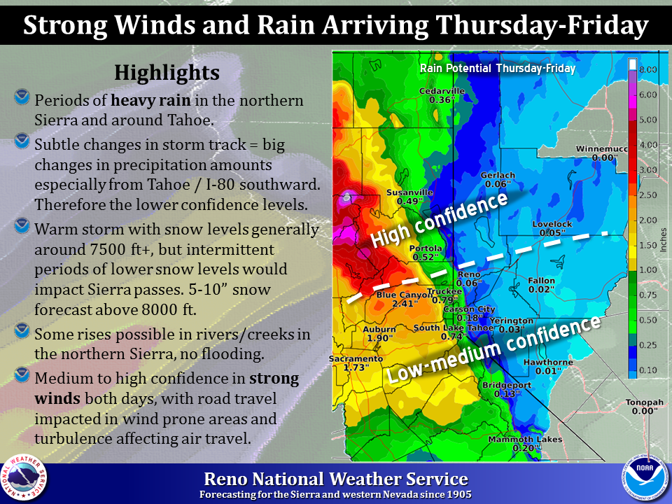
The atmospheric river headed to the West Coast is still on-track to greatly impact Northern California. Some zones in NorCal are forecast to see up to 10-inches of rain this weekend.
Tahoe is forecast to have high snow levels likely never dropping below 7,500-feet. Above 8,000-feet, Tahoe should see 1 to 2 feet of snow. The few peaks in the Tahoe area above 10,000-feet could see up to 4 feet of snow…
NOAA FORECAST DISCUSSION:
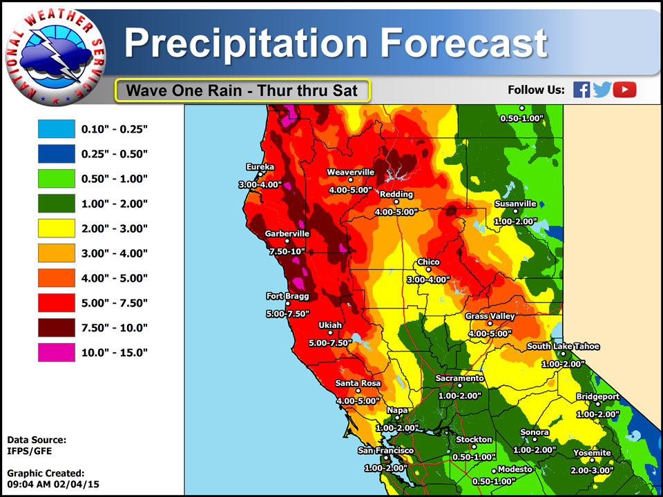
Snow levels will generally be high but Friday night into Saturday
morning some heavier bands of precipitation may lower snow levels
below major pass levels in the Sierra Nevada at times. Significant
accumulations may be possible above 7500 feet during this time
period. One to two feet of snow over the higher elevations above
8000 feet looks possible...with over four feet for the isolated
peaks over 10000 feet. Rainfall totals with this first system will
be impressive over the south and southwest facing slopes with
amounts up to around 10 inches could be common over parts of Lake
County northward...Shasta County...Butte and Western Plumas
Counties. The far north end of the valley may get 4 to 6 inches
of rainfall while further south 2 to 3 inches with lessor amounts
as you move southward into the San Joaquin Valley