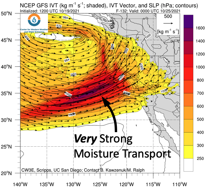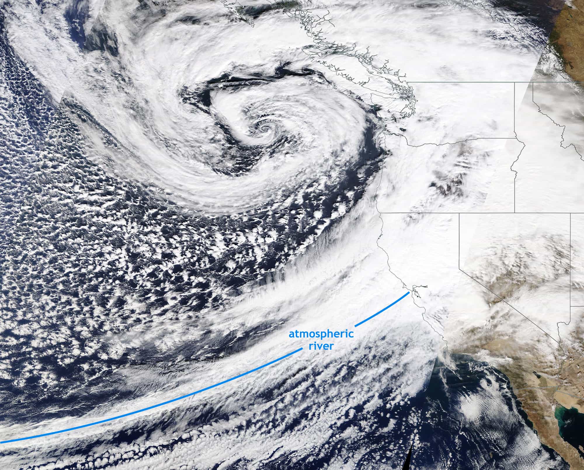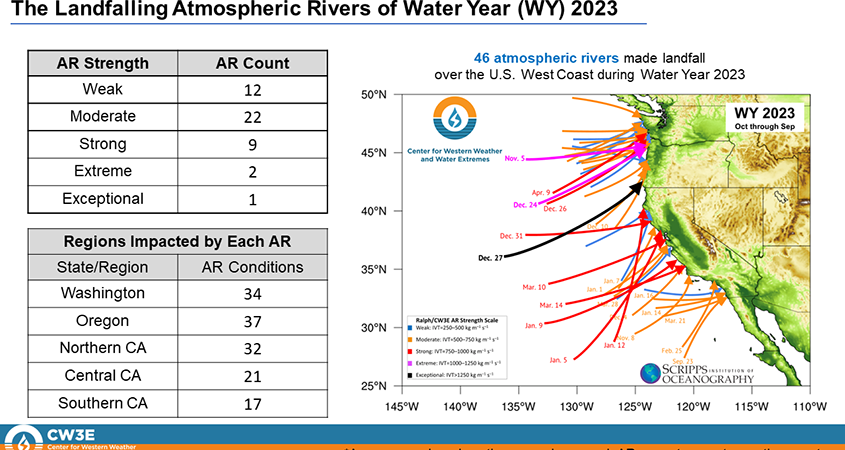
A powerful force flows invisibly over the Pacific—a conveyor belt of moisture that meteorologists call an atmospheric river (or AR for short). These moisture bands transport enormous quantities of water vapor, crucial for precipitation—and snowfall—along the West Coast. Atmospheric rivers funnel this moisture from the tropics, like a fire hose aimed at western North America. When they land, they often bring a surge of precipitation, pouring rain or snow, depending on the conditions. For skiers, atmospheric rivers are worth tracking closely, as their arrival can mean anything from epic snowfall to rain-laden risks.
How Atmospheric Rivers Form

Imagine warm, moisture-rich air forming over the vast expanse of the tropical Pacific. As winds drive it northward, this moist air catches a ride on the jet stream, converging into a narrow corridor: an atmospheric river. These rivers snake across the Pacific, carrying up to 15 times the water flow of the Mississippi River in the form of water vapor, all ready to be released over land. Unlike the slow, scattered movement of clouds, ARs channel this moisture with laser-like focus, making them powerful, targeted weather makers.
Much of this action happens over the Pacific, where trade winds and ocean currents fuel the AR’s journey. When they encounter the cold air masses and high elevation of the West Coast, especially over mountainous terrain, the moisture condenses, and precipitation surges out in heavy bursts. In a matter of hours, these ARs can deposit feet of snow—or sometimes torrential rain—depending on the ambient temperature.
Not all ARs are alike; some are colder than others, depending on where they pick up their moisture and the path they take. Those originating closer to the subtropics tend to bring warmer air, lifting snow levels higher and often delivering rain to lower elevations. Meanwhile, ARs that tap into cooler, more northerly air masses carry a chill, allowing snow to fall at lower elevations. The nature of each AR is shaped by its origins, and this variability makes forecasting their impact both challenging and critical.
Characteristics of Atmospheric Rivers
Typical ARs carry warm air, meaning they arrive with high snow levels. This warmth often leads to rain-on-snow events, where rain falls over existing snowpack, triggering rapid melting and complicating snow conditions.
The front end of an AR is usually warmer than the tail end, leading to a progression in snow levels throughout the storm. For skiers, this means that snow conditions can change significantly during the storm, often starting with wetter snow and transitioning to drier, colder snow as temperatures drop. This progression also affects snowpack stability, as the varying density of snow layers can lead to complex avalanche conditions. The AR initially pulls in warmer tropical air, and later in the storm, cooler air sweeps in behind the warm conveyor belt, allowing snow levels to drop as the storm progresses.
But it’s the concentrated moisture in ARs that truly sets them apart. Because they funnel such vast amounts of water vapor through narrow channels, ARs can deliver rainfall and snowfall rates far beyond what’s typical in regular storm systems. When that moisture meets mountainous terrain, it’s like wringing a soaked sponge over the land below.
Snowpack Dynamics During Atmospheric River Events
The impact of an AR on snowpack varies dramatically based on its temperature. Warm ARs, carrying tropical air, often raise snow levels and can dump rain over lower elevations, leading to significant snowmelt. This “rain-on-snow” effect can thin out existing snowpack and even wash away entire layers of snow in certain areas. In colder ARs, however, snowpack levels can deepen with heavy, dense snowfall that adds substantial water content to the snowpack, creating a strong yet heavy base.
Atmospheric rivers can be both friend and foe to snowpack health. While they contribute essential moisture that bolsters snowpack in dry years, their variability—especially the rain events they can bring—means they can also reduce the very snowpack they help create. Whether an AR builds or reduces snowpack depends on the atmospheric conditions accompanying it.
Skiing and Avalanche Risk During Atmospheric River Events
Skiers dream of snowfall, but when ARs swing through with their heavy precipitation, dreams can quickly turn into a balancing act between opportunity and risks like avalanche danger or unstable snowpack. AR-driven snowfall is often wetter and heavier than the dry powder skiers crave, especially during warm AR events. This moisture-laden snow settles quickly, forming slabs that can sit precariously over weaker layers in the snowpack. Combined with higher temperatures, this setup can lead to prime conditions for wet slab avalanches.
Avalanche forecasts spike in complexity during AR events, as the risk for larger avalanches often rises with waterlogged snow and fluctuating temperatures. Rapidly fluctuating temperatures can weaken existing snow layers and create instability, making it easier for slabs to release and trigger avalanches. Skiers must pay close attention to local forecasts and understand that the heavy, dense snow that accompanies many ARs can create layers prone to instability. For the backcountry skier, it’s a signal to watch, wait, and tread cautiously.
Other Impacts

Beyond skiing and avalanche risk, atmospheric rivers play a crucial role in western water cycles. The western United States relies heavily on snowpack and reservoirs for water, and in some places, such as California, ARs are the primary source of this moisture. Their ability to deliver significant amounts of precipitation makes them vital for replenishing water supplies, especially during dry years. Just one or two ARs can carry enough water to turn a dry year into a wet one, making the difference between a snow-starved winter and a snow-filled one, ensuring water storage in mountain reservoirs and snow-fed rivers. However, their concentrated nature can also trigger extreme events like flooding, especially when heavy rain falls over already saturated ground. Communities nestled in mountainous terrain sometimes grapple with floods or landslides as an AR passes, underscoring these natural phenomena’ high-stakes impact.
Atmospheric rivers are a double-edged sword; they bring incredible opportunities for deep snow and replenishing vital water reserves, but they also come with challenges like fluctuating snow levels, avalanche risks, and potential flooding. Understanding the dynamics of these powerful moisture channels is crucial for navigating both the beauty and the risk they bring. Whether seeking powder turns or ensuring your safety in the backcountry, staying informed about atmospheric river events can make all the difference between an epic day and a dangerous one. Always remember to check the forecast!