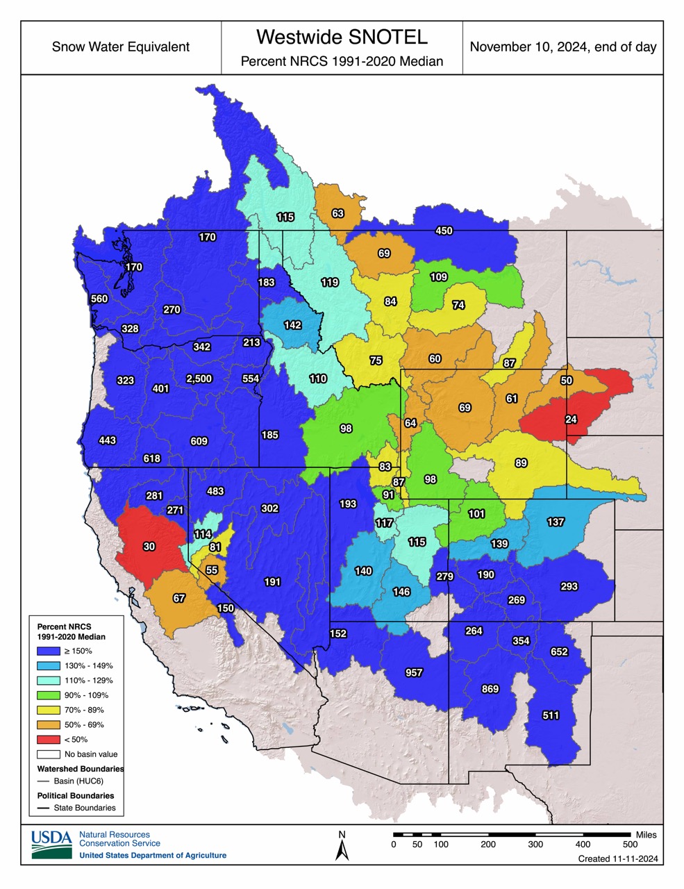
It’s still very early in the season, but this image of the current snowpack across the western states makes for good reading. As winter approaches, the latest snow water equivalent data from November 10 reveals a varied snowpack across the Western United States, with some states experiencing exceptional early-season conditions while others lag behind.
Washington and Oregon are leading the charge with remarkable snowpack levels. Many basins in these states report snow water equivalents of 200% of the median, with some areas reaching an astounding 560% in Washington and 2,500% in Oregon. Having said that, no ski resorts in the PNW are currently open.
Nevada, Arizona, and New Mexico, not areas you generally associate with big snow, are also showing similarly large numbers, ranging from 483% of normal in Nevada to 957% in Arizona and 869% of normal in New Mexico.
Colorado is above normal, with the southern half significantly better off than the north. Similarly, in Utah, the southern and western halves of the state are about 150% of normal, whereas the Salt Lake City and Park City resorts are slightly below the average.
Wyoming is below average, as is southern Montana and eastern Idaho. The western sides of these states that border with the PNW are well above average.
California is off to the worst start to winter 2024-25. The Sierra Nevada is well below average, with the eastern Sierra about two-thirds normal and the northern less than a third. The slight exception is the Tahoe region, which is just above average. The Klamath and Cascade ranges, though, have snowpacks almost 300% normal.
It’s worth repeating that it’s still early in the season, and the law of small numbers applies, but who doesn’t want to see that the snowpack where they are is 25x what it normally is?!