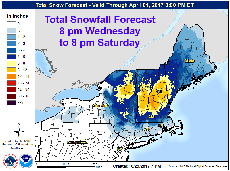
Winter is not over on the East Coast as a storm is about to hit much of the area. New York, Vermont, Massachusetts, New Hampshire, and Maine are going to get hit.
6-12″ of snow is forecasted to fall Tonight-Saturday Morning in New York.
NOAA Has Issued Winter Storm Warnings For:
- New York
- Vermont
NOAA Has Issued Winter Weather Advisories For:
- New York
- Vermont
NOAA Has Issued Winter Storm Watches For:
- New York
- Vermont
- Massachusetts
- New Hampshire
- Maine

Mainly snow is expected to fall from this storm, but it will be heavy as warm temperatures will mix in some rain.
Additional Storm Information:
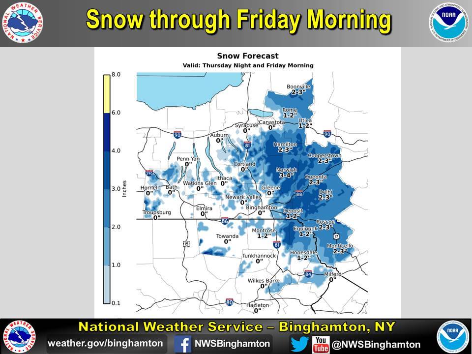
New York: 6-12″ of Snow Friday Morning – Saturday Morning
* Accumulations...6 to 12 inches of heavy dense snow.
- NOAA Binghamton, NY
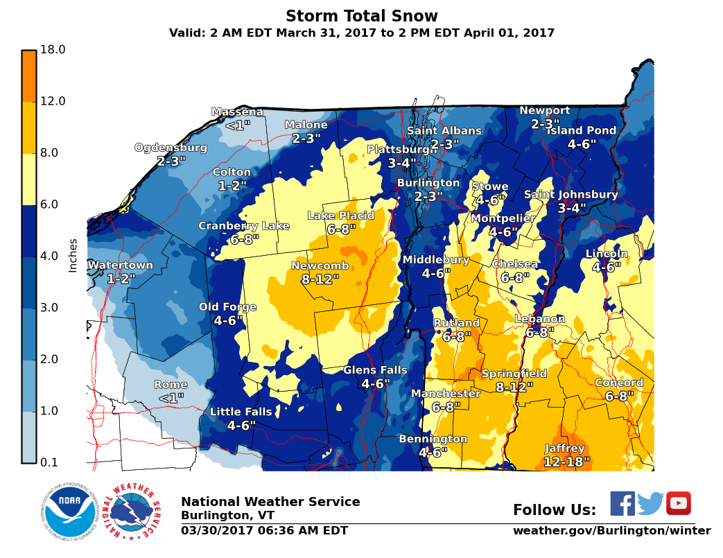
Vermont: 5-10″ of Snow Tonight-Saturday Morning
* Accumulations...5 to 10 inches of heavy dense snow.
- NOAA Burlington, VT
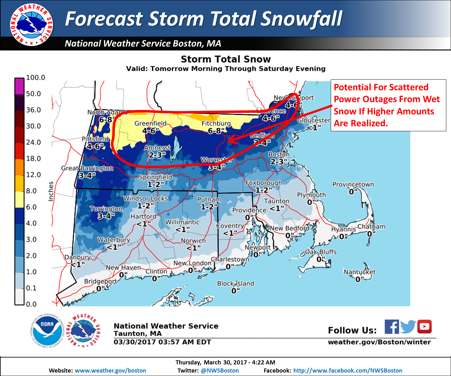
Massachusetts: 4-8″ of Snow Tonight-Saturday Morning
* ACCUMULATIONS...Snow accumulation of 4 to 8 inches, along with
  up to 0.1 inch of ice.
- NOAA Boston, MA
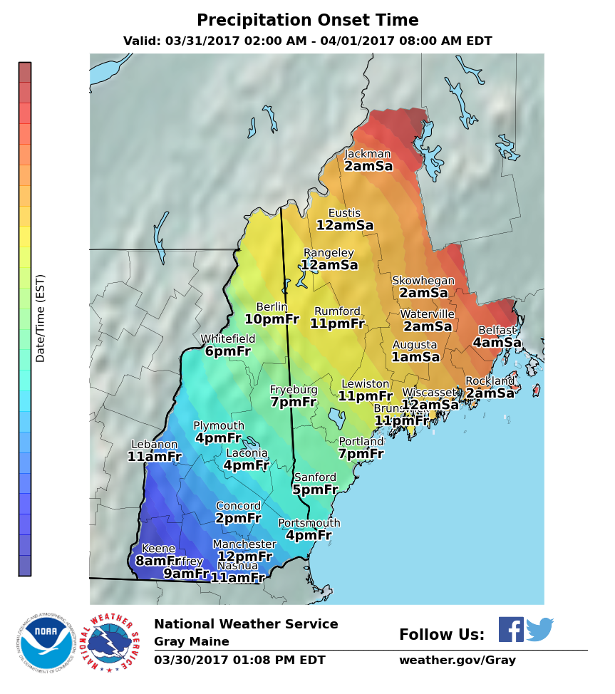
New Hampshire: 6-10″ of Snow Friday Morning-Saturday Morning
* Accumulations...Snow accumulation of 6 to 10 inches possible.
- NOAA Grey, ME
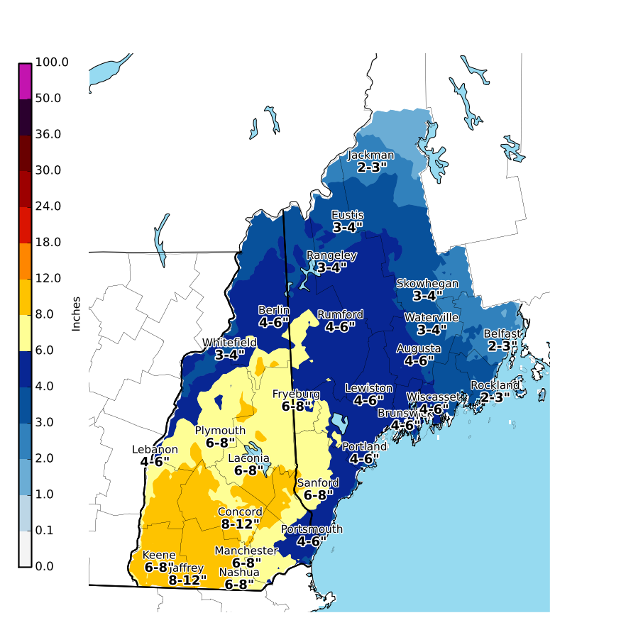
Maine: 4-7″ of Snow Friday-Saturday
* Accumulations...Snow accumulation of 4 to 7 inches possible.
- NOAA Grey, ME


New York Winter Storm Warning:
URGENT - WINTER WEATHER MESSAGE
National Weather Service Burlington VT
339 PM EDT Thu Mar 30 2017

Western Essex-Windsor-Eastern Rutland-
Including the cities of Lake Placid, Springfield,
White River Junction, East Wallingford, and Killington

...WINTER STORM WARNING REMAINS IN EFFECT FROM 5 AM FRIDAY TO
2 PM EDT SATURDAY...

The National Weather Service in Burlington continues the Winter
Storm Warning for heavy snow, from 5 AM Friday to 2 PM EDT
Saturday.

* Locations...Southern Vermont including eastern Rutland and
  Windsor Counties.

* Hazard Types...Heavy wet snow.

* Accumulations...6 to 12 inches of heavy dense snow.

* Maximum Snowfall Rate...Up to 1 inch per hour, mainly Friday
  evening through midnight.

* Timing.. Snow will begin Friday morning before possibly mixing
  with rain below 1000 feet Friday afternoon. Snow will continue
  at higher elevations Friday into Friday night before tapering
  off Saturday morning. The heaviest snowfall will occur
  from Friday evening through early Saturday morning.

* Impacts...Heavy wet snow will accumulate on trees and power
  lines which will lead to the potential for scattered power
  outages across southern Vermont. Additionally, hazardous
  travel conditions are expected on local roads.

* Winds...East 5 to 10 mph with gusts up to 20 mph.

* Temperatures...Highs in the mid 30s on Friday with lows in the
  upper 20s Friday night.

* Visibilities...As low as a half mile at times.